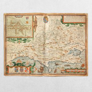
Stanford’s Library Map Of London And Its Suburbs – Sheet 6 – 1862
Publisher: Edward Stanford
Price: £145 including postage in the UK
Publication Date: 1862
Edition: First edition
Sheet Size: 42.8cm x 34.3cm
Condition: Good
Condition:
Scale: 6″ to a mile. Sheet 6 from the set of 24 showing Regent’s Park, Primrose Hill and Camden Town. Steel-engraved map with original colour. Sheet size: 42.8cm x 34.3cm. Laid down on card. Tight margins. Minor age-toning, foxing and dustiness. In good condition overall. Sheets from the first edition are scarce in any form and this is certainly a good to very good, clean copy.
Stanford’s Library Map Of London And Its Suburbs: A Brief Overview
Stanford’s Library Map Of London And Its Suburbs, issued in 1862, is one of the most accomplished and authoritative large-scale maps of Victorian London. Produced by the firm of Edward Stanford, it reflects a moment when London had become the world’s largest city and required new forms of cartographic representation to manage its scale, complexity, and rapid expansion.
The map was designed not for casual navigation but for libraries, institutions, professionals, and educated households, where it functioned as both a practical reference and a statement of urban mastery.
- Historical and Urban Context
London in 1862
By the early 1860s, London was undergoing profound transformation:
- The population exceeded three million
- Suburban development was accelerating along railway corridors
- Metropolitan governance was becoming more formalised
- Infrastructure—railways, sewers, roads, docks—was expanding rapidly
The year 1862 also coincided with the International Exhibition, reinforcing London’s role as a global capital of industry and knowledge.
Stanford’s map responds directly to this context: it is a tool for understanding Greater London as an integrated metropolitan system, rather than a compact historic city.
- Purpose and Intended Audience
The designation “Library Map” is crucial. This was not a folding street map or traveller’s guide, but a large-format wall or table map intended for:
- Libraries and learned institutions
- Surveyors, planners, and engineers
- Lawyers, administrators, and businessmen
- Educated private collectors
Its purpose was to provide:
- Comprehensive coverage
- High legibility
- Authoritative spatial information
It embodies Victorian ideals of order, classification, and rational knowledge.
- Scale, Coverage, and Format
Geographical Extent
The map covers:
- The historic City of London
- The rapidly expanding West End
- South London beyond the Thames
- A wide ring of suburbs, including developing commuter districts
This suburban emphasis is one of the map’s defining features, acknowledging that London’s true functional boundary lay far beyond its traditional core.
Large-Scale Precision
The scale allows for:
- Dense street networks to be clearly shown
- Railways and stations to be precisely plotted
- Administrative boundaries to be carefully delineated
The map balances breadth with fine-grained detail, a technically demanding achievement.
- Cartographic Content
Street and Road Network
Streets are shown with:
- Clear hierarchy (major roads emphasised)
- Accurate alignment and naming
- Dense coverage even in newly developed areas
This makes the map especially valuable for tracing mid-Victorian urban growth.
Railways and Transport
Rail infrastructure is prominently and systematically represented:
- Mainline railways entering London
- Suburban and commuter lines
- Major termini clearly labelled
The map reveals how railways structured suburban expansion and daily life.
Public Buildings and Landmarks
Important features include:
- Government buildings
- Churches and chapels
- Parks and open spaces
- Markets, docks, and institutions
These reinforce the map’s role as a civic and administrative reference.
- Administrative and Jurisdictional Detail
One of the map’s greatest strengths is its depiction of administrative geography, including:
- Parish boundaries
- Borough and district divisions
- County limits
This was especially important in the decades leading to more formal metropolitan governance, helping users navigate London’s complex legal and administrative landscape.
- Design and Aesthetic Character
Colour and Symbolism
Stanford employed restrained but effective colour:
- To differentiate districts or jurisdictions
- To clarify transport lines and boundaries
- To enhance legibility without ornamentation
The aesthetic is functional, sober, and authoritative, consistent with professional Victorian cartography.
Typography
Careful lettering distinguishes:
- Streets
- Districts
- Major features
The clarity of typography contributes significantly to the map’s enduring usability.
- Stanford’s Cartographic Philosophy
Edward Stanford’s firm was known for:
- Rigorous compilation from official and surveyed sources
- Frequent updating and revision
- A reputation for reliability
The Library Map reflects this philosophy. It is not speculative or decorative, but assertively factual, projecting confidence in mapped knowledge as a means of understanding and governing the modern city.
- Relationship to Earlier and Later London Maps
Compared with earlier London maps:
- It moves decisively beyond the historic core
- It treats suburbs as integral, not peripheral
- It foregrounds infrastructure rather than antiquarian detail
Compared with later Ordnance Survey mapping:
- It is less technically surveyed
- But more interpretative and user-oriented
It occupies a critical middle position in the evolution of urban cartography.
- Historical and Research Value Today
Today, the 1862 Stanford Library Map is highly valued for:
- Studying suburban development patterns
- Tracing lost streets and early rail alignments
- Understanding Victorian administrative geography
- Contextualising social and economic history
It is frequently consulted by:
- Urban historians
- Architectural historians
- Genealogists
- Conservation and planning specialists
Conclusion
Stanford’s Library Map of London and the Suburbs (1862) is a landmark of Victorian cartography. It captures London at a moment when the city was redefining itself as a vast, interconnected metropolis, shaped by railways, suburbs, and modern administration. Combining technical skill, intellectual ambition, and practical purpose, the map exemplifies how cartography functioned as a tool of urban comprehension and control in the nineteenth century.
More than a map, it is a visual statement of Victorian confidence in knowledge, progress, and the capacity to render even the largest city intelligible on paper.
Why buy from us?
At Hornseys, we are committed to offering items that meet the highest standards of quality and authenticity. Our collection is meticulously curated to ensure that each item is a valuable and authentic piece of history. Here’s what sets us apart:
- Authenticity and Provenance: Every item is researched, collated, and verified for authenticity.
- Expert Curation: Each item is selected with a keen eye for significance, condition, and rarity, ensuring a collection that is both diverse and distinguished.
- Customer Satisfaction: We strive to provide an exceptional customer experience, from detailed descriptions and provenance to secure and prompt delivery of your purchase.
- Returns Policy: We offer an unconditional guarantee on every item. If you wish to make a return, items may be sent back to us within fourteen days of receipt for any reason. We request advance notification of returns, and items must be returned in the same condition as sent for a full refund.
Explore Our Collection:
Visit Hornseys to explore our fine collection of rare and signed books, maps, artwork and objects. Whether you are an avid collector or looking for a special gift, our selection offers something truly unique. Located in the picturesque Yorkshire Dales, our Ripon gallery has been a haven for book lovers, art enthusiasts, and collectors since 1976.
Thank you for looking.