-
-
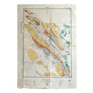
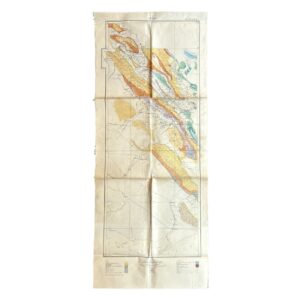
Iran – Persia – Qasr-i-Shirin Area. To Accompany Report M.H.L. 7 – Geological Map – 1929
£2,000.00Anglo-Persian Oil Company
-
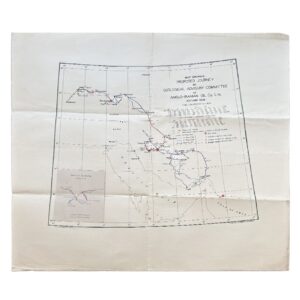
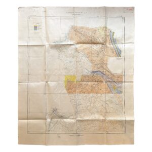
Iran – Map Showing Proposed Journey By Geological Advisory Committee Of Anglo-Iranian Oil Co. Ltd., Autumn 1936
£1,800.00Geological Advisory Committee (Iran)
-
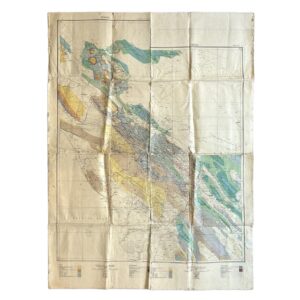
Persia. No. 9 H.E. 10.E – Geological Map Of South-West Iran Including The Masjid-I-Sulaiman And Haft Kel Oil Regions – 1929
£950.00Cornes, H & Anglo-Persian Oil Company (A.P.O.C.)
-
Persia. No. 9 H.E. 10.E – Geological Map Of South-West Iran Including The Masjid-I-Sulaiman And Haft Kel Oil Regions – 1929/35
£950.00Cornes, H & Anglo-Persian Oil Company (A.P.O.C.)
-

Iran – Persia – Masjid-i-Sulaiman Road Map – South-West Iran – Khuzestan Province – Masjid-i-Sulaiman Oilfield District – c.1949-54
£750.00Anglo-Iranian Oil Company (A.I.O.C.)
-
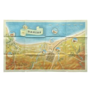
Banias – Iraq Petroleum Company Limited – Sea Terminal of the Kirkuk–Banias Pipeline – 1952
£500.00Iraq Petroleum Company Limited
-
Persia – A.P.O.C. Geological Map Of South-West Iran – Zagros Oilfields – Sheet No. 10 I & 10 J – 1929
£500.00Cornes, H & Anglo-Persian Oil Company (A.P.O.C.)
-

Geological Map Of Israel – Revised Edition – 1976 – Map On Two Sheets
£450.00Picard, L. Y, Golani, U, Bentor, Y. K, Vroman, A & Zak, I
-

-

-
-

-
-

-
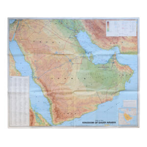
Saudi Arabia With City Maps Of Riyadh Jeddah And Dammam – Second Edition
£250.00GEOprojects Arab World Map Library
-

-

Geological Map Of The Country Around Salisbury – Rhodesia – 1958 – First Edition
£245.00R. M. Tyndale-Biscoe
-

-

-

-

-

-

-

-

-
-

Geological Map Of The Colony Of The Cape Of Good Hope Sheet 4: Paternoster – Langebaan – Darling – Malmesbury
£175.00Rogers, A. W, Schwarz, E. H. L & Du Toit, A. L
-

Geological Map Of The Colony Of The Cape Of Good Hope Sheet 1: Cape Town – Stellenbosch – Somerset West – Robertson – Napier
£175.00Rogers, A. W, Schwarz, E. H. L & Du Toit, A. L
-

-

-

Sheet 12 – Pilandsberg – Union Of South Africa Department Of Mines And Industries – Geological Survey
£145.00Hall, A. L & Humphrey, W. A