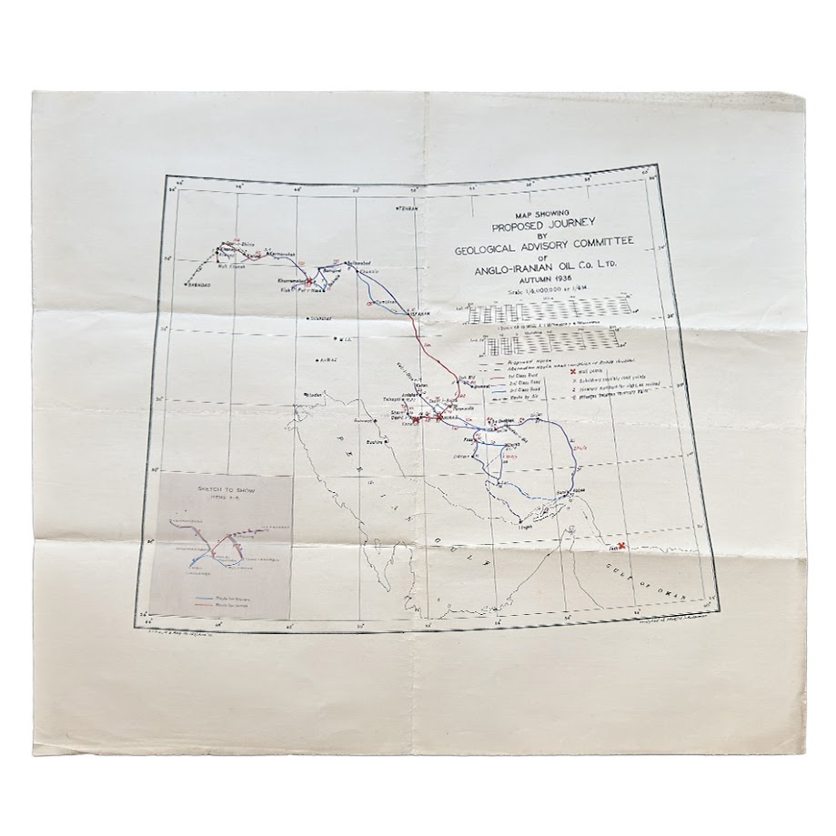
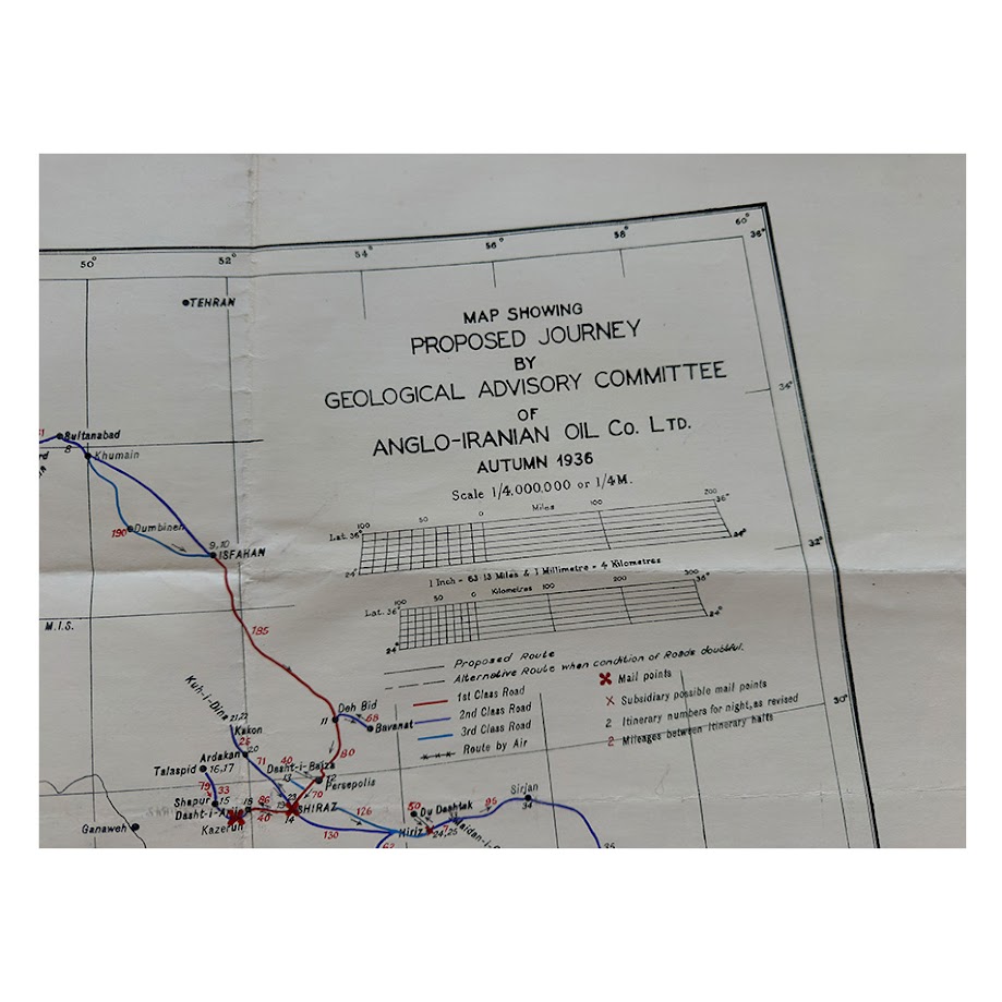
Iran – Map Showing Proposed Journey By Geological Advisory Committee Of Anglo-Iranian Oil Co. Ltd., Autumn 1936
Date: June 1936 (from printed registration)
Scale: 1:4,000,000 (as printed)
Medium: Printed map, reproduced by Van Dyke process, with coloured route overlays (red and blue)
Sheet type: Single-sheet working map
Size: 57.3cm x 50.6cm
Physical Description
Printed map of Iran with overlaid route markings in red and blue, accompanied by a printed key.
Visible features include:
- Colour-coded routes:
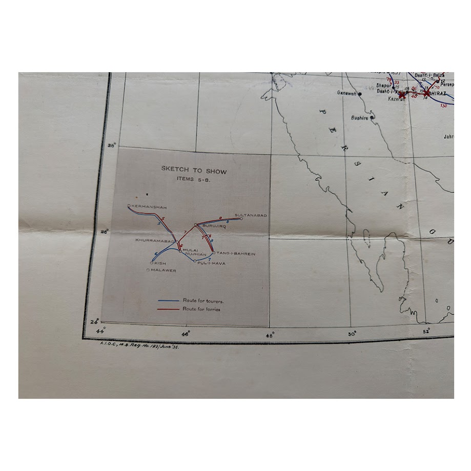
- Blue: “routes for tourers”
- Red: “routes for lorries”
- Road classification: routes differentiated as 1st, 2nd, and 3rd class
- Numbered stages: sequential numbering along routes
- Mileage figures: distances marked between points
- Mail points: indicated at intervals along the route
- Inset panel (Items 5–8): separate schematic route detail in western Iran
Printed marginal inscriptions:
- Lower left:
“A.I.O.C. M.S. Reg. No. 123 / June ’36”
- Lower right:
“Vandyked at Masjid-i-Sulaiman”
The sheet shows fold lines, light surface wear, and minor toning. All principal printed and annotated elements remain legible. In very good plus condition overall.
Geographical Coverage (as shown)
The main mapped route system is concentrated in southern Iran, with clearly legible locations including:
- Shiraz
- A south-easterly route through the Niriz–Darab region
- Termination at the coast near Bandar Abbas
- Continued eastward extension to Jask
The inset (Items 5–8) shows a separate route grouping in western Iran, centred on the Kermanshah / Khurramabad region.
Documentary Markings
- The registration line “A.I.O.C. M.S. Reg. No. 123 / June ’36” records:
- Corporate attribution (Anglo-Iranian Oil Company)
- Internal registration number
- Date: June 1936
- The imprint “Vandyked at Masjid-i-Sulaiman” records:
- Place of reproduction: Masjid-i-Sulaiman
- Method of reproduction (see technical note below)
Content (evidence-based)
The title specifies a “Proposed Journey”.
The map shows:
- Planned routes of travel
- Differentiation by vehicle type
- Staged progression with numbered points and mileages
- Mail points along the routes
No geological or thematic data are depicted.
Technical Note
“Vandyked” denotes reproduction by the Van Dyke photographic copying process, a method used for duplicating maps and technical drawings. This indicates that the present sheet is a reproduced working copy, rather than a primary engraved or lithographic issue.
Interpretation (limited)
The mapped features indicate preparation for organised overland travel along a defined itinerary.
The presence of an internal registration number and on-site reproduction imprint indicates that the map formed part of a controlled, internally produced document series.
Rarity
No identical example has been identified in accessible catalogues or sales records.
Observable factors:
- Internal registration
- Specific journey-based content
- Operational route annotation
- Identified place and method of reproduction
These indicate limited distribution and functional use.
Condition: Very Good Plus
- Old fold lines
- Minor toning and handling wear
- Printed and annotated elements intact and legible
Market Note (cautious)
Comparable material is limited. Maps combining:
- Corporate origin
- Internal registration
- Route-specific planning content
are uncommon in the market.
Summary
An internally registered Anglo-Iranian Oil Company map dated June 1936, showing a proposed journey route network across southern Iran from Shiraz to the Gulf coast and eastward to Jask, with additional inset routes in western Iran. Reproduced at Mesjid-i-Sulaiman by the Van Dyke process and distinguished by colour-coded vehicle routes, staged distances, and communication points.
Location: HO: Drawer D: 003596
SHOP WITH CONFIDENCE AT HORNSEYS
At Hornseys, we are dedicated to offering items that uphold the highest standards of quality and authenticity. Our collection of artwork is carefully curated to ensure that each item we offer is authentic, collated, and complete.
Here’s what sets us apart:
- Authenticity and Provenance: Each map is researched and verified for authenticity.
- Expert Curation: We wholly own all our artworks. We trust our taste and have invested heavily in it. We have confidence in all artwork that we offer for sale.
- Customer Satisfaction: We strive to provide an exceptional customer experience, from detailed descriptions and provenance to secure and prompt delivery of your purchase.
- Returns Policy: We offer an unconditional guarantee on every item. If, however, you wish to make a return, artworks may be sent back to us within fourteen days of receipt for whatever reason. We request that we are notified in advance if you wish to do so. They must be returned to us in the same condition as they were sent for a full refund.
OUR COMMITMENT TO QUALITY AND SERVICE
Understanding the value and rarity of these items, we ensure that every aspect of your purchase meets the highest standards of quality and service. This includes:
- Free Expedited, Tracked, and Insured Delivery within the UK: Ensuring that your artwork arrives safely and promptly.
- Fully-Insured Worldwide Delivery: Offering peace of mind for international collectors with reliable and secure shipping options.
EXPLORE OUR COLLECTION
Visit Hornseys today to explore our fine collection of maps and other artworks. Whether you are an avid collector or looking for a special gift, our selection offers something truly unique. Located since 1976 in Ripon in the picturesque Yorkshire Dales, we are recognized as a destination gallery for tastefully curated artwork, rare maps, design, and fine books.