-

This Trigonometrical Plan Of The Town And Port Of Liverpool Including The Environs Of Kirkdale Everton Low Hill & Toxteth Park From Actual Survey Is By Permission Most Respectfully Dedicated To The Worshipful Mayor And Common Council By Their Most Obedient And Obliged Humble Servant Michael Alexander Gage
£1,200.00Gage, Michael Alexander
-

-
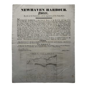
NEWHAVEN HARBOUR – NOTICE – By order of the Commissioners, with the Approbation of The Trinity House – 1814
£750.00Newhaven Harbour & The Commissioners, Trinity House
-
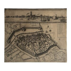
KYNGESTON UPON HULL – KINGSTON UPON HULL – THE SIEGE OF HULL – THE TOWNE OF HULL – c.1680-1890
£650.00Hollar, Wenceslaus
-

-

SCOTIA REGNUM CUM INSULIS ADJACENTIBUS ROBERTUS GORDONIUS A STRALOCH DESCRIPSIT – ORIGINAL COPPER ENGRAVED MAP PUBLISHED BY JOAN BLAEU
£650.00Blaeu, Joan & Gordon, Robert
-

-
-
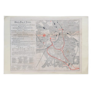
Sketch Map Of London Shewing The Position Of The London Chatham And Dover Railway Victoria (West-End) Station
£495.00The London Chatham And Dover Railway
-

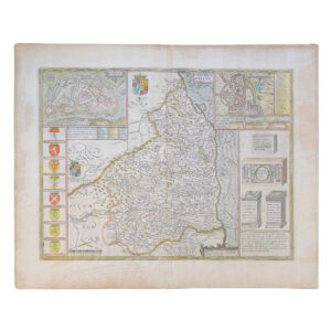
Yorkshire – Ducatus Eboracensis Pars Occidentalis – The West Riding Of Yorke Shire
£495.00Valk, Gerard & Schenk, P
-
-
-
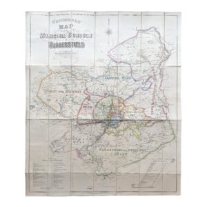
Whitehead’s Map of the Municipal Borough of Huddersfield – Folding Map – 1879
£400.00Whitehead, George & Sons
-
-
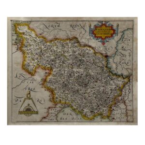
EBORACENSIS Comitatus Occidentalis vulgo WEST RIDING – c.1610-1637
£350.00Hole, William After Christopher Saxton
-

-
-

-

-

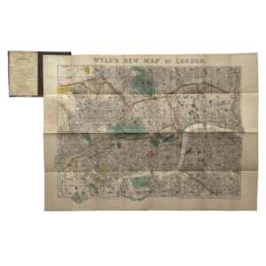
The Handy Series Of Pocket Maps – London And Four And Half Miles Round Charing Cross
£300.00George Philip & Son
-

-

Bristol – City And County Of – Brightstowe Vulgo; Quondam Venta, Flore Tissimum Angliae Emporium
£295.00Braun, Georg & Hogenberg, Franz
-

-

-

-

-

-

-

-

-

Episcopatus Dunelmensis Vulgo – The Bishoprike Of Durham – 1690-1700
£200.00Schenk, Peter & Valk, Gerard
-
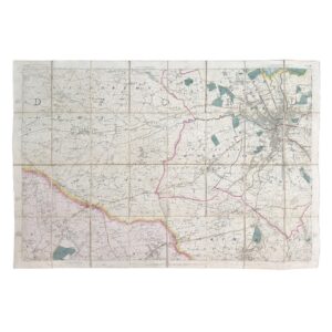
Ordnance Survey / Lt. Colonel Hall – Yorkshire – Sheet 216 – Bradford – First Edition – Folding Map – 1852
£195.00Ordnance Survey / Lt. Colonel Hall