

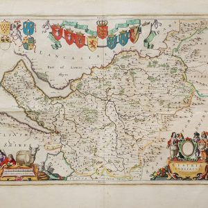
Edward Stanford – Stanford’s Map Of Central London – 1946
Edward Stanford
£250.00
Availability: In stock
Product Description
Edward Stanford – Stanford’s Map Of Central London – 1946
Publisher: Edward Stanford
Price: £250 (post-free in the UK)
Publication Date: 1946
Edition: 1st edition thus
Format: Steel engraving
Condition: Near fine condition, unframed
Sheet Size: 93.5cm x 67.4cm opened
Condition:
Folding map. Original wrappers. Shows post-war central London. Shows Omnibus, Trolleybus and Tram routes along with the Underground. Folding wrappers slightly rubbed. Very minor mark to the lower margin of the map but overall in near fine, bright, clean condition. Scarce.
Location: BR: 002675
London in 1946: A Brief Description
In 1946, London was a city still reeling from the devastation of the Second World War. The capital bore deep scars from the Blitz (1940–1941) and the later V-1 and V-2 rocket attacks (1944–1945). The war had ended in May 1945, but the reality of peacetime was harsh, with the city struggling through economic hardship, rationing, and the slow process of reconstruction. Despite these challenges, Londoners demonstrated remarkable resilience, determined to rebuild their lives and their city.
1. The Physical Landscape: A City of Ruins and Reconstruction
By 1946, London’s skyline was still marked by bomb damage. Over 30,000 bombs had fallen on the city, leaving vast swathes of destruction.
- Bomb Sites and Ruins: Many parts of central London remained unrepaired bomb sites, with entire streets reduced to rubble. Some buildings stood as roofless shells, their interiors gutted by fire. Bricks, twisted metal, and shattered glass were common sights.
- Landmarks in Ruins:
- The Houses of Parliament, particularly the Commons Chamber, had been badly damaged. Reconstruction efforts were underway, but it would take years to fully restore.
- The Temple Church and other historic buildings remained in disrepair.
- St Paul’s Cathedral, miraculously spared from destruction, stood defiantly amidst the devastation.
- Wooden Hoardings and Makeshift Repairs: In many areas, wooden barriers surrounded unsafe buildings, and temporary repairs were visible across the city.
Despite the destruction, there were early signs of rebuilding:
- Clearing of Debris: Large-scale efforts were underway to remove rubble, though shortages of materials and manpower slowed progress.
- Architectural Plans: Proposals for modernisation and new housing developments, such as those by Sir Patrick Abercrombie’s 1944 Greater London Plan, were under discussion, though implementation remained slow.
2. Daily Life: Austerity, Rationing, and Hardship
The war may have ended, but for many Londoners, the hardships continued.
- Rationing was still in full effect, even stricter than during the war.
- Food: Meat, sugar, butter, bread (which had not been rationed during the war but was now strictly controlled), and other essentials were limited. The British government encouraged “Dig for Victory” gardens to supplement food supplies.
- Clothing: Fabric was rationed, and many people made do with “make do and mend” strategies, repairing or altering existing garments.
- Coal and Fuel: The winter of 1946–47 would prove one of the harshest on record, and coal shortages made heating difficult.
- Queuing for Essentials: Long queues were a common sight outside shops, with people waiting patiently for limited goods.
- Utility Shortages: Electricity blackouts and “brownouts” were frequent, as power stations struggled to keep up with demand.
- Rebuilding Families: Many Londoners were grieving lost loved ones, while returning soldiers sought to reintegrate into civilian life.
3. Public Transport and Infrastructure
The war had placed enormous strain on London’s transport network, but by 1946, efforts were underway to restore normal service.
- The London Underground: Many stations still bore visible bomb damage. Some sections of the network had only just reopened after being used as air raid shelters during the war.
- Buses and Trams: London’s red buses were back in operation, but with limited services and aging vehicles.
- Railway Stations: Major hubs like Paddington, Waterloo, and King’s Cross were still recovering from war damage. Delays and disruptions were common.
- The River Thames: London’s docks, once the heart of British trade, were still rebuilding from extensive bomb damage.
Despite these challenges, London’s streets remained bustling. Workers commuted into the city, traders sold their goods at markets like Covent Garden, and black taxis weaved through the damaged roads.
4. Culture and Entertainment: A Glimmer of Normality
Despite the bleakness, Londoners sought entertainment and escapism.
- Theatre: The West End began its slow revival. Theatres like the Old Vic reopened, performing Shakespeare and patriotic plays.
- Cinema: British film studios gained popularity, with films such as Brief Encounter (1945) providing an emotional outlet.
- Music and Dance Halls: Big band music and jazz were popular, and dance halls attracted people eager for a night of fun, despite clothing shortages.
- Football Matches: The return of the Football League in 1946 lifted national morale.
- Literature and Newspapers: Publications like The Times and Daily Express were filled with post-war recovery news, political debates, and reports on Britain’s changing role in the world.
5. Politics and the Future of London
The post-war period marked a political shift, with the Labour government of Clement Attlee, elected in 1945, focusing on rebuilding Britain.
- The Welfare State Beginnings:
- Plans were underway to establish the NHS (National Health Service), a cornerstone of post-war Britain.
- Social housing projects were proposed to replace bombed-out homes.
- The Changing British Empire:
- London was at the centre of discussions about decolonisation, with India’s independence (1947) and tensions in the Middle East shaping British policy.
- The Cold War Begins:
- Britain’s role in the new Cold War era was emerging, and London became a key city in international diplomacy.
6. Conclusion: London’s Resilience
London in 1946 was a city in transition—a capital marked by ruins, hardship, and rationing, yet also resilience, determination, and renewal. While the physical scars of war were everywhere, the indomitable spirit of Londoners remained strong. As the city faced a challenging future, it was clear that London’s identity as a centre of culture, commerce, and global influence would endure.
Edward Stanford Ltd: Post-World War II: A Brief History
1. Introduction
Edward Stanford Ltd., one of Britain’s most renowned map and book sellers, had long established itself as a leading authority in cartography by the end of the Second World War. Founded in 1853, the company had built a reputation for producing high-quality maps, atlases, and travel books, catering to explorers, the military, and the general public. The post-war period presented both challenges and opportunities for Stanford’s as Britain emerged from wartime austerity into a new era of global change.
2. Immediate Post-War Challenges (1945–1950)
A. The Impact of War
During the war, Stanford’s had been heavily involved in producing maps for the British government, military, and intelligence services. Many of their pre-war activities were disrupted, and like many London businesses, they faced significant damage from the Blitz.
- Bomb Damage & Recovery: The company’s headquarters at 12–14 Long Acre, Covent Garden, suffered damage during air raids, requiring repairs and reconstruction.
- Paper Shortages: Post-war Britain was subject to strict rationing, including paper shortages, which affected map production and publishing.
- Economic Austerity: The broader economic difficulties of the late 1940s meant that consumer spending was limited, and many Britons prioritised essentials over travel and books.
B. Adapting to the New World Order
Despite these setbacks, Stanford’s quickly adapted to the changing world:
- Military and Government Contracts: They continued to supply the British government with maps, particularly for use in post-war reconstruction, colonial administration, and intelligence operations.
- Shift Towards Civilian Markets: With demobilisation and a return to civilian life, there was growing interest in travel, prompting a resurgence in demand for maps, travel guides, and atlases.
3. Expansion and Growth (1950s–1960s)
A. The Travel Boom
With the easing of rationing and the economic recovery of the 1950s, international travel increased, especially as commercial aviation became more accessible. Stanford’s capitalised on this trend by:
- Expanding their range of travel books, city guides, and road maps.
- Producing detailed maps for new tourist destinations, including Europe, North America, and newly independent countries in Africa and Asia.
- Offering custom mapping services for businesses, explorers, and government agencies.
B. The Decline of the British Empire and New Cartographic Needs
As Britain decolonised, newly independent nations required updated maps and atlases reflecting new borders and political realities.
- Stanford’s was involved in redrawing maps for countries gaining independence from British rule, particularly in India (1947), Africa (1950s–60s), and the Middle East.
- Their maps were widely used in academic and diplomatic circles for understanding geopolitical changes.
C. The Rise of Car Travel and Road Mapping
The 1950s and 60s saw a boom in automobile travel, both domestically and internationally.
- Stanford’s expanded their range of road maps for British and European motorists.
- Their maps became indispensable for new motorway networks in Britain and continental Europe.
4. Stanford’s in the Late 20th Century (1970s–1990s)
By the second half of the 20th century, Stanford’s had firmly re-established itself as Britain’s premier map retailer and publisher.
A. The Shift Towards Specialist and Thematic Maps
- Topographic and Ordnance Survey Maps: With increasing interest in outdoor pursuits like hiking and cycling, Stanford’s became a major stockist of Ordnance Survey maps.
- Specialist Atlases: They produced atlases focusing on economic, political, and historical themes, appealing to scholars, businesses, and travellers.
- Scientific & Environmental Cartography: There was growing demand for climate maps, geological maps, and conservation-focused mapping.
B. Embracing New Technologies
- Photolithographic printing improved the quality and accessibility of maps.
- Colour printing became standard, making maps more visually appealing and informative.
- Computing and Geographic Information Systems (GIS) began to influence map-making in the late 20th century, although traditional printed maps remained dominant.
C. The Rise of Competition
By the 1980s and 90s, Stanford’s faced increased competition from:
- Michelin and AA (Automobile Association), which produced detailed road maps and guides.
- Commercial bookshops expanding their travel sections.
- Early digital mapping technologies (though not yet widespread).
5. Stanford’s Legacy and Influence
By the end of the 20th century, Stanford’s remained a prestigious institution in the world of maps and travel literature. Despite changes in technology and consumer habits, they retained their reputation for expertise, accuracy, and historical significance.
Key aspects of their post-war legacy include:
- Being a primary resource for explorers, geographers, and travel enthusiasts.
- Helping document and shape Britain’s understanding of a rapidly changing world.
- Remaining a central fixture in Covent Garden, London, where their flagship shop continued to serve customers.
6. Conclusion
Edward Stanford Ltd. navigated the post-World War II period with resilience and adaptability. From wartime destruction and economic hardship, they emerged as a leader in cartography, benefiting from the global travel boom, decolonisation, and technological advances in map-making. Their legacy as Britain’s premier map retailer and publisher remained strong into the late 20th century, setting the stage for the challenges and opportunities of the digital age.
SHOP WITH CONFIDENCE AT HORNSEYS
At Hornseys, we are dedicated to offering items that uphold the highest standards of quality and authenticity. Our collection of artwork is carefully curated to ensure that each item we offer is authentic, collated, and complete.
Here’s what sets us apart:
- Authenticity and Provenance: Each map is researched and verified for authenticity.
- Expert Curation: We wholly own all our artworks. We trust our taste and have invested heavily in it. We have confidence in all artwork that we offer for sale.
- Customer Satisfaction: We strive to provide an exceptional customer experience, from detailed descriptions and provenance to secure and prompt delivery of your purchase.
- Returns Policy: We offer an unconditional guarantee on every item. If, however, you wish to make a return, artworks may be sent back to us within fourteen days of receipt for whatever reason. We request that we are notified in advance if you wish to do so. They must be returned to us in the same condition as they were sent for a full refund.
OUR COMMITMENT TO QUALITY AND SERVICE
Understanding the value and rarity of these items, we ensure that every aspect of your purchase meets the highest standards of quality and service. This includes:
- Free Expedited, Tracked, and Insured Delivery within the UK: Ensuring that your artwork arrives safely and promptly.
- Fully-Insured Worldwide Delivery: Offering peace of mind for international collectors with reliable and secure shipping options.
EXPLORE OUR COLLECTION
Visit Hornseys today to explore our fine collection of maps and other artworks. Whether you are an avid collector or looking for a special gift, our selection offers something truly unique. Located since 1976 in Ripon in the picturesque Yorkshire Dales, we are recognised as a destination gallery for tastefully curated artwork, rare maps, design, and fine books.
Related products


You may also like…

(The Congo, Angola) Carte Des Royaumes De Congo, Angola Et Benguela Avec Les Pays Voisins Tire de L’Anglois
£65.00Bellin, Jacques Nicolas

