Folding Maps
Folding Maps: A Brief History
Folding maps have a rich history, emerging as essential tools for travellers, explorers, military commanders, and later, tourists. Their design allowed for detailed geographical information to be conveyed in a practical, portable format. The history of folding maps can be traced back to the 16th and 17th centuries, when the rise of exploration and trade routes across Europe and the New World increased the demand for easily transportable maps.
Early Developments (16th–17th Centuries)
The earliest folding maps were printed on paper, and their portability made them an invaluable resource for travellers. During this period, cartographers such as Gerardus Mercator and Abraham Ortelius began creating more accurate maps. However, these early maps were often large and cumbersome, making it difficult for individuals to transport them on long journeys. Folding maps addressed this issue by allowing users to carry a large map that could be folded down into a compact size.
Maps from this era were generally hand-drawn or engraved, with coloured elements added by hand to indicate political boundaries or important landmarks. As the printing press evolved, folding maps became more common, particularly with the advent of guidebooks and atlases, which often included folding maps to assist travellers.
The Golden Age of Folding Maps (18th–19th Centuries)
The 18th century saw a significant increase in the production of folding maps, coinciding with the expansion of road networks, the growth of European empires, and the development of canals and railways. This period, often referred to as the “Golden Age” of cartography, was marked by a higher demand for practical maps as travel, trade, and military movements intensified.
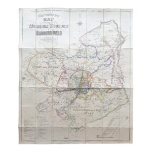
In Britain, the Ordnance Survey began producing detailed folding maps in the early 19th century, which were used by both the military and civilians. Folding maps were often incorporated into travel guides, such as Paterson’s Roads (a popular British guidebook), which provided a comprehensive overview of turnpike roads across the country. These maps, often folded within books, became indispensable for those navigating the expanding road and canal systems of the time.
Folding maps were also essential for military use, particularly during the Napoleonic Wars and later conflicts. Military commanders needed detailed topographical information that could be easily transported in the field. Folding maps became an important tool in planning campaigns and manoeuvres, with many maps specifically created for military purposes, focusing on terrain, fortifications, and key logistical routes.
Technological Advancements (19th Century)
By the mid-19th century, advancements in printing techniques, such as lithography, allowed for the mass production of maps. Folding maps were now printed in greater quantities, making them more affordable and accessible. The development of steam-powered transportation—trains and ships—further increased the demand for portable maps, as travellers sought reliable information about routes, stations, and destinations.
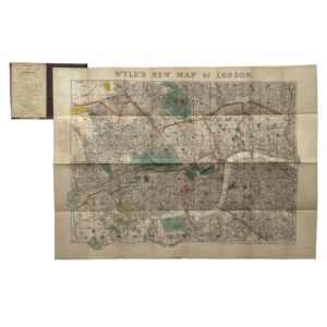
This period also saw the rise of tourism, with folding maps being produced specifically for sightseers and tourists. Maps of cities, regions, and scenic routes became popular, often sold at railway stations and bookshops. Folding maps were frequently included in tourist guidebooks, such as Baedeker’s, which became famous for providing detailed maps of European cities and attractions.
Decline and Legacy (20th Century Onwards)
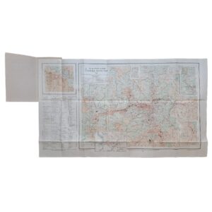
With the advent of the 20th century, folding maps remained popular, especially with the expansion of the motor car industry. Maps designed for motorists became commonplace, often showing road networks and routes across entire countries. The production of these maps was standardised, with companies like the Automobile Association (AA) in the UK and Michelin in France leading the way in producing high-quality, easy-to-use road maps.
However, the rise of digital mapping in the late 20th and early 21st centuries, alongside the invention of GPS and online map services, has led to a decline in the use of traditional folding maps. Despite this, many still value folding maps for their historical significance, aesthetic appeal, and the detailed craftsmanship that went into their production. Today, folding maps are prized by collectors, historians, and cartography enthusiasts, with many rare or antique examples fetching high prices at auctions. They remain a testament to the ingenuity and importance of portable cartography in the development of travel, exploration, and trade throughout history.
In conclusion, folding maps played a crucial role in the history of cartography, providing travellers and professionals with practical, portable solutions for navigation. From their origins in the early modern period to their heyday in the 19th century, folding maps evolved alongside advancements in transportation and technology, leaving a lasting legacy in the world of cartography.
SHOP WITH CONFIDENCE AT HORNSEYS
At Hornseys, we are dedicated to offering items that uphold the highest standards of quality and authenticity. Our collection of artwork is carefully curated to ensure that each item we offer is authentic, collated, and complete.
Here’s what sets us apart:
- Authenticity and Provenance: Each map is researched and verified for authenticity.
- Expert Curation: We wholly own all our artworks. We trust our taste and have invested heavily in it. We have confidence in all artwork that we offer for sale.
- Customer Satisfaction: We strive to provide an exceptional customer experience, from detailed descriptions and provenance to secure and prompt delivery of your purchase.
- Returns Policy: We offer an unconditional guarantee on every item. If, however, you wish to make a return, artworks may be sent back to us within fourteen days of receipt for whatever reason. We request that we are notified in advance if you wish to do so. They must be returned to us in the same condition as they were sent for a full refund.
OUR COMMITMENT TO QUALITY AND SERVICE
Understanding the value and rarity of these items, we ensure that every aspect of your purchase meets the highest standards of quality and service. This includes:
- Free Expedited, Tracked, and Insured Delivery within the UK: Ensuring that your artwork arrives safely and promptly.
- Fully-Insured Worldwide Delivery: Offering peace of mind for international collectors with reliable and secure shipping options.
EXPLORE OUR COLLECTION
Visit Hornseys today to explore our fine collection of maps and other artworks. Whether you are an avid collector or looking for a special gift, our selection offers something truly unique. Located since 1976 in Ripon in the picturesque Yorkshire Dales, we are recognized as a destination gallery for tastefully curated artwork, rare maps, design, and fine books.