

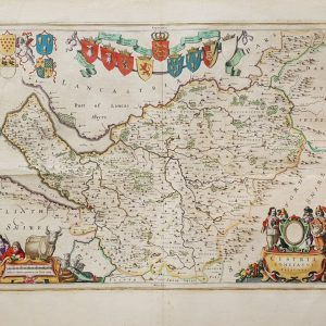
John Cary – New Plan Of London – With A Correct List Of Upwards Of 350 Hackney Coach Fares – London Westminster And Southwark – 1785
Cary, John
£300.00
Availability: In stock
Product Description
John Cary – New Plan Of London – With A Correct List Of Upwards Of 350 Hackney Coach Fares – London Westminster And Southwark – 1785
Publisher: J Wallis & J Cary
Price: £300 (post-free in the UK)
Publication Date: 1785
Edition: 1st edition thus
Format: Copper engraving
Condition: Good
Sheet Size: 55.2cm x 41.3cm opened.
Condition:
Folding map. Original or very early hand-colouring. Original slipcase. Size: 55.2cm x 41.3cm opened. Slipcase marked and rubbed. Minor marks to the ‘Hackney Coach Fares’ listings. Age marks to the reverse of the map which do not show through. Wear to the linen fold-lines with split to the central top fold. In good condition overall. Scarce.
Location: BR: 002677
London in the 1780s: A Brief Description
London in the 1780s was a city of contrasts—grand yet squalid, bustling yet perilous. As Britain’s largest and most influential city, it was the heart of commerce, politics, and culture, with a population exceeding 750,000. The city was expanding beyond its medieval walls, with new developments in the West End, while the Thames remained its lifeline, teeming with ships that connected London to the far reaches of the British Empire.
Urban Landscape and Architecture
The cityscape of late Georgian London was a mix of old and new. The medieval heart of the city, from St Paul’s Cathedral to London Bridge, remained the financial and commercial centre, while the West End was emerging as a fashionable district for the aristocracy.
Elegant Georgian townhouses lined the newly developed streets of Mayfair, Marylebone, and Bloomsbury, featuring symmetrical facades, sash windows, and classical detailing. The grand squares of Berkeley Square, Bedford Square, and Fitzroy Square housed London’s elite, while the working poor lived in cramped courts and alleys in St Giles, Whitechapel, and Southwark.
London’s skyline was dominated by the dome of St Paul’s, the towers of Westminster Abbey, and the masts of countless ships crowding the Thames docks. Public buildings such as Somerset House (completed in 1780) reflected the growing influence of Neoclassical architecture, a style favoured by the ruling elite.
However, much of the city remained dirty, overcrowded, and poorly maintained. Streets were narrow and winding, often unpaved and littered with refuse, while open sewers contributed to the city’s notorious stench.
Society and Class Structure
London was sharply divided by wealth and class. The aristocracy and gentry, many of whom had country estates, maintained townhouses in the capital, where they attended balls, the theatre, and parliamentary sessions. The middle classes, including merchants, lawyers, and skilled tradesmen, occupied respectable homes in emerging suburbs like Islington and Southwark.
For the working classes, life was harsh. Labourers, dockworkers, and servants lived in overcrowded tenements, often in squalid conditions. The poorest inhabitants, including beggars and prostitutes, congregated in the notorious rookery slums of St Giles and Wapping, where crime and disease were rampant.
Despite these divisions, Londoners of all classes shared a love for entertainment. Pleasure gardens such as Vauxhall and Ranelagh hosted extravagant concerts and fireworks, while street performances, fairs, and tavern gatherings provided amusement for the lower orders.
Commerce and Trade
By the 1780s, London had cemented its position as the commercial capital of the world. The Port of London was the busiest in Europe, with ships arriving daily laden with goods from across the Empire. The city’s economy thrived on trade, banking, and manufacturing, with the Bank of England, established in 1694, growing in importance.
Markets such as Billingsgate (for fish), Smithfield (for meat), and Covent Garden (for fruit and vegetables) were bustling hubs of activity, supplying the city’s growing population. Shopkeepers lined Fleet Street, the Strand, and Cheapside, selling luxury goods such as silk, porcelain, and watches.
Coffee houses remained important centres of business and political discussion, particularly in the City of London, where merchants and financiers gathered to exchange news and conduct transactions.
Transport and Travel
London’s streets were crowded with pedestrians, horse-drawn coaches, sedan chairs, and carts. Wealthy Londoners travelled in private carriages, while the middle and lower classes relied on hackney coaches and stagecoaches for longer journeys. The Thames was one of the city’s most efficient transport routes, with watermen ferrying passengers across and along the river.
The state of the roads was notoriously poor, with muddy thoroughfares and deep ruts making travel difficult, especially in wet weather. Street lighting was limited, with oil lamps providing faint illumination, leaving many streets in darkness and danger after nightfall.
Crime and Law Enforcement
The late 18th century was a period of high crime rates, with highwaymen, pickpockets, and burglars preying on the unwary. The Bow Street Runners, an early form of policing founded in 1749, attempted to maintain order, but crime remained rampant, particularly in poorer areas.
Public executions at Tyburn Gallows drew large crowds, with convicts hanged in full view of the public. Theft, fraud, and even minor offences could result in severe punishments, including transportation to the American colonies or Australia. Debt prisons, such as the Marshalsea, housed thousands of unfortunate individuals unable to pay their creditors.
Culture and Entertainment
London’s theatres and pleasure gardens flourished in the 1780s. Theatres such as Drury Lane and Covent Garden hosted plays by Shakespeare, Sheridan, and Goldsmith, attracting both the aristocracy and the working classes. Opera and classical music grew in popularity, with performances by Handel and Haydn drawing elite audiences.
Literature thrived, with the rise of the novel as a popular form of entertainment. Writers such as Samuel Johnson and Fanny Burney chronicled the complexities of London life, while print culture expanded through newspapers, pamphlets, and satirical prints.
At the same time, scientific and intellectual movements gained traction, with institutions such as the Royal Society and the Society of Antiquaries fostering debate and discovery.
Health, Sanitation, and Public Services
London in the 1780s was notorious for poor sanitation. The lack of a proper sewage system meant that waste was thrown into the streets or emptied into the Thames, contaminating the water supply. Disease was widespread, with smallpox, typhus, and tuberculosis common among the poor.
Hospitals such as St Bartholomew’s and Guy’s provided medical care, but treatments remained primitive, often relying on bloodletting and herbal remedies. Infant mortality was high, and life expectancy, particularly among the lower classes, was low.
Efforts to improve public health were limited, though philanthropic societies began to advocate for better conditions, particularly in workhouses and orphanages.
Conclusion
London in the 1780s was a city on the cusp of modernisation, still deeply rooted in Georgian traditions but beginning to experience the changes that would define the Industrial Revolution. It was a city of grand townhouses and filthy slums, of bustling commerce and rampant crime, of high culture and harsh realities. The foundations of modern London were being laid, but it remained a place of chaos, opportunity, and contradiction, reflecting both the grandeur and the struggles of Britain in the late 18th century.
John Cary: A Brief Biography
John Cary was one of the most influential British cartographers of the late 18th and early 19th centuries, renowned for his accuracy, clarity, and craftsmanship in mapmaking. His work played a crucial role in improving the precision of British cartography, bridging the gap between the artistic maps of the early Georgian era and the scientifically accurate maps of the Victorian period. His atlases, road maps, and county surveys provided vital information for travellers, merchants, and government officials, leaving a lasting legacy in the field of cartography.
Early Life and Career
John Cary was born in the mid-18th century and apprenticed as an engraver before establishing his own mapmaking business in London. His skill as an engraver set the foundation for his later success, as he quickly gained recognition for his ability to produce detailed and legible maps.
By the 1780s, he had begun publishing his own works, focusing on maps that were both aesthetically pleasing and highly functional. Unlike many of his predecessors, who often prioritised decoration over accuracy, Cary was committed to producing maps that were clear, precise, and easy to read, ensuring their practical use for both government and civilian purposes.
Major Works and Contributions
Cary’s reputation was cemented in 1787, when he published his New and Correct English Atlas, a collection of county maps that became one of the most widely used atlases of its time. The work was celebrated for its accuracy and set new standards for British cartography, improving upon earlier maps that often contained significant errors in measurement and geographical representation.
In 1794, he was appointed Surveyor of Roads to the General Post Office, a role that required him to map the country’s major routes with precision. This position led to the publication of Cary’s New Itinerary in 1798, a groundbreaking work that provided a detailed account of the roads of England and Wales. The Itinerary included distances between towns, descriptions of road conditions, and practical information for travellers, making it an indispensable resource for stagecoach drivers, merchants, and tourists.
His work continued with the Cary’s Traveller’s Companion, a pocket-sized road atlas designed for ease of use on long journeys. This publication further established him as a leading figure in cartography, ensuring that his maps were used across Britain by those who needed reliable geographical information.
Scientific Accuracy and Innovations
Cary was among the first mapmakers to apply the findings of the Ordnance Survey, incorporating more precise measurements into his maps. His commitment to accuracy and his meticulous approach to engraving resulted in maps that were not only visually appealing but also scientifically reliable.
One of his most significant achievements was Cary’s New Universal Atlas, published in 1808. This work provided detailed maps of the world, reflecting Britain’s growing influence as a global power. It became a widely respected reference for explorers, traders, and naval officers, reinforcing Cary’s status as one of the foremost mapmakers of his time.
His maps were distinguished by their clarity, detailed road networks, and consistent use of scale, which set a precedent for future British cartographers. While earlier maps often contained exaggerated proportions or decorative flourishes that obscured key details, Cary prioritised functionality and readability, making his works highly practical.
Later Years and Legacy
Cary’s influence extended well beyond his lifetime. His sons, George and John Cary, continued the business, maintaining the high standards he had set. His maps remained in widespread use long after his death, and many of his techniques were adopted by later cartographers.
The impact of his work is still evident today. His atlases and road maps not only provided an essential resource for travellers in his own time but also serve as valuable historical documents, offering insights into Britain’s transportation networks, urban development, and geographical understanding during the early 19th century.
John Cary’s dedication to accuracy, his clear and practical approach to cartography, and his contributions to British mapping cemented his reputation as one of the greatest cartographers of his era. His maps and atlases continue to be studied and admired, reflecting a legacy built on precision, innovation, and craftsmanship.
SHOP WITH CONFIDENCE AT HORNSEYS
At Hornseys, we are dedicated to offering items that uphold the highest standards of quality and authenticity. Our collection of artwork is carefully curated to ensure that each item we offer is authentic, collated, and complete.
Here’s what sets us apart:
- Authenticity and Provenance: Each map is researched and verified for authenticity.
- Expert Curation: We wholly own all our artworks. We trust our taste and have invested heavily in it. We have confidence in all artwork that we offer for sale.
- Customer Satisfaction: We strive to provide an exceptional customer experience, from detailed descriptions and provenance to secure and prompt delivery of your purchase.
- Returns Policy: We offer an unconditional guarantee on every item. If, however, you wish to make a return, artworks may be sent back to us within fourteen days of receipt for whatever reason. We request that we are notified in advance if you wish to do so. They must be returned to us in the same condition as they were sent for a full refund.
OUR COMMITMENT TO QUALITY AND SERVICE
Understanding the value and rarity of these items, we ensure that every aspect of your purchase meets the highest standards of quality and service. This includes:
- Free Expedited, Tracked, and Insured Delivery within the UK: Ensuring that your artwork arrives safely and promptly.
- Fully-Insured Worldwide Delivery: Offering peace of mind for international collectors with reliable and secure shipping options.
EXPLORE OUR COLLECTION
Visit Hornseys today to explore our fine collection of maps and other artworks. Whether you are an avid collector or looking for a special gift, our selection offers something truly unique. Located since 1976 in Ripon in the picturesque Yorkshire Dales, we are recognised as a destination gallery for tastefully curated artwork, rare maps, design, and fine books.
Related products

Durham: Map Of The County Palatine Of Durham From An Actual Survey Made In The Years 1818 & 1819
£150.00Greenwood, C & I


You may also like…
(The Congo, Angola) Carte Des Royaumes De Congo, Angola Et Benguela Avec Les Pays Voisins Tire de L’Anglois
£65.00Bellin, Jacques Nicolas


