

Edward Mogg – Mogg’s Diamond New Plan Of London – 1840
Mogg, Edward S
£220.00
Availability: In stock
Product Description
Edward Mogg – Mogg’s Diamond New Plan Of London – 1840
Publisher: Edward Mogg
Price: £220 (post-free in the UK)
Publication Date: 1840
Edition: 1st edition thus
Format: Steel engraving
Condition: Very good plus
Sheet Size: 31.2cm x 23.8cm opened
Condition:
Folding map. Original boards with paper label. Size: 31.2cm x 23.8cm opened. Boards slightly marked and rubbed. Minor marks to the margins of the map but overall in very good plus, clean condition. Scarce.
Location: BR: 002676
London in the 1840s: A Brief Description
London in the 1840s was a city of stark contrasts, shaped by industrial expansion, social upheaval, and rapid population growth. It was a place of grandeur and filth, innovation and squalor, where the wealth of the Empire co-existed with extreme poverty. Below is a detailed description of life in the city during this decade.
Population and Urban Growth
By the 1840s, London was the largest city in the world, with a population exceeding two million. The rapid expansion was fuelled by industrialization, rural migration, and the city’s position as the heart of the British Empire. New suburbs were emerging, but central areas like Whitechapel, St Giles, and Southwark were overcrowded slums teeming with the poor.
The city was a chaotic maze of narrow streets, alleys, and grand avenues. St Paul’s Cathedral and Westminster Abbey remained dominant landmarks, while newer developments, such as Trafalgar Square (completed in 1844) and the construction of the Houses of Parliament (following the 1834 fire), added to London’s evolving architectural landscape.
Industry, Trade, and Commerce
London was the financial centre of the world, with the Bank of England and the Royal Exchange at its core. The River Thames, though polluted, bustled with ships, barges, and wherries transporting goods to and from the docks at Wapping, Rotherhithe, and Limehouse.
Factories and workshops, particularly in Spitalfields, Clerkenwell, and the East End, produced textiles, furniture, and metal goods. The Great Exhibition of 1851 was still a decade away, but the city was already the hub of Victorian enterprise. Shops and markets, from the elegant arcades of Regent Street to the rag fairs of Petticoat Lane, catered to every class.
Housing and Social Divide
London’s social hierarchy was rigid. The West End was home to aristocrats and wealthy merchants, with grand terraces in Mayfair and Belgravia. Middle-class professionals lived in semi-detached villas in areas like Camden and Islington.
The working classes, however, endured appalling conditions. Slum housing in areas like Seven Dials, Bethnal Green, and the Rookeries of St Giles was overcrowded, unsanitary, and disease-ridden. Rooms were often shared between multiple families, and makeshift lodging houses crammed in as many tenants as possible.
Transport and Infrastructure
The 1840s saw the dawn of railway expansion in London. Euston Station, opened in 1837, was followed by King’s Cross and Paddington. Trains revolutionized travel, allowing people to commute from the suburbs.
Within the city, transport remained primitive. Horse-drawn omnibuses and hackney carriages served the main thoroughfares, but streets were congested and filthy. The Thames, though heavily-polluted, was still a primary means of transport, with paddle steamers ferrying passengers.
Health, Sanitation, and Crime
Public health in the 1840s was dire. The Thames was a stinking sewer, overflowing with human and industrial waste. Cholera outbreaks, such as the one in 1848-49, devastated the city, and diseases like typhus and tuberculosis were rampant in poorer districts.
The Metropolitan Police, founded in 1829 by Sir Robert Peel, struggled to maintain order. Petty crime was rife, with pickpockets and thieves operating in the crowded streets. The criminal underworld, as depicted in Charles Dickens’s Oliver Twist (1837), flourished in areas like Jacob’s Island.
Culture and Society
London’s literary and artistic scene was thriving. Charles Dickens was at the height of his career, publishing Dombey and Son (1846-48) and David Copperfield (1849-50), often drawing from the city’s harsh realities. Theatres in Covent Garden and Drury Lane entertained both the elite and working classes.
The British Museum, already a centre of learning, continued to grow, while the Royal Academy exhibited works by leading artists of the day. Meanwhile, religious revival movements influenced social attitudes, with growing concern for the poor leading to reforms in education and welfare.
Conclusion
London in the 1840s was a city of extremes—of wealth and poverty, progress and suffering. The Industrial Revolution brought new opportunities, but also exacerbated social inequalities. The foundations of modern London were being laid, but it remained a place of hardship for many, a setting immortalised in the works of Dickens and other Victorian chroniclers.
Chaplin’s Spread Eagle Inn, Gracechurch Street, London: A Brief Description
The Spread Eagle Inn, located on Gracechurch Street, was one of London’s most renowned coaching inns during the early 19th century. It was a vital hub for travellers and traders, serving as a gateway to and from the city during the height of the coaching era.
Architecture and Layout
The inn was a classic example of a traditional coaching inn, designed around a large central courtyard where stagecoaches would arrive and depart. The buildings surrounding the yard were three stories high, with wooden galleries on the upper floors that provided access to guest rooms. The courtyard was a bustling space, constantly filled with the sounds of horses being changed, luggage being loaded, and travellers preparing for their journeys.
Inside, the inn had warm and spacious public rooms, including a taproom, parlour, and dining area, catering to both short-term visitors and those staying overnight. The guest rooms, though simple, were well-maintained and suited for weary travellers. The kitchen and staff quarters were located toward the back, ensuring that meals could be prepared efficiently for the constant flow of guests.
Role in London’s Coaching Network
The Spread Eagle Inn was owned and managed by William James Chaplin, a dominant figure in the London coaching industry. By the mid-1830s, Chaplin operated an extensive network of stagecoaches, with dozens of services departing from the inn daily. His company maintained over 1,800 horses and employed thousands of coachmen, ostlers, and inn staff to ensure smooth operations.
Passengers could board long-distance coaches to destinations across England or short-haul services to market towns and nearby suburbs. The inn also functioned as a parcel and mail hub, where goods and letters were collected and distributed alongside passenger services.
Bustling Atmosphere
The inn’s prime location near Leadenhall Market made it a lively meeting place for merchants, businessmen, and travellers alike. The yard was filled with the clip-clop of hooves, the shouts of ostlers tending to horses, and the murmur of passengers preparing for their journeys. Inside, the tavern provided a warm refuge, with ale flowing, fires crackling, and lively conversation among those pausing in their travels.
The Spread Eagle was not just a transport hub—it was a social and commercial centre. Many who passed through were gentlemen on business, families on holiday, or working-class individuals seeking new opportunities in the growing industrial landscape.
Decline and Demolition
With the arrival of the railways in the 1840s, coaching inns like the Spread Eagle saw a gradual decline. Chaplin, ever the businessman, adapted by integrating his services with the expanding railway network, using his expertise to connect passengers between trains and destinations not yet served by rail. However, by the 1860s, the dominance of rail travel had largely replaced the stagecoach industry.
In 1865, the Spread Eagle Inn was demolished, marking the end of an era. Its disappearance symbolised the transformation of London’s transport system and the decline of the traditional coaching inn, once the beating heart of the city’s travel network.
Edward S. Mogg: A Brief Biography
Edward S. Mogg was a distinguished British mapmaker, publisher, and travel guide author of the early 19th century. His work played a significant role in documenting the evolving infrastructure of Britain during a period of rapid industrialisation and urban expansion. Through his meticulously detailed maps and comprehensive travel guides, he provided essential resources for both local residents and travellers navigating an increasingly complex transport network.
Early Life and Career
Little is known about Mogg’s early life, but by the early 19th century, he had established himself as a notable figure in London’s publishing scene. He specialised in producing maps and guides that detailed the roads, coach routes, and later, railway networks of Britain. His work reflected the needs of a growing and mobile population, eager for accurate and practical travel information.
Contributions to Cartography and Travel Literature
Mogg’s maps were renowned for their clarity, precision, and ease of use. He published detailed road surveys, providing essential information for travellers relying on horse-drawn coaches. His early works included meticulously plotted routes from London to major destinations such as Brighton, Southampton, and Dover, ensuring that both business travellers and holidaymakers could navigate their journeys efficiently.
As Britain’s transport system evolved, Mogg adapted his publications to reflect these changes. His Survey of the High Roads of England and Wales was a particularly influential work, documenting key routes and offering insight into the geography of southern England. These publications were indispensable to coachmen, merchants, and tourists alike, serving as comprehensive guides to the country’s roads and towns.
Mapping London and Its Environs
Beyond national travel guides, Mogg had a keen interest in mapping London and its surrounding areas. His New Picture of London, first published in the early 19th century, was an essential reference for visitors and residents. It provided not only detailed maps but also descriptions of the city’s major landmarks, public institutions, and facilities. Updated regularly, it captured the transformation of London from a bustling Georgian city into a modern Victorian metropolis.
Mogg’s London maps often included intricate details of streets, districts, and the rapidly expanding suburbs, reflecting the city’s shifting landscape. His work was particularly valuable as new roads and buildings were constructed, and as infrastructure improvements, such as bridges and thoroughfares, reshaped the capital.
The Railway Era and Adaptation
The arrival of the railways in the 1830s and 1840s marked a dramatic shift in British transport. Ever the innovator, Mogg quickly recognised the importance of this new mode of travel and adapted his work accordingly. In 1840, he published Mogg’s Handbook for Railway Travellers, a practical guide that provided essential information for passengers navigating Britain’s growing railway network.
This handbook covered key railway lines, offering details about stations, fares, routes, and nearby attractions. Mogg also produced specialised guides for significant lines, including the Brighton Railway and the Great Western Railway, ensuring that passengers had access to accurate and reliable travel advice. His work catered to a new kind of traveller—one who could cover great distances in hours rather than days, thanks to the advent of steam locomotion.
Legacy and Influence
Mogg’s dedication to precision and practicality ensured that his publications remained widely used throughout the first half of the 19th century. His work captured a time of immense change in Britain’s transport history, from the coaching era to the rise of the railways, offering a unique glimpse into how people moved across the country.
Though many of his maps and guides were eventually superseded by newer publications, they remain valuable historical documents. Today, collectors and historians regard Mogg’s works as essential references for understanding 19th-century Britain’s transport infrastructure, urban development, and social mobility.
His contribution to British cartography and travel literature cannot be overstated. Through his meticulous documentation of roads, cities, and railways, Edward S. Mogg provided an indispensable service to his contemporaries, and his legacy endures as a window into a transformative era in British history.
SHOP WITH CONFIDENCE AT HORNSEYS
At Hornseys, we are dedicated to offering items that uphold the highest standards of quality and authenticity. Our collection of artwork is carefully curated to ensure that each item we offer is authentic, collated, and complete.
Here’s what sets us apart:
- Authenticity and Provenance: Each map is researched and verified for authenticity.
- Expert Curation: We wholly own all our artworks. We trust our taste and have invested heavily in it. We have confidence in all artwork that we offer for sale.
- Customer Satisfaction: We strive to provide an exceptional customer experience, from detailed descriptions and provenance to secure and prompt delivery of your purchase.
- Returns Policy: We offer an unconditional guarantee on every item. If, however, you wish to make a return, artworks may be sent back to us within fourteen days of receipt for whatever reason. We request that we are notified in advance if you wish to do so. They must be returned to us in the same condition as they were sent for a full refund.
OUR COMMITMENT TO QUALITY AND SERVICE
Understanding the value and rarity of these items, we ensure that every aspect of your purchase meets the highest standards of quality and service. This includes:
- Free Expedited, Tracked, and Insured Delivery within the UK: Ensuring that your artwork arrives safely and promptly.
- Fully-Insured Worldwide Delivery: Offering peace of mind for international collectors with reliable and secure shipping options.
EXPLORE OUR COLLECTION
Visit Hornseys today to explore our fine collection of maps and other artworks. Whether you are an avid collector or looking for a special gift, our selection offers something truly unique. Located since 1976 in Ripon in the picturesque Yorkshire Dales, we are recognised as a destination gallery for tastefully curated artwork, rare maps, design, and fine books.
Related products

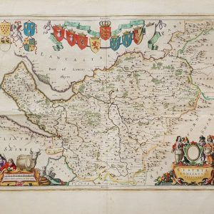
SCOTIA REGNUM CUM INSULIS ADJACENTIBUS ROBERTUS GORDONIUS A STRALOCH DESCRIPSIT – ORIGINAL COPPER ENGRAVED MAP PUBLISHED BY JOAN BLAEU
£650.00Blaeu, Joan & Gordon, Robert


You may also like…
(The Congo, Angola) Carte Des Royaumes De Congo, Angola Et Benguela Avec Les Pays Voisins Tire de L’Anglois
£65.00Bellin, Jacques Nicolas


