


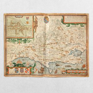
Cary’s Reduction Of His Six Sheet Map Of The British Isles – Comprehending The Whole Of The Turnpike Roads With The Great Rivers And Course Of The Different Navigable Canals…
Cary, John
£300.00
Availability: In stock
Product Description
Cary’s Reduction Of His Six Sheet Map Of The British Isles – Comprehending The Whole Of The Turnpike Roads With The Great Rivers And Course Of The Different Navigable Canals…
Cartographer: John Cary
Publisher: G & J Cary
Price: £300
Publication Date: 1828
Format: Original copper engraving with original hand-colouring
Condition: In very good condition, unframed
Sheet Size: 125cm x 99cm
Condition:
Title continues with: “Also The Market and Borough Towns and Villages adjoining the Road. By which is added the actual distance from one Market Town to another. With the exact measurement to each from the Metropolis. Drawn from the most Recent Surveys”. Original slipcase. Dissected on linen on 42 folds. Slight wear along original folds. Minor age-toning and foxing but generally bright and clean. Overall in very good condition in original marbled slipcase with paper label which is rubbed to the edges. Scarce.
Description:
Cary’s Reduction of His Six Sheet Map of the British Isles is an elegantly crafted map that condenses the detailed features of John Cary’s larger six-sheet series into a single, comprehensive sheet. The map showcases the entirety of the British Isles, including all major turnpike roads, great rivers, and the courses of navigable canals.
Notable for its clarity and precision, it provides an accurate representation of the transportation networks of the time, highlighting the major routes essential for travel and commerce. The rivers and canals, key for transporting goods, are clearly delineated, reflecting the importance of waterways before the dominance of railways.
The map also features boundaries for counties, and the typography is carefully executed to ensure readability, with towns, cities, and geographic features clearly labelled. Cary’s work was renowned for its attention to detail, and this reduction preserves that meticulous quality, making it a valuable reference for both travellers and scholars of geography and history.
The map’s visual style is characteristic of early 19th-century cartography, with neat hand-coloured elements accentuating county boundaries and key features, adding to its aesthetic and practical appeal.
John Cary: A Short Biography
John Cary (1754–1835) was a highly respected British cartographer, engraver, and globe-maker, renowned for his contributions to British cartography in the late 18th and early 19th centuries. His work is noted for its precision, clarity, and practicality, making his maps valuable tools for travellers, government officials, and scholars alike.
Cary’s maps gained widespread recognition for their accuracy at a time when cartographic standards varied significantly. He is particularly known for producing maps that were clear and easy to read, avoiding the decorative excesses of earlier cartographers and focusing instead on practicality. His most famous work, Cary’s New and Correct English Atlas (1787), set a new standard for English mapmaking, and it was used as the basis for many county maps throughout the 19th century.
In addition to his atlases, Cary produced road maps, including Cary’s New Itinerary (1798), which became an essential guide for travellers on British roads. His work on navigable rivers and canals was also highly valued, as he meticulously charted routes crucial for the transport of goods during the Industrial Revolution.
Cary was also known for his work on globes, where his attention to detail and craftsmanship were equally evident. His influence extended beyond cartography, as his maps were used as references by the Ordnance Survey in the early stages of their national mapping project.
John Cary’s legacy endures through his contributions to modern cartography, with many of his maps still admired for their clarity, accuracy, and aesthetic qualities.
Location: Book room: 002432
SHOP WITH CONFIDENCE AT HORNSEYS
At Hornseys, we are dedicated to offering items that uphold the highest standards of quality and authenticity. Our collection of artwork is carefully curated to ensure that each item we offer is authentic, collated, and complete.
Here’s what sets us apart:
- Authenticity and Provenance: Each map is researched and verified for authenticity.
- Expert Curation: We wholly own all our artworks. We trust our taste and have invested heavily in it. We have confidence in all artwork that we offer for sale.
- Customer Satisfaction: We strive to provide an exceptional customer experience, from detailed descriptions and provenance to secure and prompt delivery of your purchase.
- Returns Policy: We offer an unconditional guarantee on every item. If, however, you wish to make a return, artworks may be sent back to us within fourteen days of receipt for whatever reason. We request that we are notified in advance if you wish to do so. They must be returned to us in the same condition as they were sent for a full refund.
OUR COMMITMENT TO QUALITY AND SERVICE
Understanding the value and rarity of these items, we ensure that every aspect of your purchase meets the highest standards of quality and service. This includes:
- Free Expedited, Tracked, and Insured Delivery within the UK: Ensuring that your artwork arrives safely and promptly.
- Fully-Insured Worldwide Delivery: Offering peace of mind for international collectors with reliable and secure shipping options.
EXPLORE OUR COLLECTION
Visit Hornseys today to explore our fine collection of maps and other artworks. Whether you are an avid collector or looking for a special gift, our selection offers something truly unique. Located since 1976 in Ripon in the picturesque Yorkshire Dales, we are recognized as a destination gallery for tastefully curated artwork, rare maps, design, and fine books.
Related products

The Handy Series Of Pocket Maps – London And Four And Half Miles Round Charing Cross
£300.00George Philip & Son


You may also like…
SCOTIA REGNUM CUM INSULIS ADJACENTIBUS ROBERTUS GORDONIUS A STRALOCH DESCRIPSIT – ORIGINAL COPPER ENGRAVED MAP PUBLISHED BY JOAN BLAEU
£650.00Blaeu, Joan & Gordon, Robert


