Wyld’s New Map of London – 1891
Compiled and Published by James Wyld, Geographer to the Queen
London: James Wyld, 11 & 12 Charing Cross & 2 Royal Exchange, 1891
Large folding colour pocket map of London, complete with original printed index and housed in the original publisher’s cloth folding covers. Scale: 3.75 inches to one mile.
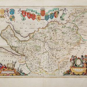
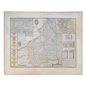
An exceptionally attractive and increasingly uncommon late Victorian folding map of London issued by the celebrated cartographer James Wyld, Geographer to the Queen. Published in 1891, this detailed and highly practical map presents London at the height of the imperial age, capturing the immense scale, density and infrastructural complexity of the metropolis during one of the most transformative periods in its history.
The map extends across central and metropolitan London, divided into a carefully ruled reference grid with large red numerical squares corresponding to the accompanying street index. Administrative districts including N.W., W.C., E.C., S.W. and S.E. are prominently marked, while parks, railway lines, bridges, principal roads, public buildings and the dense Victorian street network are rendered in remarkable detail. The Thames cuts dramatically through the centre of the composition, with riverside industry, railway approaches and bridges vividly delineated.
Issued at the unusually practical and highly detailed scale of 3.75 inches to one mile, the map was specifically designed for real urban navigation and day-to-day metropolitan use. The accompanying preface explains Wyld’s innovative “new principal” system whereby any street, building or place could be instantly located through the numerical grid reference system. Distances were additionally calibrated to assist in calculating cab fares and routes across London, reflecting the increasingly mobile and commercially interconnected nature of Victorian metropolitan life.
Includes the printed index booklet, an element frequently absent from surviving examples. This example has now had its staples removed to prevent rust damage. Pocket maps of this type were intended for continual practical use by travellers, businessmen and visitors to the capital, and the accompanying indexes were especially prone to loss or damage.
Issued by James Wyld, among the most important British map publishers of the nineteenth century, the map reflects the extraordinary sophistication of late Victorian commercial cartography. Wyld held the prestigious title “Geographer to the Queen” and became renowned for producing highly accurate and visually attractive maps of London, Britain and the wider empire. His London maps remain among the most recognisable and enduring productions of Victorian urban cartography.
The map itself is exceptionally rich in detail. Railway infrastructure is especially prominent, documenting the enormous expansion of London’s transport system during the nineteenth century. Major termini including Waterloo, Victoria, Charing Cross, Cannon Street and London Bridge are shown connected by dense rail networks that transformed the geography and economy of the city. Parks and open spaces including Hyde Park, Regent’s Park, St James’s Park and Battersea Park are highlighted in colour, providing elegant visual contrast against the surrounding urban fabric.
It measures approximately 73.5 x 54 cm including margins unfolded and folds into the original brown cloth publisher’s folding covers with printed title label to upper cover and ‘London’ paper label to the spine. The interior retains the original printed preface and publisher’s advertising material for other Wyld maps, including cycling and county maps, offering a fascinating glimpse into late nineteenth-century commercial map publishing. The original outline colouring remains fresh and attractive throughout. The restrained palette of reds, greens and yellows against the finely engraved street plan creates an elegant and highly decorative visual effect while retaining complete practical clarity.
Surviving examples of Wyld’s late nineteenth-century large scale London folding maps are increasingly difficult to locate in complete and attractive condition. Most were heavily used, frequently folded and unfolded, carried in pockets or luggage, and ultimately discarded when superseded by newer editions reflecting London’s continual expansion. Institutional holdings of Wyld London maps are recorded in collections including the British Library, the National Library of Scotland, the London Archives and the David Rumsey Map Collection, though surviving editions and states vary considerably.
Condition: Large folding colour map measuring approximately 73.5 x 54 cm unfolded, scale 3.75 inches to one mile, housed in the original publisher’s cloth slipcase with printed title label. Complete with the original printed index booklet and publisher’s advertisements. Folding as issued. General age toning and handling wear with some softening at folds and occasional light creasing. Cloth covers are a little rubbed with minor wear but sound and including the paper ‘London’ label to the spine. Original colouring bright and attractive throughout. Overall very good plus.
An elegant and historically important Victorian London map by one of Britain’s foremost nineteenth-century cartographers, combining practical utility, decorative appeal and remarkable documentary interest.
Why buy from us?
At Hornseys, we are committed to offering items that meet the highest standards of quality and authenticity. Our collection is meticulously curated to ensure that each item is a valuable and authentic piece of history. Here’s what sets us apart:
- Authenticity and Provenance: Every item is researched, collated, and verified for authenticity.
- Expert Curation: Each item is selected with a keen eye for significance, condition, and rarity, ensuring a collection that is both diverse and distinguished.
- Customer Satisfaction: We strive to provide an exceptional customer experience, from detailed descriptions and provenance to secure and prompt delivery of your purchase.
- Returns Policy: We offer an unconditional guarantee on every item. If you wish to make a return, items may be sent back to us within fourteen days of receipt for any reason. We request advance notification of returns, and items must be returned in the same condition as sent for a full refund.
Explore Our Collection:
Visit Hornseys to explore our fine collection of rare and signed books, maps, artwork and objects. Whether you are an avid collector or looking for a special gift, our selection offers something truly unique. Located in the picturesque Yorkshire Dales, our Ripon gallery has been a haven for book lovers, art enthusiasts, and collectors since 1976.
Thank you for looking.