
Related products

Mediterranean Sea: Mappa Maris Mediterranei Fluxus Currentes Et Naturum Motionum Explicans
£350.00Kircher (Athanasius)
Rapin-Thoyras, Paul de
£95.00
Availability: In stock
Engraved for Harrison’s edition of Rapin. Date: c.1787. Original copper engraving. Sheet size: 39.3cm x 51.1cm. Blank to the reverse. Early outline hand-colouring. Minor age toning which is mainly confined to the margins. A very good indeed, bright, clean copy.
SR: Sleeve 1111. Map Drawer D.
Our fine maps date from the 16th century right through to the modern era. Our antique and modern stock includes detailed maps and folding maps of countries and regions throughout the world alongside celestial maps and charts. We hold a good range of items relating to the county of Yorkshire. The vast majority of our maps are unmounted and unframed and the stock is held in our Ripon gallery. We are always interested in buying single items or entire collections of maps and atlases. Please contact us for more details. All prices include free expedited, tracked and insured delivery in the UK and we also offer a fully-insured, world-wide delivery service.

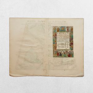


Kircher (Athanasius)

| Cookie | Duration | Description |
|---|---|---|
| cookielawinfo-checkbox-analytics | 11 months | This cookie is set by GDPR Cookie Consent plugin. The cookie is used to store the user consent for the cookies in the category "Analytics". |
| cookielawinfo-checkbox-functional | 11 months | The cookie is set by GDPR cookie consent to record the user consent for the cookies in the category "Functional". |
| cookielawinfo-checkbox-necessary | 11 months | This cookie is set by GDPR Cookie Consent plugin. The cookies is used to store the user consent for the cookies in the category "Necessary". |
| cookielawinfo-checkbox-others | 11 months | This cookie is set by GDPR Cookie Consent plugin. The cookie is used to store the user consent for the cookies in the category "Other. |
| cookielawinfo-checkbox-performance | 11 months | This cookie is set by GDPR Cookie Consent plugin. The cookie is used to store the user consent for the cookies in the category "Performance". |
| viewed_cookie_policy | 11 months | The cookie is set by the GDPR Cookie Consent plugin and is used to store whether or not user has consented to the use of cookies. It does not store any personal data. |