
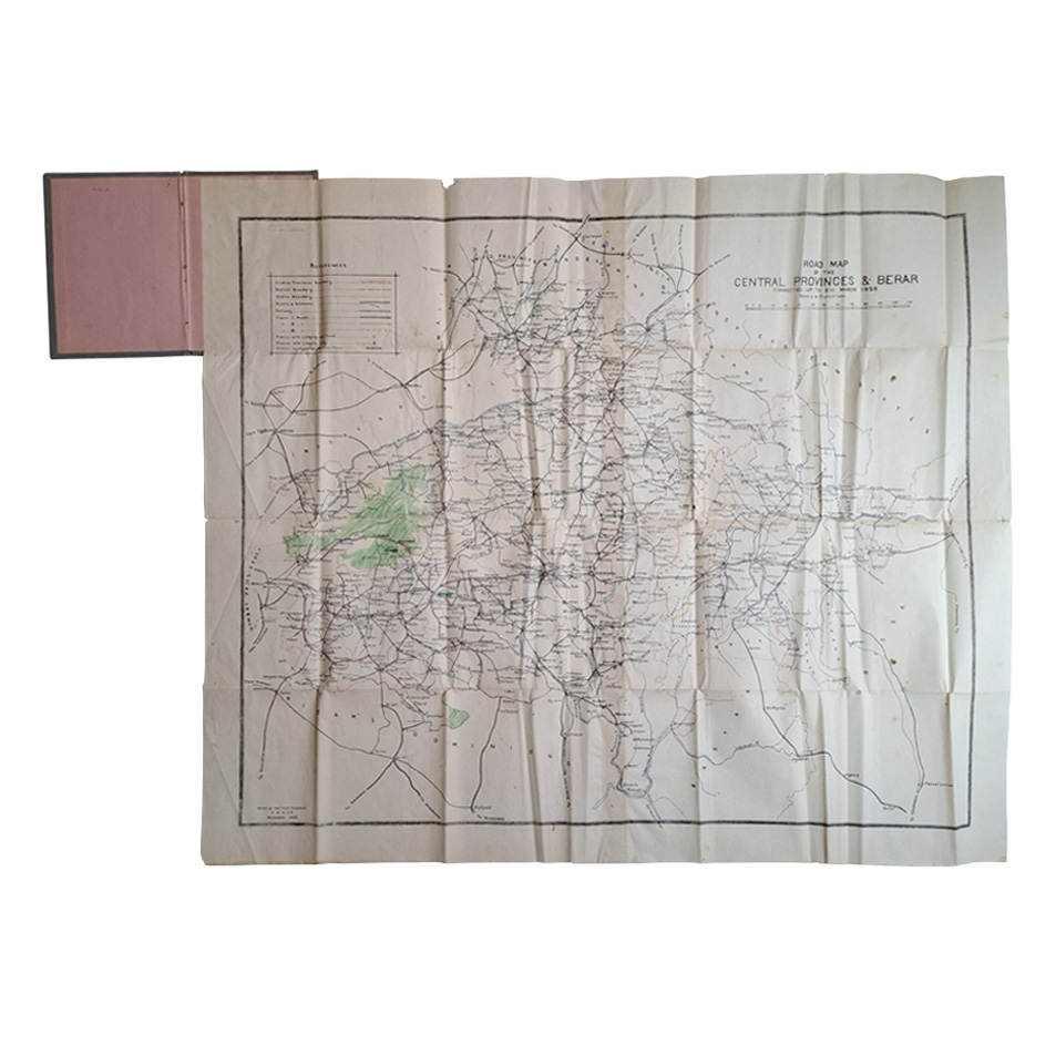
ROAD MAP OF THE CENTRAL PROVINCES & BERAR CORRECTED UP TO 31ST MARCH 1938
Offices Of The Chief Engineer P. W. D. C. P.
£125.00
Availability: In stock
Product Description
ROAD MAP OF THE CENTRAL PROVINCES & BERAR CORRECTED UP TO 31ST MARCH 1938
Publisher: Offices Of The Chief Engineer P. W. D. C. P.
Price: £125
Publication Date: 1938
Edition: Corrected edition
Format: Colour printed
Condition: In very good condition, unframed
Sheet Size: 80.8cm x 95.8cm
Scale: 1 inch to 16 miles
Condition:
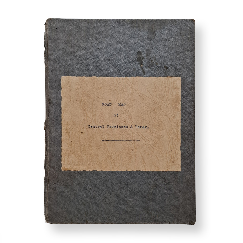
Bound in cloth with paper label. Original fold lines. A detailed map of the region at a time when the numbers of cars on the roads in India was relatively low. Covers dusty and marked with edge-wear. Original fold lines. Minor wear to the fold intersections with a very small amount of loss and minor marks and with a small amount of loss to the margins. Reverse has very minor age toning and marks. In very good, original and un-restored condition. Scarce.
Location: Map Drawer C: FS: Folder 1220 002511
The Central Provinces and Berar in the 1930s: A Brief Description
The Central Provinces and Berar, located in central India, was a prominent administrative division under British rule during the early 20th century. This region combined the Central Provinces (created in 1861 from the Nagpur Province and parts of the Saugor and Nerbudda Territories) with the Berar region, which was formally merged in 1936. In the 1930s, the Central Provinces and Berar represented a microcosm of India’s socio-political, cultural, and economic conditions during a turbulent period of the country’s colonial history.
Geography and Demographics
The region covered a significant area in central India, including parts of present-day Madhya Pradesh and Maharashtra. It was characterised by a mix of plateaus, fertile plains, and dense forests, particularly in the Satpura and Vindhya ranges. The Narmada and Godavari rivers were vital lifelines, supporting agriculture and trade.
- Population: The region had a diverse population comprising Hindus, Muslims, tribal communities, and other minority groups. The tribal population, particularly the Gond and Bhil communities, lived in the forested areas and retained distinct cultural practices.
- Urban Centres: Nagpur served as the capital and a major urban hub, along with other towns like Jabalpur, Amravati, and Akola.
Economy
The economy of the Central Provinces and Berar in the 1930s was predominantly agrarian, with agriculture forming the backbone of rural livelihoods. Key crops included cotton, wheat, rice, and millet, with cotton being a major cash crop.
- Agriculture: The introduction of commercial farming under British policies led to the expansion of cotton cultivation, particularly in Berar. However, small farmers often faced exploitation through high taxes and debt cycles tied to moneylenders.
- Forestry: The forests were an essential resource, with timber and other forest products contributing to the colonial economy. The British controlled these resources, often at the expense of the local tribal communities who depended on them.
- Industry and Trade: The region had limited industrialisation. Cotton ginning and pressing mills were prominent, especially in towns like Nagpur. Railways, built to serve British economic interests, facilitated the export of raw materials.
Socio-Cultural Dynamics
The 1930s saw significant social changes, driven by growing nationalist sentiments and reform movements.
- Caste and Social Reform: The caste system was deeply entrenched, but social reformers, including those inspired by Gandhi and Ambedkar, challenged traditional hierarchies. Dr. B.R. Ambedkar’s efforts to uplift Dalits resonated strongly in the region, especially in urban centres like Nagpur.
- Tribal Communities: Tribals maintained distinct cultures, languages, and traditions but faced increasing marginalisation due to British forest laws and land policies.
- Education: The British introduced modern education, but its reach was limited, primarily benefiting urban elites. Traditional forms of education persisted in rural areas.
Political Landscape
The Central Provinces and Berar played a significant role in India’s freedom struggle during the 1930s, a decade marked by the intensification of nationalist activities and the emergence of mass political movements.
- Indian National Congress: The Congress Party had a strong presence in the region. Leaders organised protests, boycotts, and civil disobedience campaigns as part of Gandhi’s larger movement against British rule.
- Communal Dynamics: The Hindu-Muslim unity fostered during the freedom struggle was occasionally strained, particularly during the rise of the Muslim League and communal politics in the latter half of the decade.
- Peasant Movements: Rural discontent, fuelled by high taxes and oppressive land policies, led to peasant uprisings and agitations, often aligned with the Congress’s broader anti-colonial agenda.
Administration
The British administration governed the Central Provinces and Berar through a Chief Commissioner until 1920, after which it was reorganised under the Government of India Act, 1919. By the 1930s, it had a Provincial Legislature and was part of the broader framework of dyarchy introduced by the British.
- Law and Order: The British maintained strict control, using the police and military to suppress nationalist movements and tribal rebellions.
- Infrastructure: Railways and roads were expanded to serve colonial trade needs. Urban areas like Nagpur saw some modernisation, while rural areas remained largely neglected.
Nationalist Movements in the Region
The region was a hotbed of nationalist activities during the 1930s, contributing significantly to India’s independence movement.
- Civil Disobedience Movement: Gandhi’s call for civil disobedience found widespread support. Boycotts of British goods, protests against land taxes, and salt satyagrahas occurred in several towns and villages.
- Nagpur Pact: Nagpur played a pivotal role in India’s nationalist politics, hosting important meetings of the Congress Party and serving as a venue for significant resolutions, such as the Nagpur Pact, which sought to address the division of provinces on linguistic lines.
Conclusion
The Central Provinces and Berar in the 1930s stood at the crossroads of tradition and modernity, grappling with the socio-economic challenges of colonial exploitation and the awakening of a nationalist consciousness. The region’s cultural diversity, agrarian economy, and political activism made it a microcosm of India’s larger struggle for freedom. Its contributions, particularly through leaders and grassroots movements, left a lasting impact on the course of Indian history.
Road Use in India in the 1930s: A Brief Account
In the 1930s, road use in India reflected a society undergoing gradual modernisation under British colonial rule, yet still largely dependent on traditional forms of transportation. The road network was relatively underdeveloped compared to the railways, which were prioritised by the colonial government for their economic and strategic importance. Despite this, roads played a vital role in connecting rural areas, facilitating local trade, and supporting emerging modern transportation.
1. Road Infrastructure
The road network in India during the 1930s was sparse and varied significantly in quality.
- Primary Roads: Major routes, often referred to as “trunk roads,” connected important cities and trade centres. These were typically better maintained and paved with macadam (crushed stone bound with tar) or occasionally with concrete in urban areas.
- Secondary and Rural Roads: The majority of roads were in rural areas and were dirt or gravel paths. These roads were poorly maintained, often becoming impassable during the monsoon season.
- Colonial Influence: Roads near administrative hubs, military bases, and ports were prioritised for strategic and economic reasons. Key routes supported the movement of goods like cotton, tea, and other exports to railheads or ports.
2. Modes of Transportation on Roads
Road use was characterised by a mix of traditional and emerging modern vehicles.
Traditional Transport
- Bullock Carts: The most common mode of transport for goods and people in rural areas. These carts, drawn by oxen, were slow but reliable, capable of navigating unpaved roads.
- Horse and Mule Carts: Used primarily in urban areas and hilly regions, these carts were faster than bullock carts but less common in rural areas.
- Camel Carts: Used in arid regions like Rajasthan, camels were suited to the harsh terrain and played a vital role in transporting goods.
- Hand-Pulled and Cycle Rickshaws: Common in urban areas for short-distance passenger transport, particularly in cities like Calcutta (now Kolkata) and Madras (now Chennai).
Motorised Vehicles
- Cars: Ownership of cars was limited to wealthy Indians, British officials, and business elites. Iconic brands like Ford, Morris, and Austin were popular among the affluent.
- Buses: Public and private buses began to emerge, offering transport services between towns and cities. However, these were limited in number and often unreliable.
- Lorries (Trucks): Used primarily for transporting goods over short to medium distances, lorries were gradually replacing traditional carts for commercial transport.
- Motorcycles and Scooters: A rare sight, used by a small number of affluent individuals, including officials and merchants.
Pedestrian Traffic
Walking remained the most common means of transport for the majority of the population, especially in rural areas where distances between villages were manageable.
3. Challenges of Road Use
The state of road infrastructure and transportation in the 1930s posed numerous challenges:
- Poor Maintenance: Many roads, especially in rural areas, were not properly maintained, leading to frequent damage and difficulty in usage.
- Seasonal Impact: Monsoons rendered many dirt roads muddy and impassable, severely disrupting transport and trade.
- Traffic Diversity: The coexistence of motor vehicles, animal-drawn carts, and pedestrians on the same roads led to frequent congestion and accidents.
- Limited Road Network: While railways were extensive, road networks were often confined to areas of administrative or economic importance, leaving large parts of the country poorly connected.
4. Socio-Economic Impact
Road use in the 1930s was deeply intertwined with the socio-economic conditions of colonial India:
- Rural Dependency: Villagers relied heavily on traditional transport for moving goods like grains, vegetables, and firewood to local markets.
- Urbanisation: Urban centres saw an increase in motor vehicles, reflecting the growing influence of modernisation and industrialisation.
- Colonial Priorities: The development of roads often served British interests, such as facilitating the movement of raw materials to railheads or ports rather than addressing the needs of local populations.
- Class Disparities: Modern vehicles like cars and buses were accessible only to the wealthy, while the vast majority relied on traditional means.
5. Government Initiatives and Policies
In the 1930s, road construction and management were not as prioritised as the railways but still saw some development:
- Public Works Departments (PWD): The colonial government tasked the PWD with constructing and maintaining roads, though resources were limited.
- Legislation: Basic traffic rules and regulations were introduced to manage the growing use of motor vehicles in cities.
- Development Focus: Key routes like the Grand Trunk Road were maintained and expanded to improve connectivity across northern India.
6. Cultural and Regional Variations
The types of road use and modes of transport varied significantly across regions:
- Northern India: Bullock carts and camel caravans dominated, particularly in agricultural and desert areas.
- Southern India: Roads were more developed in British-administered regions like Madras Presidency, with increasing use of buses and lorries.
- Urban Areas: Cities like Bombay (Mumbai), Calcutta, and Delhi saw a gradual rise in motorised traffic, creating a need for better urban roads.
Conclusion
Road use in India during the 1930s reflected a transitional phase between traditional modes of transport and modernisation under colonial influence. While the majority of Indians relied on bullock carts and walking, motor vehicles began to make inroads, symbolising the socio-economic changes of the time. Despite challenges like poor infrastructure and seasonal disruptions, roads played a crucial role in connecting rural and urban India and laid the groundwork for future development.
The P. W. D. C. P: A Brief Account
The Public Works Department (PWD) of the Central Provinces (C.P.) during the British colonial era was responsible for the construction and maintenance of public infrastructure, including roads, buildings, and irrigation systems. The Chief Engineer’s office was the apex authority within the PWD, overseeing all engineering projects and administrative functions.
Structure and Responsibilities:
- Chief Engineer: The highest-ranking official in the PWD, the Chief Engineer was responsible for planning, executing, and supervising public works projects across the Central Provinces. This role involved coordinating with British colonial authorities and ensuring that infrastructure developments met the administrative and strategic needs of the region.
- Superintending Engineers: Reporting directly to the Chief Engineer, Superintending Engineers managed specific districts or major projects. They were responsible for overseeing the work of Executive Engineers and ensuring that projects adhered to established standards and timelines.
- Executive Engineers: These officials acted as project managers for individual projects, handling day-to-day operations, resource allocation, and on-site supervision. They reported to the Superintending Engineers and were crucial in implementing the plans and directives issued by the higher authorities.
Historical Context:
The PWD in India was established in the mid-19th century to centralise and professionalise the management of public infrastructure. In 1854, the Public Works Department was formally established, and all civil, military, and public engineering works were placed under it, with Lord Robert Napier as its first Chief Engineer.
By the 1930s, the PWD had become a pivotal institution in the colonial administration, facilitating the construction of roads, bridges, canals, and public buildings that were essential for governance and economic activities.
Notable Projects:
The PWD under the Chief Engineer’s leadership undertook several significant projects in the Central Provinces, including:
- Road Construction: Developing and maintaining major roadways to improve connectivity between urban centres and rural areas, facilitating trade and mobility.
- Irrigation Works: Constructing canals and dams to support agriculture, which was the backbone of the region’s economy.
- Public Buildings: Erecting administrative buildings, schools, hospitals, and other public facilities to serve the local population and colonial administration.
Legacy:
The infrastructure developed by the PWD during this period laid the foundation for modern public works in the region. Many of the roads, bridges, and buildings constructed under the supervision of the Chief Engineer’s office continue to be in use today, reflecting the enduring impact of the department’s work during the colonial era.
SHOP WITH CONFIDENCE AT HORNSEYS
At Hornseys, we are dedicated to offering items that uphold the highest standards of quality and authenticity. Our collection of artwork is carefully curated to ensure that each item we offer is authentic, collated, and complete.
Here’s what sets us apart:
- Authenticity and Provenance: Each map is researched and verified for authenticity.
- Expert Curation: We wholly own all our artworks. We trust our taste and have invested heavily in it. We have confidence in all artwork that we offer for sale.
- Customer Satisfaction: We strive to provide an exceptional customer experience, from detailed descriptions and provenance to secure and prompt delivery of your purchase.
- Returns Policy: We offer an unconditional guarantee on every item. If, however, you wish to make a return, artworks may be sent back to us within fourteen days of receipt for whatever reason. We request that we are notified in advance if you wish to do so. They must be returned to us in the same condition as they were sent for a full refund.
OUR COMMITMENT TO QUALITY AND SERVICE
Understanding the value and rarity of these items, we ensure that every aspect of your purchase meets the highest standards of quality and service. This includes:
- Free Expedited, Tracked, and Insured Delivery within the UK: Ensuring that your artwork arrives safely and promptly.
- Fully-Insured Worldwide Delivery: Offering peace of mind for international collectors with reliable and secure shipping options.
EXPLORE OUR COLLECTION
Visit Hornseys today to explore our fine collection of maps and other artworks. Whether you are an avid collector or looking for a special gift, our selection offers something truly unique. Located since 1976 in Ripon in the picturesque Yorkshire Dales, we are recognised as a destination gallery for tastefully curated artwork, rare maps, design, and fine books.


