Homs – Beirut Sheet – Syria and Lebanon – War Office Map – 1910 – Folding Map
A scarce and historically important British War Office map of Syria and Lebanon issued on the eve of the First World War, depicting the region between Homs, Beirut and Damascus in remarkable topographical detail. Compiled by the Geographical Section, General Staff, and dated December 1910, the map captures the late Ottoman Levant shortly before the political transformation of the Middle East under the French Mandate system and the subsequent creation of modern Lebanon and Syria.
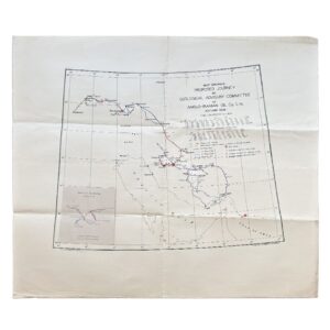
The map extends from the Mediterranean coast eastwards across the Lebanon and Anti-Lebanon mountain ranges to Damascus and the Syrian interior. Coastal settlements including Beirut, Sidon and Tripoli are shown alongside inland centres such as Homs, Baalbek and Damascus. Relief is rendered with delicate hachuring and contouring, giving an impressive visual sense of the mountainous terrain and strategic routes across the region. Railways, caravan routes, roads, telegraph lines, rivers, wells and administrative boundaries are all carefully identified, reflecting the military and geopolitical concerns of the period.
Of particular historical interest is the printed note at lower right stating that the railway between Tripoli and Homs remained incomplete in December 1910, an evocative reminder of the rapidly developing infrastructure of the late Ottoman Empire. The map is overprinted “FOR OFFICIAL USE ONLY”, indicating intended military or governmental circulation rather than commercial sale.
Published in London and dissected onto linen for folding into its original marbled card covers bearing the label of Sifton, Praed & Co. Ltd., “The Map House”, St James’s Street, London. Sifton Praed specialised in supplying maps to military officers, travellers and imperial administrators during the early twentieth century, and surviving examples of their Levant mapping are uncommon.
An exceptionally atmospheric and visually engaging pre-war map of the eastern Mediterranean, combining military utility, colonial-era cartography and substantial historical significance.
Sheet size: 82.4 cm x 66 cm.
Condition: Very good overall. Dissected and mounted on linen as issued. Folding into original marbled covers. Light age-toning and handling wear commensurate with use, with some soiling and soft creasing at folds verso some of which is visible on the map in the Mediterranean Sea area. Covers slightly rubbed and worn at extremities. A presentable example of a scarce survival.
SHOP WITH CONFIDENCE AT HORNSEYS
At Hornseys, we are dedicated to offering items that uphold the highest standards of quality and authenticity. Our collection of artwork is carefully curated to ensure that each item we offer is authentic, collated, and complete.
Here’s what sets us apart:
- Authenticity and Provenance: Each map is researched and verified for authenticity.
- Expert Curation: We wholly own all our artworks. We trust our taste and have invested heavily in it. We have confidence in all artwork that we offer for sale.
- Customer Satisfaction: We strive to provide an exceptional customer experience, from detailed descriptions and provenance to secure and prompt delivery of your purchase.
- Returns Policy: We offer an unconditional guarantee on every item. If, however, you wish to make a return, artworks may be sent back to us within fourteen days of receipt for whatever reason. We request that we are notified in advance if you wish to do so. They must be returned to us in the same condition as they were sent for a full refund.
OUR COMMITMENT TO QUALITY AND SERVICE
Understanding the value and rarity of these items, we ensure that every aspect of your purchase meets the highest standards of quality and service. This includes:
- Free Expedited, Tracked, and Insured Delivery within the UK: Ensuring that your artwork arrives safely and promptly.
- Fully-Insured Worldwide Delivery: Offering peace of mind for international collectors with reliable and secure shipping options.
EXPLORE OUR COLLECTION
Visit Hornseys today to explore our fine collection of maps and other artworks. Whether you are an avid collector or looking for a special gift, our selection offers something truly unique. Located since 1976 in Ripon in the picturesque Yorkshire Dales, we are recognized as a destination gallery for tastefully curated artwork, rare maps, design, and fine books.