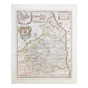
A Mapp Of Ye County of Northumberland With Ye Isles Of Farne & Holy Island – 1673
£145.00Blome, Richard
Dunelmensis Episcopatus Qui Comitatus Est Palatinus Olim Pars Brigantum – 1607
£125.00Kip, William & Saxton, Christopher
River Mersey From Rock Lighthouse To Eastham & Garston 1969 Corrected To June 1970
£125.00Colbeck, Captain W. R.
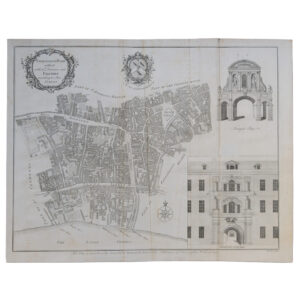
London – Farringdon Ward Without With Its Division Into Parishes According to A New Survey – 1755
£95.00Cole, Benjamin & Mailtand, William
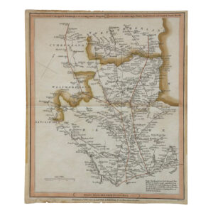
Ordnance Survey Map Of The Ripon – Masham – Richmond – Northallerton Area – Copy of The North Eastern Railway Office In York
£95.00The Ordnance Survey & The North Eastern Railway
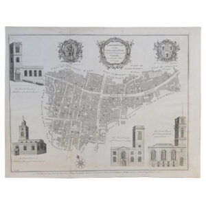
London – Langborn Ward And Candlewick Ward With Their Divisions Into Parishes According To A New Survey – 1755
£70.00Cole, Benjamin & Mailtand, William
Ordnance Survey Folding Map Of Leicester And District – Special Sheet Popular Edition One Inch Map
£35.00The Ordnance Survey