Johore and Singapore – British War Office Military Map – G.S.G.S. 4305 – First Edition – 1942
Description
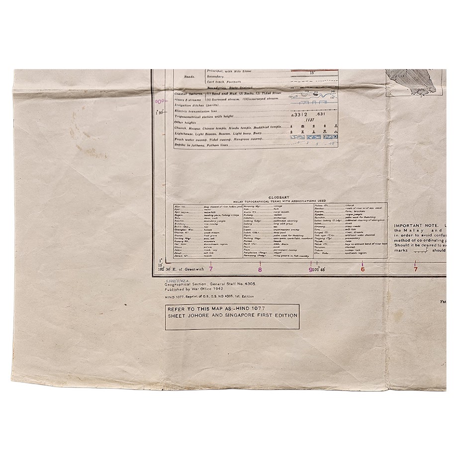
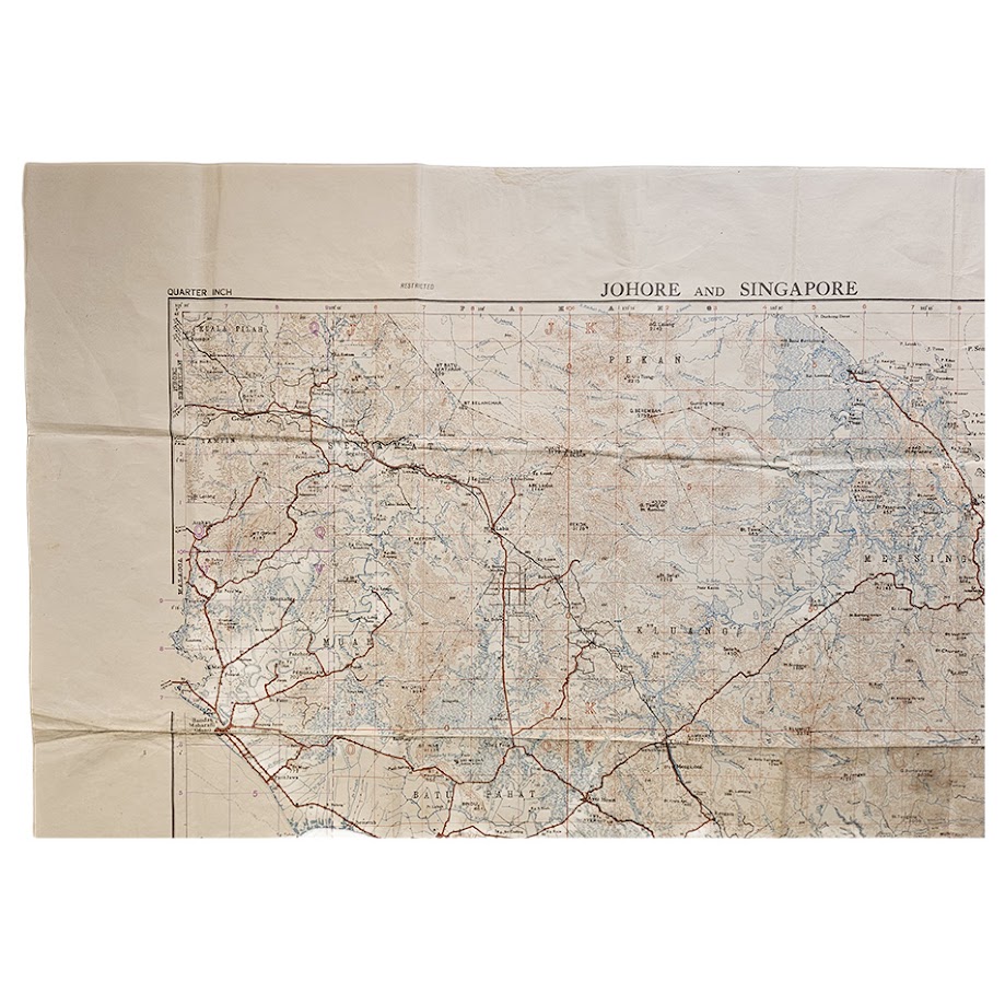
An important and very large British military map of Johore and Singapore, published by the War Office in 1942 during one of the most consequential campaigns in British military history. Issued as Geographical Section, General Staff No. 4305, this is the First Edition of the quarter-inch map subsequently referenced as HIND 1077, Sheet Johore and Singapore First Edition.
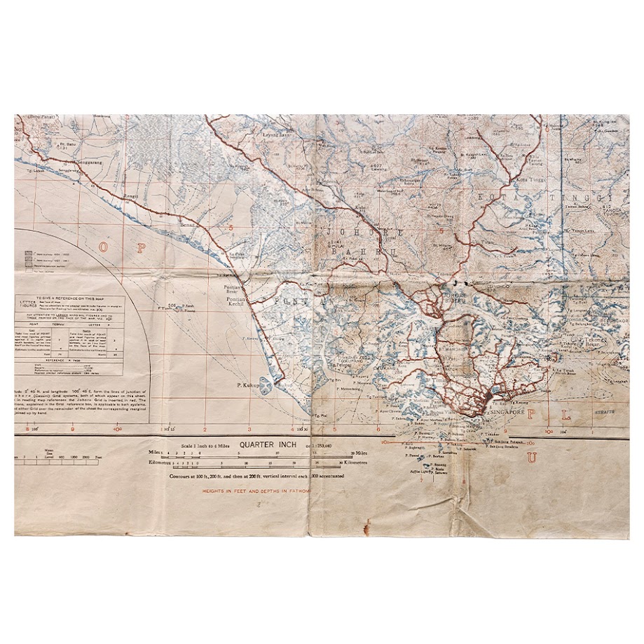
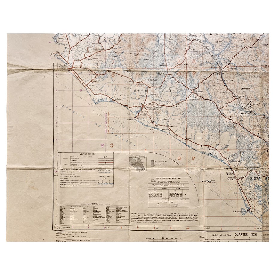
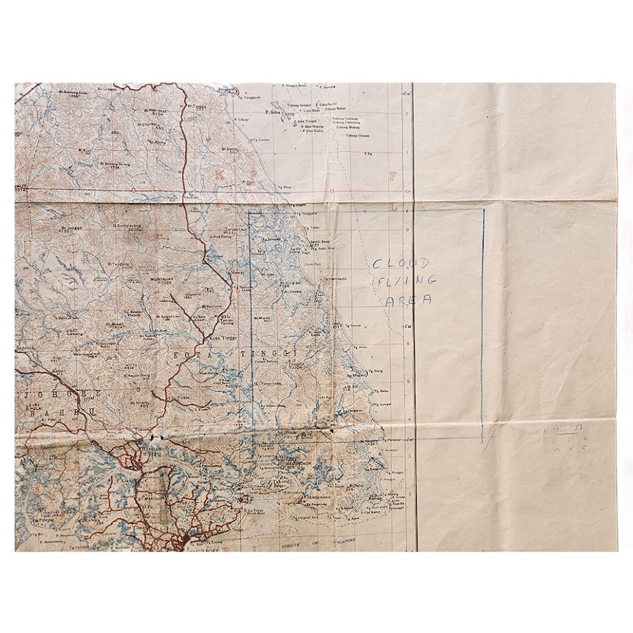
The sheet covers a substantial part of southern Malaya, extending from the western coast and the Straits of Malacca across Johore to the South China Sea, with Singapore prominently mapped at the southern extremity. Johore Bahru, the Johore Strait and the road and rail communications approaching Singapore are shown in considerable detail, together with settlements, rivers, roads, tracks, railways, plantations, coastal features and relief.
The geographical coverage is exceptionally significant. Japanese forces invaded Malaya in December 1941 and advanced rapidly southwards through the peninsula. The final British and Commonwealth forces withdrew across the causeway from Johore to Singapore on 31 January 1942, destroying part of the causeway behind them. Japanese troops crossed the Johore Strait on 8 February, and Lieutenant-General Arthur Percival surrendered Singapore on 15 February 1942. The National Army Museum describes Singapore as Britain’s principal military base in Southeast Asia and the keystone of its regional defence system; approximately 130,000 Allied personnel were captured during the Malaya and Singapore campaign. The Imperial War Museums similarly records the surrender on 15 February as the largest surrender in British military history.
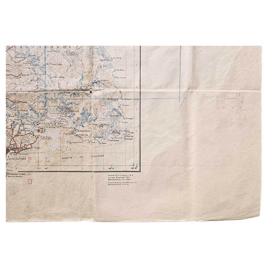
This particular edition has additional interest because the base cartography itself was compiled immediately before the campaign. The sheet states that portions were compiled from a map by F.M.S. Surveys, November 1941, and reproduced by the War Office in 1942. It therefore represents British geographical knowledge of the region at almost exactly the moment at which the Malay Peninsula and Singapore became an active battlefield.
The scale is 1 inch to 4 miles, approximately 1:253,440, allowing the complete southern operational region to be presented on one imposing sheet. The map includes a substantial printed reference table, Malay topographical glossary, grid information and magnetic diagram. Singapore itself, the island’s northern shore and the adjacent Johore mainland can all be readily identified.
Of particular interest are contemporary manuscript additions. On the eastern portion is a large blue-pencil rectangular annotation accompanied by the words “CLOUD FLYING AREA”, together with further pencilled numerical and navigational annotations. These should be described as contemporary or later working annotations rather than attributed to a specific military unit without supporting provenance, but they materially reinforce the character of the sheet as a map that appears to have been used rather than retained simply as an unused reference copy.
The scale and extensive blank margins give the map considerable visual presence when opened, while the combination of Singapore, Johore, 1942, First Edition and War Office military issue gives it unusually strong historical appeal.
Condition
Good condition overall for a large wartime working map. Originally folded and consequently retaining numerous horizontal and vertical fold lines, with associated creasing, rubbing and localised wear. Some marking, soiling and age-toning, particularly along folds and margins, together with occasional small areas of wear, minor loss at fold intersections and minor splitting. A more noticeable area of wear and marking is present around the lower central folds. Contemporary manuscript annotations in blue pencil and other pencil markings are present, most notably the large “CLOUD FLYING AREA” annotation at the right-hand side. Despite its evident use, the sheet remains substantially complete, readable and visually impressive. Please study the photographs carefully as they form part of the description.
WorldCat records institutional holdings at the British Library and only three further locations located at the time of cataloguing. We have been unable to trace another example of G.S.G.S. 4305, Johore and Singapore, First Edition 1942 currently offered for sale. Institutional references include the National Archives of Singapore, while the official GSGS index records the sheet as no. 4305 at 1:253,440.
Every map offered by Hornseys is handled, inspected and catalogued in-house at our Ripon gallery. The publication details, edition statement and cartographic references given here have been checked directly against the map itself.
Cartographer/Publisher: Geographical Section, General Staff / War Office
Title: Johore and Singapore
G.S.G.S. Number: 4305
Edition: First Edition
HIND Reference: HIND 1077
Date: 1942
Scale: 1 inch to 4 miles, approximately 1:253,440
Sheet Size: 112.2 × 84.7 cm
Printing: Colour lithographic military map on paper
Subject: Johore, Singapore, Malaya, Second World War, Fall of Singapore
SHOP WITH CONFIDENCE AT HORNSEYS
At Hornseys, we are dedicated to offering items that uphold the highest standards of quality and authenticity. Our collection of artwork is carefully curated to ensure that each item we offer is authentic, collated, and complete.
Here’s what sets us apart:
- Authenticity and Provenance: Each map is researched and verified for authenticity.
- Expert Curation: We wholly own all our artworks. We trust our taste and have invested heavily in it. We have confidence in all artwork that we offer for sale.
- Customer Satisfaction: We strive to provide an exceptional customer experience, from detailed descriptions and provenance to secure and prompt delivery of your purchase.
- Returns Policy: We offer an unconditional guarantee on every item. If, however, you wish to make a return, artworks may be sent back to us within fourteen days of receipt for whatever reason. We request that we are notified in advance if you wish to do so. They must be returned to us in the same condition as they were sent for a full refund.
OUR COMMITMENT TO QUALITY AND SERVICE
Understanding the value and rarity of these items, we ensure that every aspect of your purchase meets the highest standards of quality and service. This includes:
- Free Expedited, Tracked, and Insured Delivery within the UK: Ensuring that your artwork arrives safely and promptly.
- Fully-Insured Worldwide Delivery: Offering peace of mind for international collectors with reliable and secure shipping options.
EXPLORE OUR COLLECTION
Visit Hornseys today to explore our fine collection of maps and other artworks. Whether you are an avid collector or looking for a special gift, our selection offers something truly unique. Located since 1976 in Ripon in the picturesque Yorkshire Dales, we are recognized as a destination gallery for tastefully curated artwork, rare maps, design, and fine books.