The Near and Middle East – British War Office Strategic Map – G.S.G.S. No. 4108 – 1941
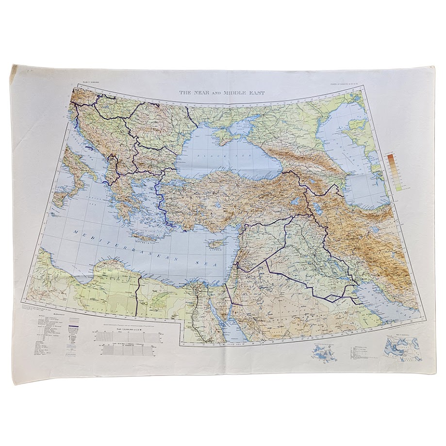
Description: A large and visually impressive original British War Office map of the Near and Middle East, published in 1941 by the Geographical Section, General Staff as G.S.G.S. No. 4108. Measuring 76.1 × 103.6 cm and printed at the broad strategic scale of 1:4,000,000, the sheet covers an enormous arc from the Balkans and eastern Mediterranean across Turkey, Cyprus, Syria, Lebanon, Palestine, Transjordan, Iraq, Iran and the Persian Gulf, extending south into Egypt and Libya and eastwards towards the Caucasus and Caspian region.
The map is particularly effective visually, with relief strongly modelled in brown, seas and lakes in blue, national and administrative boundaries emphasised in purple, and an extensive network of roads, railways and communications shown across the region. Major cities and strategic centres include Cairo, Alexandria, Jerusalem, Haifa, Beirut, Damascus, Aleppo, Baghdad, Basra, Tehran and Istanbul, while the Persian Gulf, Red Sea approaches, eastern Mediterranean, Black Sea and Caspian Sea provide the wider geographical framework.
Published by the War Office in 1941, the map belongs to one of the most critical periods in Britain’s military involvement in the Middle East. In that year British and Allied forces were simultaneously engaged in the Western Desert Campaign, the Anglo-Iraqi War, the Syria–Lebanon Campaign and the Anglo-Soviet invasion of Iran. The region shown on this single sheet therefore encompassed multiple active or strategically sensitive theatres, as well as the oilfields, ports, railways and imperial communications routes upon which Britain’s position in the eastern Mediterranean and Middle East depended.
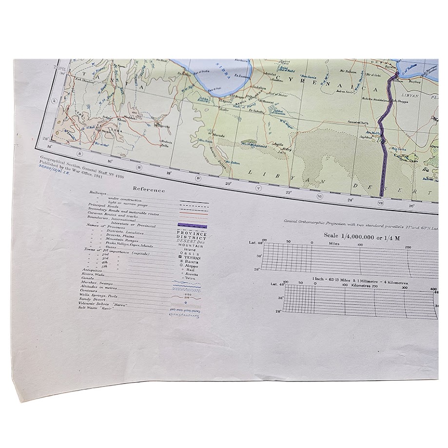
The map is especially noteworthy for the way it presents the political geography of the region before the major territorial and political transformations of the later twentieth century. Palestine and Transjordan, the British and French Mandate territories, Iraq, Iran and the Arabian Peninsula are shown within the administrative framework of the early war years. Thick purple lines make international and provincial boundaries immediately legible, while the index diagrams and reference information provide additional context for the sheet’s broad strategic purpose.
Institutional holdings confirm the importance and survival of this issue. Yale University Library catalogues The Near and Middle East as G.S.G.S. 4108, published at the War Office in 1941. The National Library of Israel also records the 1941 War Office map, noting that it was compiled and drawn at the War Office and heliographed at the Ordnance Survey. A further example or related archival file is recorded by Cambridge University Library under The Near and Middle East, 1940–1941. The map was also specifically included among the cartographic materials supplied to the United Nations Special Committee on Palestine, whose published list identifies The Near and Middle East, scale 1:4,000,000, Geographical Section, General Staff, published by the War Office in 1941.
Condition: Very good condition for a large wartime map of this size. The sheet retains its original folds with light general handling, minor creasing and some age-related marking. There is a little localised marginal wear and slight softening at corners, but the map remains complete and highly presentable. The colour printing is strong and attractive, with the blue hydrography, brown relief and purple boundary overprinting remaining particularly vivid. Please study the photographs carefully, as they form an important part of the condition assessment.
Title: The Near and Middle East
Series: G.S.G.S. No. 4108
Publisher: War Office
Cartographic authority: Geographical Section, General Staff
Date: 1941
Scale: 1:4,000,000
Sheet size: 76.1 × 103.6 cm
Areas shown: Turkey, Balkans, Cyprus, Syria, Lebanon, Palestine, Transjordan, Iraq, Iran, Egypt, Libya, Persian Gulf, Caucasus and eastern Mediterranean
Format: Large colour-printed folding strategic map
Every map offered by Hornseys is handled, inspected and catalogued individually in-house, with edition, imprint, scale, cartographic content and condition assessed directly from the original sheet wherever possible.
Scarcity: At the time of cataloguing we have been unable to locate another example of this exact 1941 G.S.G.S. No. 4108 issue currently offered for sale or a clearly recorded previous auction result. Institutional examples are, however, documented, including a copy at Yale University and a further 1941 example recorded by Northwestern University Libraries. The absence of readily identifiable commercial examples should not be taken as a definitive census, but it suggests that the map is comparatively uncommon on the market.
SHOP WITH CONFIDENCE AT HORNSEYS
At Hornseys, we are dedicated to offering items that uphold the highest standards of quality and authenticity. Our collection of artwork is carefully curated to ensure that each item we offer is authentic, collated, and complete.
Here’s what sets us apart:
- Authenticity and Provenance: Each map is researched and verified for authenticity.
- Expert Curation: We wholly own all our artworks. We trust our taste and have invested heavily in it. We have confidence in all artwork that we offer for sale.
- Customer Satisfaction: We strive to provide an exceptional customer experience, from detailed descriptions and provenance to secure and prompt delivery of your purchase.
- Returns Policy: We offer an unconditional guarantee on every item. If, however, you wish to make a return, artworks may be sent back to us within fourteen days of receipt for whatever reason. We request that we are notified in advance if you wish to do so. They must be returned to us in the same condition as they were sent for a full refund.
OUR COMMITMENT TO QUALITY AND SERVICE
Understanding the value and rarity of these items, we ensure that every aspect of your purchase meets the highest standards of quality and service. This includes:
- Free Expedited, Tracked, and Insured Delivery within the UK: Ensuring that your artwork arrives safely and promptly.
- Fully-Insured Worldwide Delivery: Offering peace of mind for international collectors with reliable and secure shipping options.
EXPLORE OUR COLLECTION
Visit Hornseys today to explore our fine collection of maps and other artworks. Whether you are an avid collector or looking for a special gift, our selection offers something truly unique. Located since 1976 in Ripon in the picturesque Yorkshire Dales, we are recognized as a destination gallery for tastefully curated artwork, rare maps, design, and fine books.