Felix Oswald – A Geological Map of the Caucasus – Author’s Presentation Copy – British Museum (Natural History) Provenance – With Original Explanatory Notes – 1914
Description:
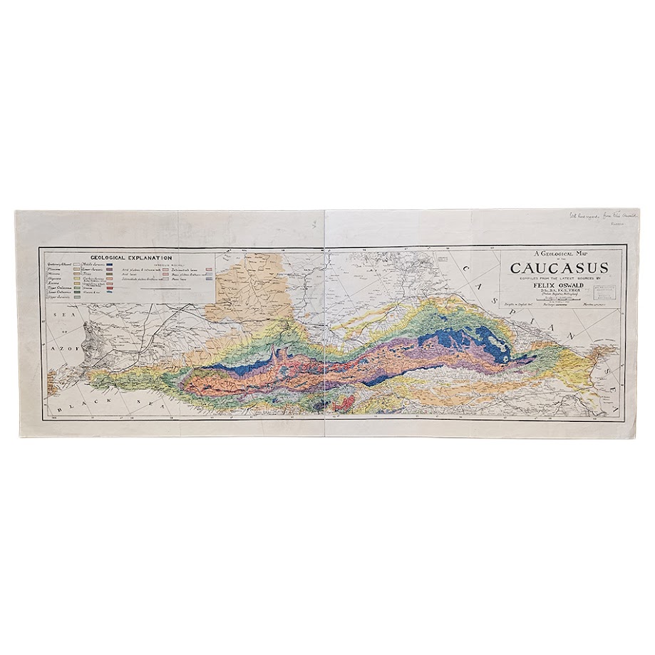
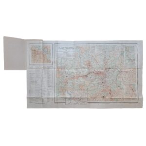
OSWALD, Felix. A Geological Map of the Caucasus. Compiled from the Latest Sources. London: Dulau & Co., Ltd., 1914. Large colour-printed geological map on two joined sheets, scale 1:1,000,000, measuring approximately 50.5 × 132.2 cm overall, accompanied by the original sixteen-page pamphlet, Explanatory Notes to Accompany the Geological Map of the Caucasus. An exceptional author’s presentation copy, inscribed by Felix Oswald in manuscript at the upper right: “With kind regards from Felix Oswald / Russia.” Subsequently preserved in the scientific collections of the British Museum (Natural History), with institutional Palaeontological Library / Map Room markings and later withdrawal stamps.
Oswald’s map occupies an important place in the history of geological cartography of the Caucasus. The Library of Congress describes it as essentially the first accurate and comprehensive geological map of the region, noting that it revealed the Alpine and Hercynian structural history of the Caucasus together with its exceptionally varied lithology. It was therefore considerably more than a geographical map overprinted with geological information: it represented a major synthesis of the existing surveys of the region combined with Oswald’s own field research and interpretation.
Felix Oswald was already an established authority on the geology of Armenia and the Caucasus when this map appeared. He had accompanied H. F. B. Lynch on his second journey through Turkey and Armenia, subsequently producing his substantial geological studies of Armenia. The importance of that work was formally recognised in 1907 when the Geological Society of London awarded Oswald the Murchison Fund, an award made for noteworthy published research in the Earth sciences. His earlier geological map of Armenia had itself been issued by Dulau in 1907 at the substantial price of 25 shillings net, demonstrating the specialist scientific market for which his cartographic publications were intended.
The 1914 Caucasus map extends from the Sea of Azov and Black Sea eastwards to the Caspian Sea, encompassing the Greater and Lesser Caucasus and adjoining parts of Russia, Georgia, Armenia, Azerbaijan and eastern Anatolia. Its extensive colour key distinguishes Quaternary and recent deposits, Pliocene, Miocene, Oligocene and Eocene formations, Upper and Lower Cretaceous strata, Upper, Middle and Lower Jurassic rocks, Carboniferous and older Palaeozoic formations, crystalline schists, gneiss, glaciers and snow, together with numerous categories of plutonic and volcanic rocks. Railways, settlements, political boundaries, marshes and relief information are incorporated into the underlying geographical framework.
The map was recognised immediately by the scientific press. Nature reviewed it on 20 August 1914, drawing attention to the fact that it incorporated a considerable amount of Oswald’s own personal study. The review singled out his interpretation of the Caucasus’s ancient crystalline rocks, granite intrusions, Jurassic folding, later Miocene and post-Sarmatian mountain-building, and the volcanic development of Kazbek and Elbrus. The Geological Magazine devoted a substantial three-page review to the publication in August of the same year.
The original published price is itself revealing. Dulau & Co. issued the map with explanatory notes at 15 shillings net. Both Nature and the Geological Magazine recorded that price contemporaneously. This was not an inexpensive popular map but a substantial specialist scientific publication aimed at geologists, research libraries, learned societies and institutional users. Its original price, together with its large format, complex multi-colour printing and separately issued explanatory text, underlines the seriousness of the publication from the outset.
The accompanying Explanatory Notes to Accompany the Geological Map of the Caucasus, London: Dulau & Co., 1914, forms an integral component of the original issue. The Bibliothèque nationale de France specifically catalogues Oswald’s map as two coloured sheets accompanied by a sixteen-page explanatory text and records only three institutional examples. The survival of the explanatory pamphlet with the present map is therefore bibliographically important and distinguishes it from detached map-only examples.
This copy is further distinguished by its exceptional provenance. The manuscript inscription “With kind regards from Felix Oswald / Russia” establishes direct authorial association. It subsequently entered the collections of the British Museum (Natural History), where it was preserved within the institution’s scientific library and Map Room system. The accompanying explanatory pamphlet also bears institutional markings, maintaining the association between the map and text.
The resulting provenance is unusually coherent and particularly appropriate to the subject: Felix Oswald → British Museum scientific collection → formally withdrawn copy. In this context the institutional stamps are not merely ex-library markings but form part of the history of a specialist geological publication which passed directly from its author into one of Britain’s principal natural-history collections.
Historical and Scientific Importance
The map represents an important stage in the transition from nineteenth-century exploratory geology to increasingly systematic regional geological mapping. Earlier Russian and European geologists had made major contributions to the understanding of individual parts of the Caucasus, but Oswald attempted a unified geological synthesis of the entire mountain system.
The Library of Congress’s description of the map as essentially the first accurate and comprehensive geological map of the Caucasus is particularly significant. Its importance rests not simply upon its age, colouring or geographical scope, but upon its attempt to bring the extraordinarily complicated geological history of the Caucasus into a single coherent cartographic representation.
Oswald’s work also belongs to an important period in the geological investigation of the Caucasus, when structural geology had increasing practical importance for the understanding of mineral and petroleum-bearing regions. The map records the geology of an area that included some of the world’s most important early petroleum districts, while simultaneously documenting the broader tectonic and stratigraphic structure of the mountain chain.
Provenance
Author’s presentation copy, inscribed in manuscript at the upper right:
“With kind regards from Felix Oswald / Russia.”
Subsequently in the British Museum (Natural History) scientific collections, with Palaeontological Library / Map Room institutional markings and later Natural History Museum withdrawal stamps.
Condition
Very good considering the exceptional dimensions and specialist working nature of the map. Original folds with associated light creasing, minor handling and occasional marginal marks. Fold lines tender with minor splitting. The extensive geological colouring remains strong and visually impressive. Authorial inscription clear and legible. Institutional markings as described. Complete with the original sixteen-page explanatory pamphlet, preserved in a later protective binding.
Author
Felix Oswald, D.Sc., B.A., F.G.S., F.R.G.S.; British geologist, cartographer and archaeologist; recipient of the Geological Society of London’s Murchison Fund in 1907.
Title
A Geological Map of the Caucasus. Compiled from the Latest Sources.
Publication
London: Dulau & Co., Ltd.
Date: 1914
Original Published Price: 15 shillings net, including the explanatory notes.
Scale: 1:1,000,000.
Sheet Size: Approximately 50.5 × 132.2 cm overall.
Accompanying Material: Explanatory Notes to Accompany the Geological Map of the Caucasus, Felix Oswald, London: Dulau & Co., 1914, 16 pages.
Location: Map Drawer D.
SHOP WITH CONFIDENCE AT HORNSEYS
At Hornseys, we are dedicated to offering items that uphold the highest standards of quality and authenticity. Our collection of artwork is carefully curated to ensure that each item we offer is authentic, collated, and complete.
Here’s what sets us apart:
- Authenticity and Provenance: Each map is researched and verified for authenticity.
- Expert Curation: We wholly own all our artworks. We trust our taste and have invested heavily in it. We have confidence in all artwork that we offer for sale.
- Customer Satisfaction: We strive to provide an exceptional customer experience, from detailed descriptions and provenance to secure and prompt delivery of your purchase.
- Returns Policy: We offer an unconditional guarantee on every item. If, however, you wish to make a return, artworks may be sent back to us within fourteen days of receipt for whatever reason. We request that we are notified in advance if you wish to do so. They must be returned to us in the same condition as they were sent for a full refund.
OUR COMMITMENT TO QUALITY AND SERVICE
Understanding the value and rarity of these items, we ensure that every aspect of your purchase meets the highest standards of quality and service. This includes:
- Free Expedited, Tracked, and Insured Delivery within the UK: Ensuring that your artwork arrives safely and promptly.
- Fully-Insured Worldwide Delivery: Offering peace of mind for international collectors with reliable and secure shipping options.
EXPLORE OUR COLLECTION
Visit Hornseys today to explore our fine collection of maps and other artworks. Whether you are an avid collector or looking for a special gift, our selection offers something truly unique. Located since 1976 in Ripon in the picturesque Yorkshire Dales, we are recognized as a destination gallery for tastefully curated artwork, rare maps, design, and fine books.