Riyadh 1971 – Large Bilingual City Plan of Riyadh, Saudi Arabia
Description:
Date: 1971
Scale: 1:15,000
Size: 55 × 84.4 cm
Catalogue Number: 004172
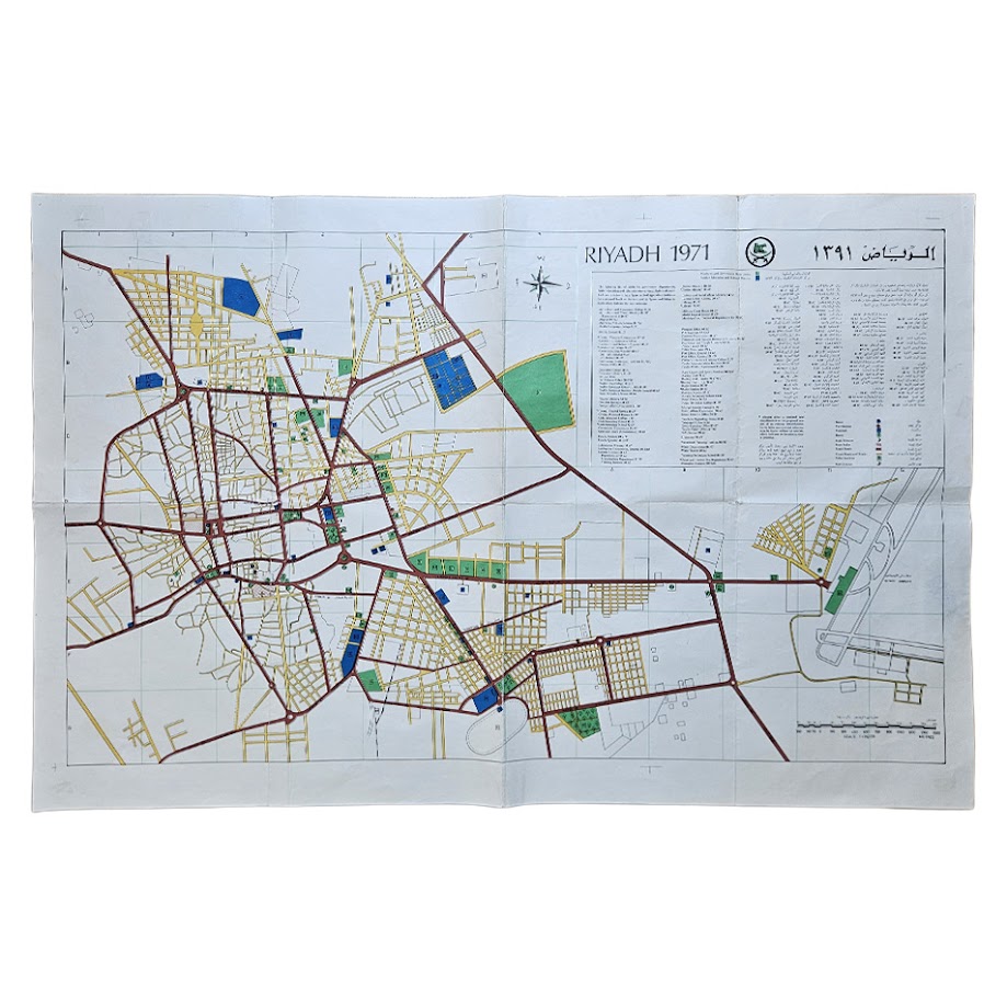
A scarce and highly informative large-format city plan of Riyadh, Saudi Arabia, dated 1971, printed in colour with titles, street names, public institutions and explanatory information in both English and Arabic. At the unusually detailed scale of 1:15,000, the map provides an important record of the Saudi capital at a formative point in its modern development, before the enormous urban expansion of the later twentieth and early twenty-first centuries.
Riyadh in 1971
Riyadh has been the political centre of the Saudi state since the nineteenth century. It became the capital of the Second Saudi State in 1824–25, and after its recapture by King Abdulaziz in 1902 it became the base from which the modern Kingdom of Saudi Arabia was consolidated. Riyadh was formally confirmed as the capital of the newly unified Kingdom in 1932.
By 1971, however, Riyadh was entering an entirely new phase. The traditional walled settlement had already begun to give way to a rapidly expanding modern capital, and the early 1970s marked the beginning of an especially intense period of road building, institutional construction, suburban development and government planning. Contemporary accounts have described Riyadh in the 1970s as effectively one of the world’s largest construction sites. The Kingdom’s first national five-year development plan began in 1970, making this 1971 map particularly valuable as a cartographic record of the city at the outset of that transformation.
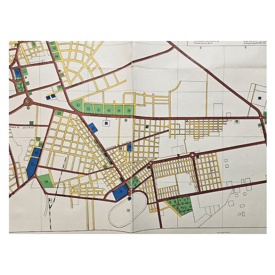
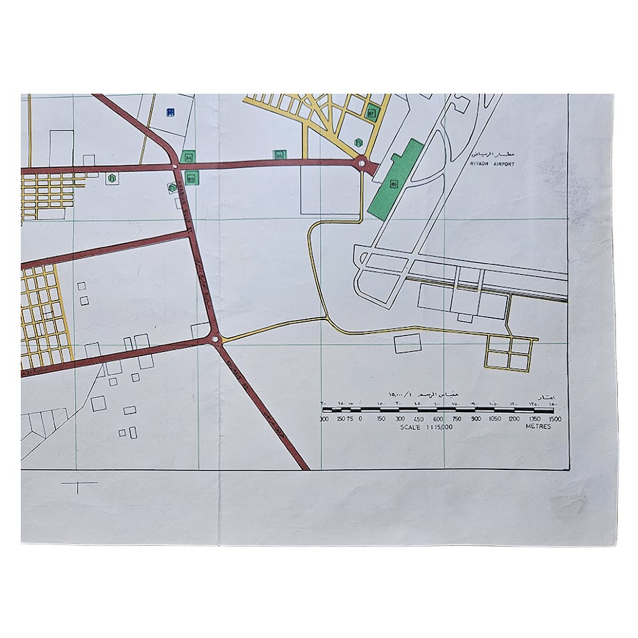
The map therefore documents Riyadh at the threshold between the older city and the vast modern metropolis. Its compact built-up core is surrounded by extensive planned road systems, new residential grids, institutional compounds and open land awaiting development. Riyadh Airport is shown clearly on the eastern side of the city with its runways, buildings and approach roads. Its location, then still beyond much of the urban fabric, provides a vivid measure of how dramatically Riyadh has expanded since the early 1970s.
Only three years after this map was issued, in 1974, the Riyadh City Development Authority was established to coordinate the capital’s accelerating growth. The city shown here therefore predates much of the large-scale planning that shaped later Riyadh, including the major metropolitan expansion of the late twentieth century.
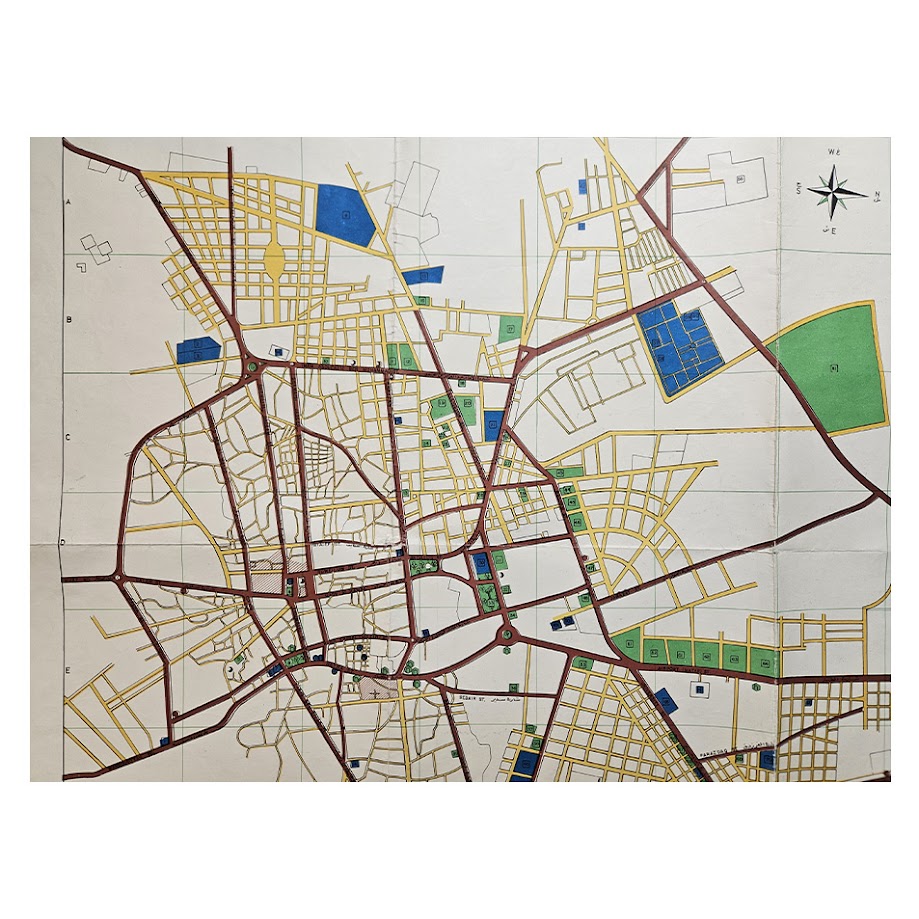
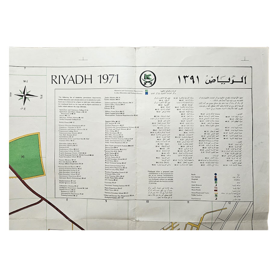
The street plan is particularly detailed, showing the established central road network together with extensive areas of planned development spreading beyond the older urban core. Major roads are picked out in dark red, secondary streets in yellow, while government institutions, public buildings, parks and other facilities are distinguished through coloured symbols and numbered references. The extensive bilingual key identifies a remarkable range of ministries, government departments, educational institutions, hospitals, mosques, markets, hotels, recreational facilities and public services, allowing the developing administrative structure of the Saudi capital to be read directly from the map.
Riyadh Airport is shown to the east of the principal built-up area with its runways, associated buildings and road approaches clearly delineated. The airport occupies a striking position within what was then still comparatively open land and provides an excellent visual indication of how dramatically Riyadh’s urban footprint has subsequently expanded. The map also records major radial routes, roundabouts, new residential districts, institutional compounds, green spaces and areas laid out for further development.
The upper-right title panel is headed “RIYADH 1971” together with the Arabic title and the corresponding 1391 AH date. The Saudi emblem appears above the extensive bilingual directory. A compass rose and metric scale are also provided.
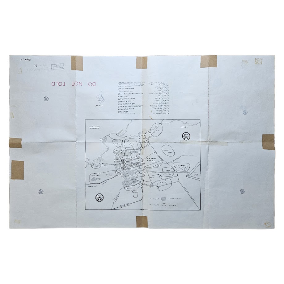
The reverse carries a further schematic plan of Riyadh, together with bilingual printed information, official stamps and a large contemporary “DO NOT FOLD” marking. There are several old paper-tape reinforcements to folds and margins on the reverse.
A valuable piece of modern Middle Eastern urban cartography, documenting Riyadh during the early 1970s transformation of Saudi Arabia, and of particular relevance to collectors and researchers interested in Saudi history, Arabian Peninsula cartography, urban development, transport history and the changing geography of Riyadh.
Condition: Very good overall for a large working map of this period. Folded, with the expected fold creasing and light handling marks. Several folds and marginal areas have been reinforced on the reverse with old paper tape. A few institutional/ownership stamps are present on the reverse with ‘Withdrawn’ stamp from Westminster Library, none of which show through to the colour-printed map. The printed image remains bright and clear with strong colour throughout. Please see the photographs, which form part of the description.
Location: Map Drawer D. Separate sleeve.
SHOP WITH CONFIDENCE AT HORNSEYS
At Hornseys, we are dedicated to offering items that uphold the highest standards of quality and authenticity. Our collection of artwork is carefully curated to ensure that each item we offer is authentic, collated, and complete.
Here’s what sets us apart:
- Authenticity and Provenance: Each map is researched and verified for authenticity.
- Expert Curation: We wholly own all our artworks. We trust our taste and have invested heavily in it. We have confidence in all artwork that we offer for sale.
- Customer Satisfaction: We strive to provide an exceptional customer experience, from detailed descriptions and provenance to secure and prompt delivery of your purchase.
- Returns Policy: We offer an unconditional guarantee on every item. If, however, you wish to make a return, artworks may be sent back to us within fourteen days of receipt for whatever reason. We request that we are notified in advance if you wish to do so. They must be returned to us in the same condition as they were sent for a full refund.
OUR COMMITMENT TO QUALITY AND SERVICE
Understanding the value and rarity of these items, we ensure that every aspect of your purchase meets the highest standards of quality and service. This includes:
- Free Expedited, Tracked, and Insured Delivery within the UK: Ensuring that your artwork arrives safely and promptly.
- Fully-Insured Worldwide Delivery: Offering peace of mind for international collectors with reliable and secure shipping options.
EXPLORE OUR COLLECTION
Visit Hornseys today to explore our fine collection of maps and other artworks. Whether you are an avid collector or looking for a special gift, our selection offers something truly unique. Located since 1976 in Ripon in the picturesque Yorkshire Dales, we are recognized as a destination gallery for tastefully curated artwork, rare maps, design, and fine books.