Mapa Geológico de España – África, Cádiz, Málaga – Hoja No. 59 – Segunda Edición
Description:
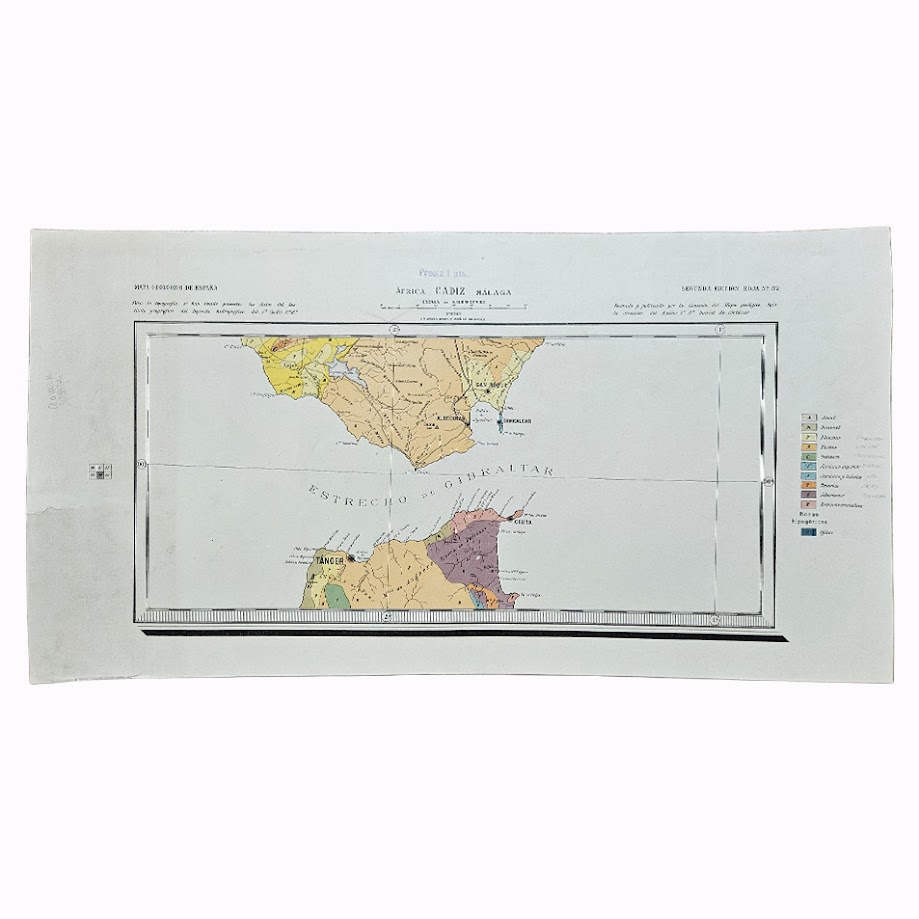
An uncommon geological map of the Strait of Gibraltar and the adjoining coasts of southern Spain and North Africa, issued as Hoja No. 59, África – Cádiz – Málaga, in the historic Mapa Geológico de España. The sheet is explicitly designated “Segunda Edición Hoja No. 59” but is undated.
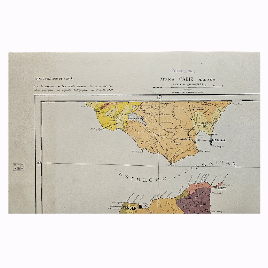
The map has an unusually striking geographical composition, placing the Estrecho de Gibraltar at its centre. The southern extremity of Andalusia occupies the upper part of the map, including Algeciras, San Roque and Gibraltar, while the opposing North African coastline incorporates Tangier, Ceuta and the surrounding territories. It consequently presents the geology of the two continents in direct geographical relationship across the Strait.
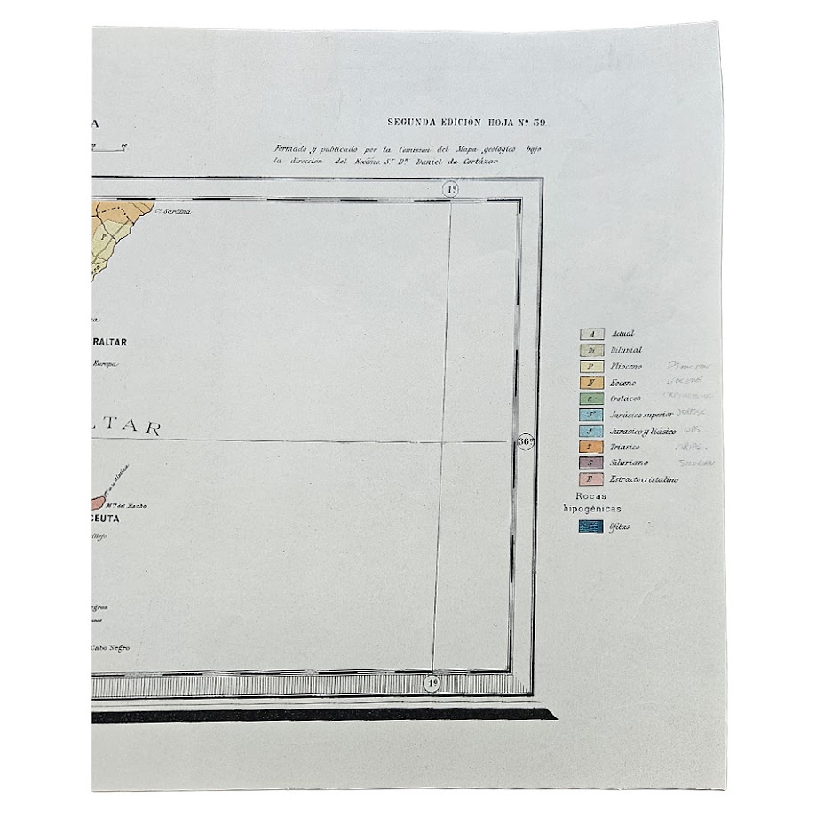
Geological formations are differentiated by colour and identified in the printed key at the right, including Actual, Diluvial, Plioceno, Mioceno, Cretáceo, Jurásico Superior, Jurásico Liásico, Triásico, Siluriano and Estratocristalino, together with igneous rocks. The combination of geological information with the political and geographical configuration of the Strait makes the map of interest beyond purely geological collecting, particularly in relation to Gibraltar, Tangier, Ceuta, Spanish North Africa and the historical cartography of the western Mediterranean.
The upper left bears the heading “Mapa Geológico de España”, together with a note concerning the topographical information employed in its preparation. At upper right it is described as having been formed and published by the commission responsible for the geological map under the direction of Manuel Fernández de Castro. The printed price “Precio 1 pta.” appears above the central title.
Institutional records confirm África–Cádiz–Málaga as Sheet 59 of the historic Mapa Geológico de España. This early national geological sheet numbering should not be confused with that employed for later Spanish geological mapping programmes. Separate examples of the África–Cádiz–Málaga sheet appear to be infrequently encountered, particularly as loose maps outside institutional collections.
The sheet is particularly appealing cartographically because it does not treat the Mediterranean as a boundary to the mapped area. Instead, southern Spain and northern Africa are presented as part of the same geological landscape, making the Strait itself the visual and geographical focus of the map.
Condition
Very good. Original horizontal and vertical fold lines. Some light handling and minor age-toning, principally to the margins. Small contemporary pencil annotations beside several entries in the geological key and faint manuscript markings to the margins. The printed colours remain strong and clear. Please refer to the accompanying photographs for further detail.
Maker: Comisión del Mapa Geológico de España. Issued under the direction of Manuel Fernández de Castro.
Date: Undated but c. 1890–1895
Edition: Second Edition – Hoja No. 59
Sheet Size: Approximately 30.4 × 58.5 cm
Subject: Cádiz – Málaga – Gibraltar – Strait of Gibraltar – Tangier – Ceuta – North Africa
Location: Map Drawer D
Sleeve: 2234
Rarity and Historical Interest
An uncommon individual sheet from the historic Spanish national geological mapping programme. Its subject gives it considerably wider interest than many regional geological sheets: Gibraltar, Tangier and Ceuta are all represented within a single geological survey, with the Strait of Gibraltar occupying the centre of the composition.
Institutional holdings establish the existence and identity of África–Cádiz–Málaga as Sheet 59, but individual examples are not commonly encountered in the commercial market. It is therefore best described as scarce.
The map has particular relevance to collectors of Spanish geology, Gibraltar, Morocco, Tangier, Ceuta and Mediterranean cartography, while its strong original colour and unusual cross-Strait configuration also give it considerable decorative appeal.
SHOP WITH CONFIDENCE AT HORNSEYS
At Hornseys, we are dedicated to offering items that uphold the highest standards of quality and authenticity. Our collection of artwork is carefully curated to ensure that each item we offer is authentic, collated, and complete.
Here’s what sets us apart:
- Authenticity and Provenance: Each map is researched and verified for authenticity.
- Expert Curation: We wholly own all our artworks. We trust our taste and have invested heavily in it. We have confidence in all artwork that we offer for sale.
- Customer Satisfaction: We strive to provide an exceptional customer experience, from detailed descriptions and provenance to secure and prompt delivery of your purchase.
- Returns Policy: We offer an unconditional guarantee on every item. If, however, you wish to make a return, artworks may be sent back to us within fourteen days of receipt for whatever reason. We request that we are notified in advance if you wish to do so. They must be returned to us in the same condition as they were sent for a full refund.
OUR COMMITMENT TO QUALITY AND SERVICE
Understanding the value and rarity of these items, we ensure that every aspect of your purchase meets the highest standards of quality and service. This includes:
- Free Expedited, Tracked, and Insured Delivery within the UK: Ensuring that your artwork arrives safely and promptly.
- Fully-Insured Worldwide Delivery: Offering peace of mind for international collectors with reliable and secure shipping options.
EXPLORE OUR COLLECTION
Visit Hornseys today to explore our fine collection of maps and other artworks. Whether you are an avid collector or looking for a special gift, our selection offers something truly unique. Located since 1976 in Ripon in the picturesque Yorkshire Dales, we are recognized as a destination gallery for tastefully curated artwork, rare maps, design, and fine books.