Ruwandiz, Iraqi Kurdistan – British Military Map – GSGS 3919 / K501 – 1958
Description:
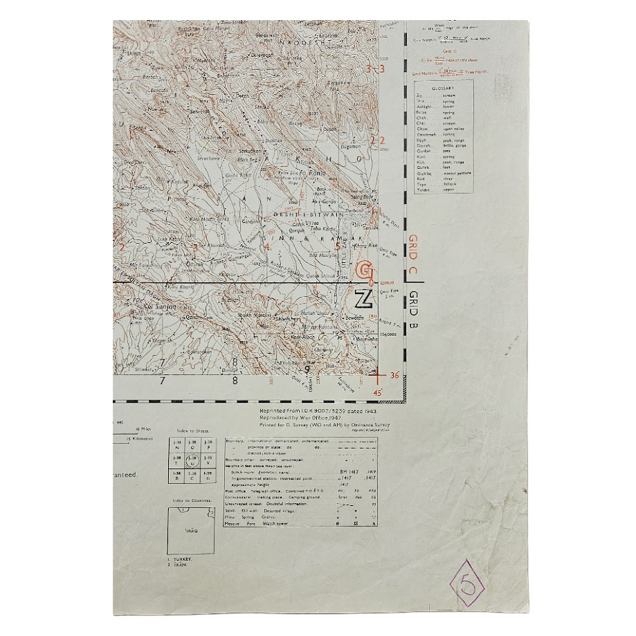
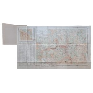
A detailed British military topographical map of Ruwandiz and the mountainous frontier region of north-eastern Iraq, extending towards the borders with Iran and Turkey, issued in the Quarter Inch Series at a scale of approximately 1:253,440. Designated Sheet J-38U, Ruwandiz, this example is the Third Edition, originally reproduced by the War Office in 1947 and subsequently reprinted in September 1958 as Series K501 (GSGS 3919), Edition 3-GSGS.
The map covers one of the most dramatic and strategically significant areas of Iraqi Kurdistan. Centred on Ruwandiz, it records the deeply dissected mountain landscape of the Zagros system, including the Ruwandiz district, the approaches towards the Iranian frontier and the high country extending northwards towards Turkey. The exceptionally dense contouring vividly conveys the difficult terrain, with mountain ridges, passes, river valleys, villages, roads, tracks and communications shown in considerable detail.
Ruwandiz occupies an important geographical position in the mountains north-east of Erbil, close to the routes historically connecting northern Iraq with western Iran. The area’s steep gorges and high passes gave accurate topographical mapping considerable military importance, particularly during the Second World War and the subsequent early Cold War period. The present sheet retains the cartographic foundations of wartime British mapping while representing its continued military use into the late 1950s.
The publication history is particularly well documented. The underlying Survey of India mapping was originally compiled and published in the 1920s and subsequently revised. A Second Edition of Ruwandiz was issued in 1942, while the present sequence derives from an I.D.R. 9002/5239 edition of 1943. The map was brought to Third Edition in 1947, reproduced by the War Office, and this edition was then reprinted for the Directorate of Survey, War Office and Air Ministry by the Ordnance Survey in September 1958.
The sheet carries Grids B and C in metres, together with detailed marginal information concerning communications, administrative boundaries, water supply, terrain, road classification and geographical terminology. Heights are given in feet. The title panel identifies the coverage as Iran, Iraq and Turkey, although the principal subject is the rugged Ruwandiz district of north-eastern Iraq.
Institutional holdings firmly establish the map’s bibliographical history. The British Library preserves both the earlier 1942 Second Edition and the exact 1958 Edition 3-GSGS reprint represented here. The wider K501 Iraq and Iran series is also represented in major American map collections and catalogued under OCLC 6589753, confirming its place within the systematic military mapping of Iraq and Iran. The precise Ruwandiz sheet is nevertheless encountered relatively infrequently as an original separate map outside institutional collections.
Condition
Good to very good. Original horizontal and vertical fold lines with some general creasing, principally to the margins. Minor handling, rubbing and age-related surface marks. Several former ownership or administrative ink stamps and manuscript marks are present in the upper margin, including a blue letter “K”, with a violet numerical stamp towards the lower right margin. The mapped area remains complete, highly legible and well preserved, with strong brown, black and red printing. Please refer to the accompanying photographs for further detail.
Maker: Directorate of Survey, War Office and Air Ministry. Printed by the Ordnance Survey
Series: K501 / GSGS 3919 – Quarter Inch Series
Sheet: J-38U – Ruwandiz
Edition: Third Edition / Edition 3-GSGS
Date: 1958
Cartographic History: Third Edition 1947; reprinted September 1958 from earlier wartime mapping
Scale: 1:253,440 – Quarter Inch Series
Sheet Size: Approximately 61.3 × 48.2 cm
Area Shown: Ruwandiz, Iraqi Kurdistan, north-eastern Iraq and the approaches towards Iran and Turkey
Location: Tube C: Middle East
Historical Context and Rarity
The Ruwandiz sheet is particularly interesting because of the military importance of its terrain. This is not simply a regional road map: it is a detailed representation of a mountainous frontier landscape where movement is controlled by valleys, gorges and passes. The density of contour information is immediately striking and reflects precisely the type of terrain for which accurate military cartography was essential.
The sheet also has a substantial wartime lineage. The British Library records a 1942 Second Edition and the later Third Edition sequence represented by this 1958 printing. A contemporary post-war mountaineering account specifically refers to the British military J-38U Ruwandiz sheet at 1:253,440, demonstrating its practical use for understanding the exceptionally difficult Ruwandiz mountain region.
The wider K501 / GSGS 3919 Iraq and Iran series is well represented institutionally, including in American university map collections under OCLC 6589753. Individual Ruwandiz sheets survive institutionally and occasional examples do appear commercially, so we would describe this edition as scarce rather than rare.
SHOP WITH CONFIDENCE AT HORNSEYS
At Hornseys, we are dedicated to offering items that uphold the highest standards of quality and authenticity. Our collection of artwork is carefully curated to ensure that each item we offer is authentic, collated, and complete.
Here’s what sets us apart:
- Authenticity and Provenance: Each map is researched and verified for authenticity.
- Expert Curation: We wholly own all our artworks. We trust our taste and have invested heavily in it. We have confidence in all artwork that we offer for sale.
- Customer Satisfaction: We strive to provide an exceptional customer experience, from detailed descriptions and provenance to secure and prompt delivery of your purchase.
- Returns Policy: We offer an unconditional guarantee on every item. If, however, you wish to make a return, artworks may be sent back to us within fourteen days of receipt for whatever reason. We request that we are notified in advance if you wish to do so. They must be returned to us in the same condition as they were sent for a full refund.
OUR COMMITMENT TO QUALITY AND SERVICE
Understanding the value and rarity of these items, we ensure that every aspect of your purchase meets the highest standards of quality and service. This includes:
- Free Expedited, Tracked, and Insured Delivery within the UK: Ensuring that your artwork arrives safely and promptly.
- Fully-Insured Worldwide Delivery: Offering peace of mind for international collectors with reliable and secure shipping options.
EXPLORE OUR COLLECTION
Visit Hornseys today to explore our fine collection of maps and other artworks. Whether you are an avid collector or looking for a special gift, our selection offers something truly unique. Located since 1976 in Ripon in the picturesque Yorkshire Dales, we are recognized as a destination gallery for tastefully curated artwork, rare maps, design, and fine books.