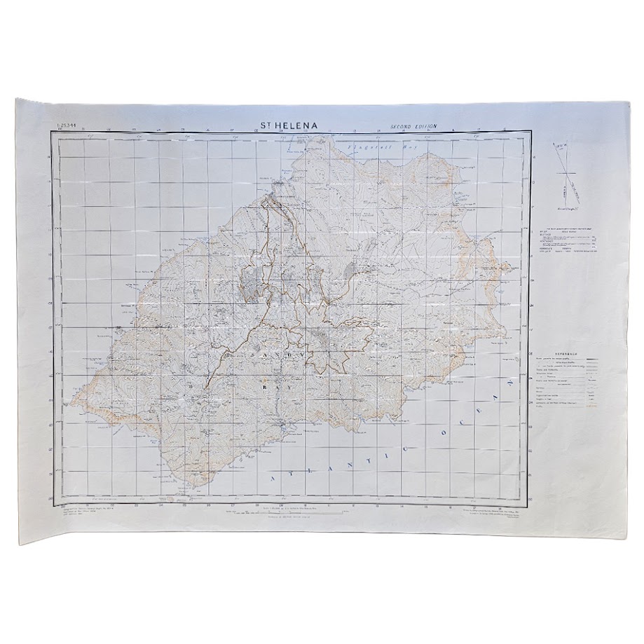
St Helena – G.S.G.S. No. 1853A – Second Edition dated 1941 – Ordnance Survey Printing of 500 Copies – 1959
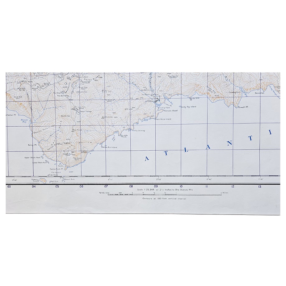
Description: A large and highly detailed British government topographical map of the entire island of St Helena, one of Britain’s most historically important and geographically isolated overseas territories. The sheet is G.S.G.S. No. 1853A, originally published by the War Office in 1904 and here carrying the designation Second Edition, 1941, at the unusually detailed scale of 1:25,344, or 2½ inches to one statute mile. Crucially, the printer’s information on this particular sheet shows that it was printed by the Ordnance Survey in 1959 in a stated run of only 500 copies. It should therefore be described bibliographically as a 1959 printing of the Second Edition dated 1941, rather than as a physical printing made in 1941.
The map provides remarkably comprehensive coverage of St Helena on a single large sheet, showing Jamestown, James Bay, Ladder Hill, Longwood, Deadwood, Sandy Bay, Plantation House, Prosperous Bay, Rupert’s Valley and numerous smaller settlements, estates and topographical features. Roads, tracks, buildings, watercourses, coastal features, ridges and valleys are represented in considerable detail, while close contouring conveys particularly well the island’s dramatic mountainous terrain. At 1:25,344, the map is substantially more detailed than the small-scale maps on which St Helena usually appears and offers an unusually complete cartographic portrait of the island.
The Second Edition date of 1941 is historically significant because the underlying revision belongs to the Second World War period, when St Helena retained an important strategic role for Britain in the South Atlantic. The island maintained military defences and a garrison, while its isolated position between Africa and South America gave it continued value for communications, shipping and naval support. The wartime importance of James Bay was demonstrated dramatically in October 1941 when the Royal Fleet Auxiliary tanker RFA Darkdale was torpedoed and sunk by the German submarine U-68 while anchored off St Helena, with heavy loss of life. The present sheet was printed later, in 1959, and no claim is made that this particular impression saw wartime use; rather, it preserves the detailed topographical content of the Second Edition dated 1941.
St Helena also occupies an exceptional place in British and European history. Long important as a British station on the sea route around the Cape of Good Hope, the island is internationally famous as the place chosen for the final exile of Napoleon Bonaparte, who lived at Longwood from 1815 until his death in 1821. St Helena later held thousands of Boer prisoners during the South African War and remained an important British possession throughout the twentieth century. The combination of Napoleonic history, British imperial history, South Atlantic maritime history and Second World War associations gives detailed maps of the island a particularly broad historical appeal.
The map appears to be scarce in this form. An example of G.S.G.S. No. 1853A, Second Edition, 2½ inches to one mile, is recorded in the former Foreign & Commonwealth Office archive inventory and is catalogued there with the date 1941. The inventory does not identify the printer’s code or impression date of that particular copy, so it cannot presently be established whether the institutional example represents an earlier physical printing or a later impression of the same Second Edition. At the time of cataloguing, we have been unable to locate another clearly identified copy of this 1959 printing of 500 copies currently offered for sale or a reliably documented previous commercial sale.
Condition: Very good condition. The sheet is complete with strong printed detail and attractive colour. There is light handling and minor creasing, principally towards the broad margins, together with slight age-related marking and occasional minor wear. No significant loss is apparent. Please refer carefully to the accompanying photographs, which form an important part of the condition assessment.
Title: St Helena
Series: G.S.G.S. No. 1853A
Edition: Second Edition, dated 1941
Printing: Ordnance Survey, 1959
Print run: 500 copies
Original publication: War Office, 1904
Scale: 1:25,344 / 2½ inches to one statute mile
Sheet size: 64.2 × 88.7 cm
Area: St Helena, South Atlantic Ocean
Format: Large colour-printed topographical map
Every map offered by Hornseys is handled, inspected and catalogued individually in-house, with edition, printing, scale, imprint and condition details taken directly from the surviving sheet wherever possible.
SHOP WITH CONFIDENCE AT HORNSEYS
At Hornseys, we are dedicated to offering items that uphold the highest standards of quality and authenticity. Our collection of artwork is carefully curated to ensure that each item we offer is authentic, collated, and complete.
Here’s what sets us apart:
- Authenticity and Provenance: Each map is researched and verified for authenticity.
- Expert Curation: We wholly own all our artworks. We trust our taste and have invested heavily in it. We have confidence in all artwork that we offer for sale.
- Customer Satisfaction: We strive to provide an exceptional customer experience, from detailed descriptions and provenance to secure and prompt delivery of your purchase.
- Returns Policy: We offer an unconditional guarantee on every item. If, however, you wish to make a return, artworks may be sent back to us within fourteen days of receipt for whatever reason. We request that we are notified in advance if you wish to do so. They must be returned to us in the same condition as they were sent for a full refund.
OUR COMMITMENT TO QUALITY AND SERVICE
Understanding the value and rarity of these items, we ensure that every aspect of your purchase meets the highest standards of quality and service. This includes:
- Free Expedited, Tracked, and Insured Delivery within the UK: Ensuring that your artwork arrives safely and promptly.
- Fully-Insured Worldwide Delivery: Offering peace of mind for international collectors with reliable and secure shipping options.
EXPLORE OUR COLLECTION
Visit Hornseys today to explore our fine collection of maps and other artworks. Whether you are an avid collector or looking for a special gift, our selection offers something truly unique. Located since 1976 in Ripon in the picturesque Yorkshire Dales, we are recognized as a destination gallery for tastefully curated artwork, rare maps, design, and fine books.