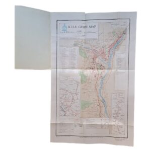
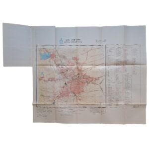
Jinja & Environs, Uganda – Second World War Military Survey Map – King’s African Rifles Cantonment – 1945
Description:
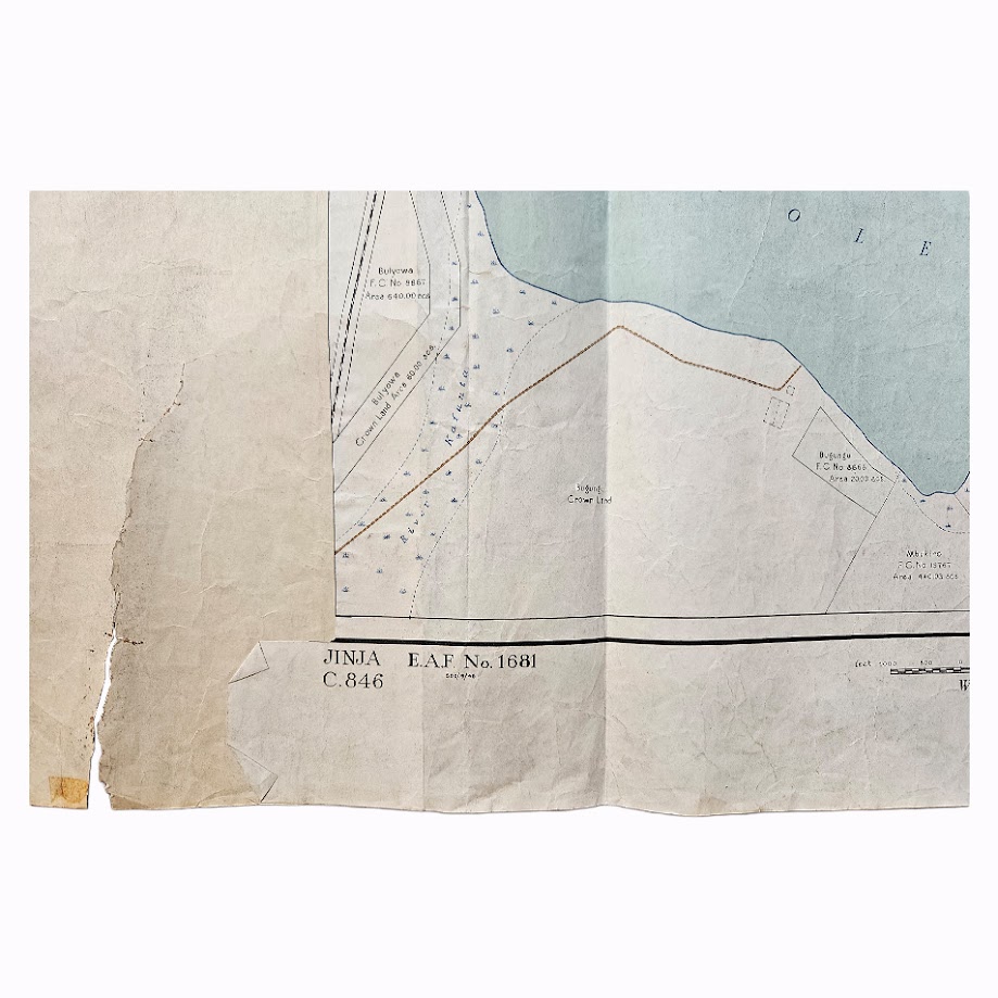
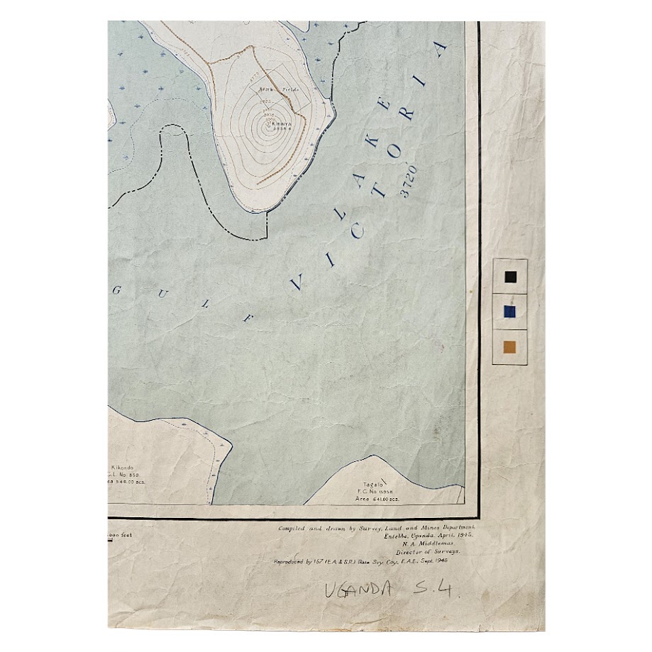
A scarce and historically important Second World War military survey map of Jinja and its environs in the Uganda Protectorate, compiled and drawn by the Survey, Land and Mines Department, Entebbe, Uganda, in April 1945, and reproduced in September 1945 by 157 (East Africa & Southern Rhodesia) Base Survey Company, East African Engineers. The map is identified E.A.F. No. 1681 and C.846, and is drawn at the unusually detailed scale of 1:12,600.
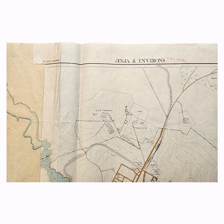
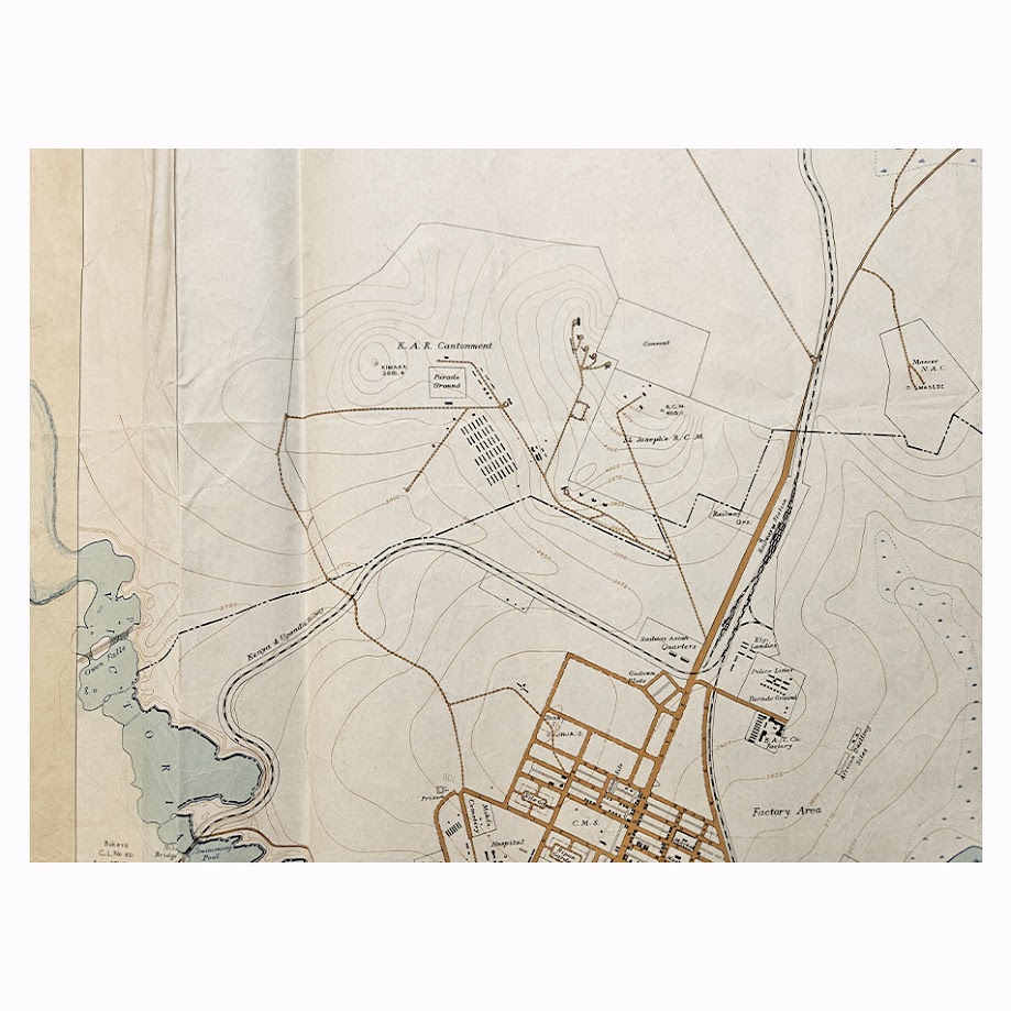
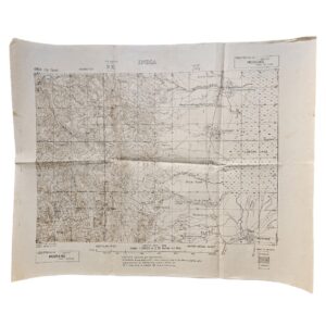
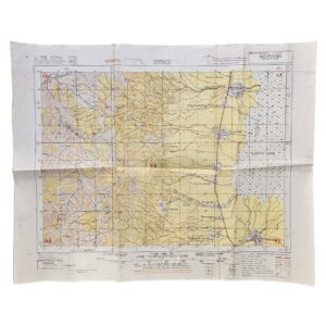
The map provides a remarkably detailed survey of Jinja at the end of the Second World War, showing the township street plan, individual administrative and institutional sites, railway infrastructure, roads, contours, land holdings and property boundaries, together with the shoreline of Napoleon Gulf, Lake Victoria, and the point at which the Victoria Nile leaves the lake. Among the numerous named features are the hospital, schools, police and administrative sites, railway facilities, factory area, golf course and agricultural holdings, providing an unusually comprehensive picture of Jinja immediately before the major post-war industrial development of the town.
Of particular importance is the area immediately north of the town, prominently marked “K.A.R. Cantonment”, together with its Parade Ground and associated buildings. This is a direct cartographic record of Jinja’s association with the King’s African Rifles. The 4th (Uganda) Battalion, King’s African Rifles was Uganda’s principal regular infantry formation, while Jinja also operated as an important wartime infantry training centre. A contemporary history of Uganda’s wartime military units records that new barracks had been completed at Jinja shortly before the outbreak of the Second World War; although the war prevented the 4th Battalion from making its intended move at that point, Jinja’s Infantry Training Centre was active during the conflict, and the 4th (Uganda) Battalion eventually occupied the Jinja barracks in March 1948.
The date of the map is consequently particularly significant. It was compiled in April 1945, while the East African campaign forces were still on a wartime footing and Ugandan units of the King’s African Rifles were serving overseas. The National Army Museum records the 4th (Uganda) Battalion serving with the 11th (East African) Division in Burma and identifies surviving photographs of its African soldiers, NCOs and British officers from 1945. The map therefore captures the physical military infrastructure at Jinja at precisely the period in which Ugandan KAR formations were completing their Second World War service.
Its production is also noteworthy. 157 (East Africa & Southern Rhodesia) Base Survey Company was formed in October 1943 following the reorganisation of British military surveying in East Africa. The unit remained in East Africa and, during the final two years of the war, was responsible for extensive military mapping, training maps and large-scale surveys throughout the East African Command. Surviving institutional collections identify numerous E.A.F.-numbered maps produced by the same company in 1944–46.
The printed imprint names N. A. Middlemas, Director of Surveys. Noel Allan Middlemas was Director of Surveys, Land Officer and Commissioner of Mines in Uganda, placing this map firmly within the official colonial surveying establishment as well as the British military cartographic programme.
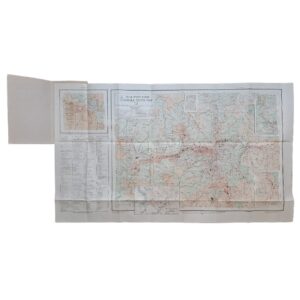
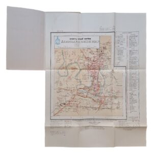
An additional and highly unusual feature appears on the reverse: a faint map of the Kampala Industrial Area, apparently transferred or printed onto the verso. Although considerably fainter than the principal Jinja map, its presence adds another layer of interest to the sheet as a surviving working product of the Uganda survey establishment.
Institutional research demonstrates the rarity of this particular edition. The American Geographical Society Library at the University of Wisconsin-Milwaukee holds a later Jinja & Environs survey dated 1950, at a different scale of 1:10,000, while official Uganda records list another Jinja and Environs township map of 1953. British Library holdings record extensive groups of E.A.F. military mapping produced by 157 Base Survey Company, establishing the institutional context of the present map. I have not located a readily accessible institutional catalogue entry for this exact 1945 E.A.F. No. 1681 / C.846 issue, nor an identifiable original example currently circulating in ordinary commercial channels. This supports describing the map as scarce, while avoiding an unsupported claim of unique survival.
Condition
Good, considering its nature as a large working military survey map. Numerous original and later fold lines and general creasing throughout. Noticeable handling, surface wear and age-toning, particularly to the margins and blank western portion. Several tears and splits, most notably towards the lower left margin, with old tape repairs and reinforcement visible in places. Small marginal losses and abrasions. Contemporary or later manuscript annotations occur in the margins. The principal printed map remains substantially complete and clearly legible, with the blue and brown printed detail retaining good definition. A faint plan of the Kampala Industrial Area is visible on the reverse. The condition is consistent with a map which appears to have been retained and used as a practical survey document rather than preserved as a decorative map.
Maker: Survey, Land and Mines Department, Entebbe, Uganda. Reproduced by 157 (East Africa & Southern Rhodesia) Base Survey Company, East African Engineers
Director of Surveys: Noel Allan Middlemas
Date: April 1945; reproduced September 1945
Scale: 1:12,600
Reference: E.A.F. No. 1681 / C.846
Sheet Size: Approximately 76 × 89.2 cm
Material: Printed survey map on paper, with colour.
Subject: Jinja, Uganda Protectorate; King’s African Rifles; K.A.R. Cantonment; British East Africa; Second World War; Lake Victoria; Victoria Nile; military surveying; colonial Uganda.
Location: Tube B: Africa
Historical Context and Rarity
This map is considerably more interesting than a conventional Jinja town plan because its date, military production and content intersect. It was produced by the Uganda colonial survey authorities and reproduced by a British Army survey company during the final months of the Second World War, while explicitly mapping the K.A.R. Cantonment at Jinja.
The King’s African Rifles connection is not incidental. Uganda’s regular colonial battalion was the 4th (Uganda) Battalion, King’s African Rifles, and the wartime expansion of East African forces created a substantial military training organisation in Uganda. Jinja’s Infantry Training Centre operated during the war, while the Jinja barracks became the permanent home of the 4th Battalion in 1948. The site subsequently remained central to Uganda’s military history: at independence in 1962 the Jinja-based 4th Battalion became part of the Uganda Rifles, from which the national army developed.
As a large-scale 1945 plan actually locating the King’s African Rifles cantonment and parade ground, the map has relevance to military history as well as African cartography and urban history. That combination, together with the apparent absence of the precise issue from readily searchable institutional and commercial records, makes this one of the more worthwhile twentieth-century Uganda maps of this type.
SHOP WITH CONFIDENCE AT HORNSEYS
At Hornseys, we are dedicated to offering items that uphold the highest standards of quality and authenticity. Our collection of artwork is carefully curated to ensure that each item we offer is authentic, collated, and complete.
Here’s what sets us apart:
- Authenticity and Provenance: Each map is researched and verified for authenticity.
- Expert Curation: We wholly own all our artworks. We trust our taste and have invested heavily in it. We have confidence in all artwork that we offer for sale.
- Customer Satisfaction: We strive to provide an exceptional customer experience, from detailed descriptions and provenance to secure and prompt delivery of your purchase.
- Returns Policy: We offer an unconditional guarantee on every item. If, however, you wish to make a return, artworks may be sent back to us within fourteen days of receipt for whatever reason. We request that we are notified in advance if you wish to do so. They must be returned to us in the same condition as they were sent for a full refund.
OUR COMMITMENT TO QUALITY AND SERVICE
Understanding the value and rarity of these items, we ensure that every aspect of your purchase meets the highest standards of quality and service. This includes:
- Free Expedited, Tracked, and Insured Delivery within the UK: Ensuring that your artwork arrives safely and promptly.
- Fully-Insured Worldwide Delivery: Offering peace of mind for international collectors with reliable and secure shipping options.
EXPLORE OUR COLLECTION
Visit Hornseys today to explore our fine collection of maps and other artworks. Whether you are an avid collector or looking for a special gift, our selection offers something truly unique. Located since 1976 in Ripon in the picturesque Yorkshire Dales, we are recognized as a destination gallery for tastefully curated artwork, rare maps, design, and fine books.