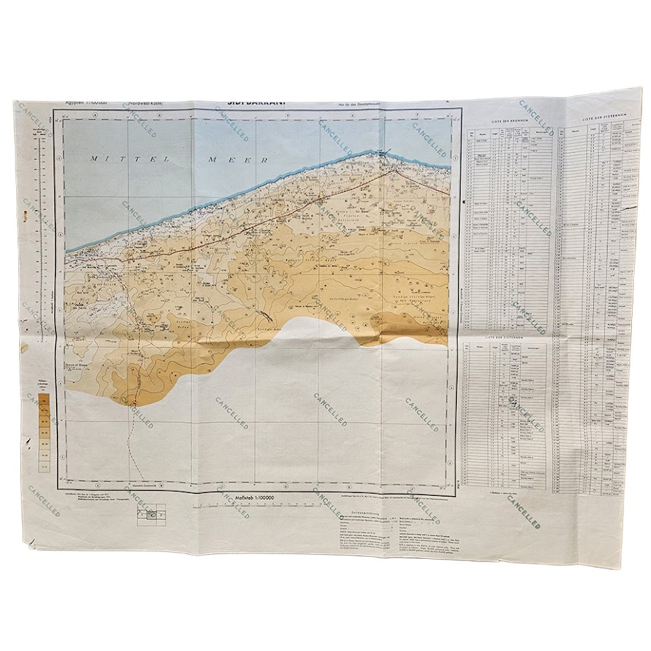
Wadi el Natrun, Egypt – British Army Military Map Printed on the Reverse of a Cancelled German Sidi Barrani Map – 512 Field Survey Company, Royal Engineers – 1942
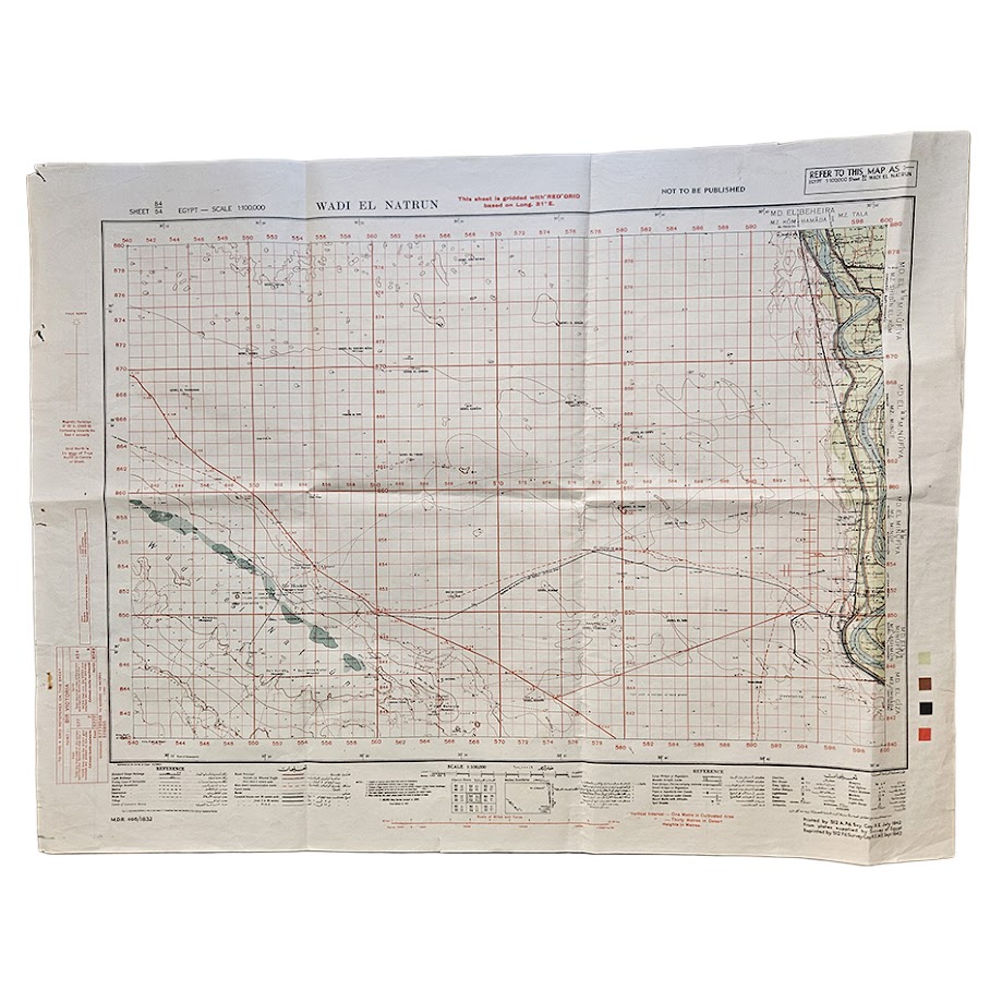
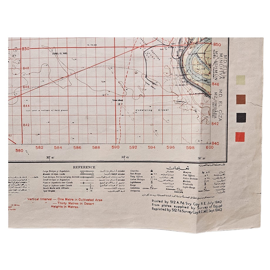
Description: A particularly unusual original Second World War military map of Wadi el Natrun and the western approaches to the Nile Delta, printed in Egypt by 512 Army Field Survey Company, Royal Engineers, in 1942 and, remarkably, printed on the reverse of a cancelled German military map of Sidi Barrani. The British-facing sheet is titled Wadi el Natrun, Egypt Sheet 84/54, at a scale of 1:100,000, and is prominently marked “NOT TO BE PUBLISHED”. The map was printed by 512 A. Fd. Svy. Coy., R.E. in July 1942, from plates supplied by the Survey of Egypt, and the present state was reprinted by 512 Field Survey Company, Royal Engineers, in September 1942. Contemporary institutional records confirm that 512 Field Survey Company was reproducing Survey of Egypt 1:100,000 mapping of Wadi el Natrun during 1942; the Australian War Memorial, for example, holds the adjoining Wadi el Natrun north-west sheet reproduced by the same unit in June 1942.
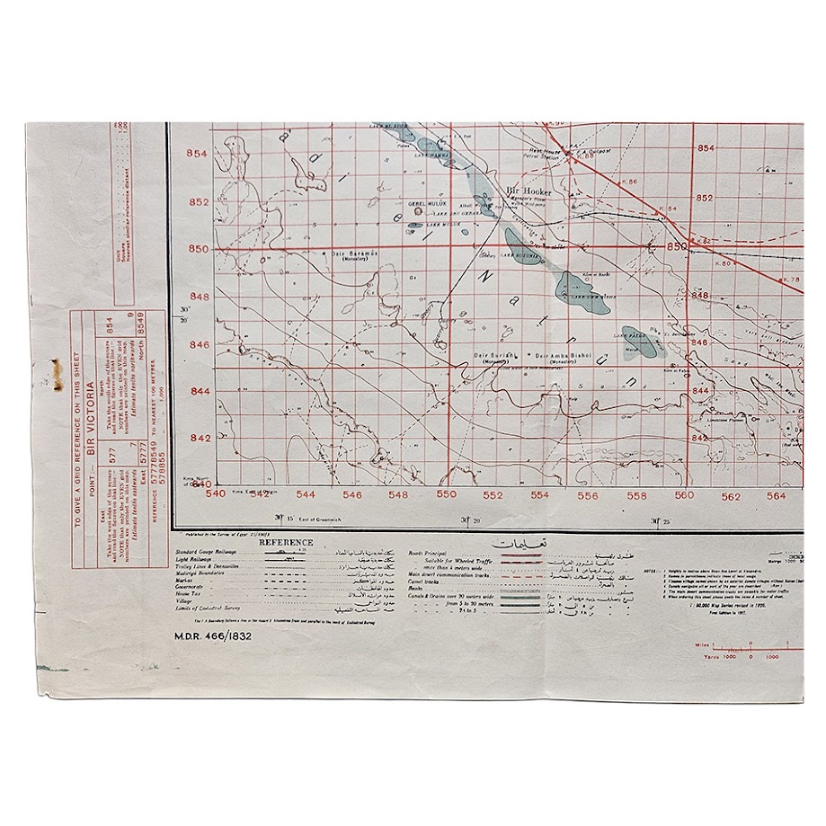
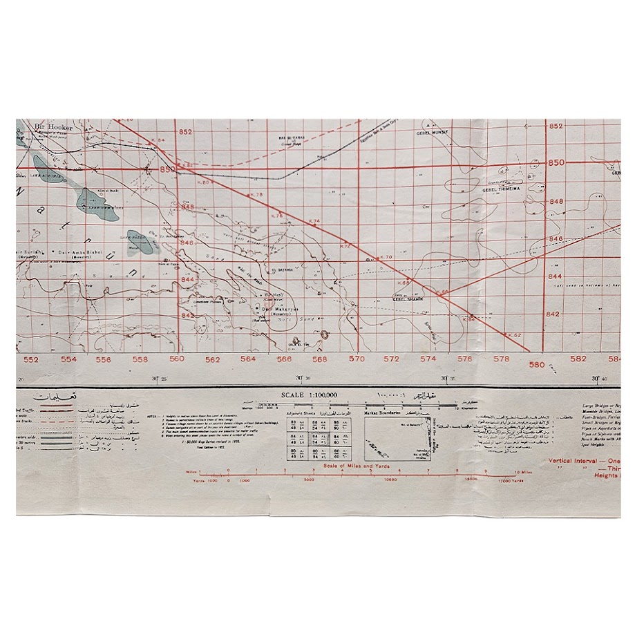
The sheet covers a strategically important area west of the Nile, extending from the Wadi el Natrun depression and its chain of lakes eastwards towards the cultivated Nile Valley, with Bir Hooker and numerous wells, desert tracks, roads, cultivation limits, railways and communications carefully recorded. A conspicuous red military grid has been superimposed across the sheet, and the map itself explains that it is gridded with a “RED GRID based on Long. 31° E.” The extensive bilingual English and Arabic reference key distinguishes roads, tracks, railways, canals, wells, cultivated areas, villages, police stations, hospitals and other features useful for military movement and orientation. The University of Texas Perry-Castañeda Map Collection preserves a later U.S. Army Map Service version of Wadi El Natrun Sheet 84/54, demonstrating the continuing military importance of the same 1:100,000 sheet within Allied mapping programmes.
The date is particularly significant. September 1942 places the production of this map immediately before the decisive Second Battle of El Alamein, at a moment when Axis forces under Rommel had advanced deep into Egypt and the defence of the Nile Delta and Cairo was of critical Allied concern. Wadi el Natrun lies west of the Delta on one of the natural corridors between the Western Desert and the Nile Valley. Although no claim is made that this particular surviving sheet was carried operationally, its production by a field survey company in Egypt at precisely this point in the Western Desert Campaign gives it a compelling contemporary military context.
What makes this example especially remarkable is its verso. Rather than unused paper, the British map has been printed on the back of an existing German military map titled Sidi Barrani, also at 1:100,000 scale. The German map is marked “Nur für den Dienstgebrauch!” — “For official/service use only” — and has subsequently been repeatedly overprinted “CANCELLED” across its surface. It includes Sidi Barrani and the Mediterranean coast together with detailed lists of wells and cisterns, water-capacity information and other data of obvious military relevance in the Western Desert. Sidi Barrani itself had been occupied by the Italian Tenth Army in 1940 and became the scene of the opening major action of Operation Compass, when British and Commonwealth forces recaptured the area in December 1940.
The reuse of an obsolete or captured military map as printing stock is entirely consistent with documented wartime practice. Paper shortages led military and government mapmakers to print new mapping on the reverse of superseded sheets, and institutional collections preserve other examples of wartime maps produced in this way. Leiden University specifically documents the wartime reuse of old topographic maps because of paper scarcity, while surviving British military examples are also known printed on the backs of cancelled earlier maps. The precise chain by which this German Sidi Barrani sheet entered British hands cannot be established from the map itself, however, so it would be inappropriate to state categorically that it was battlefield-captured.
The result is an unusually evocative double-sided document of the North African Campaign: on one side, a British Royal Engineers map of the approaches to the Nile Delta produced during the crisis of 1942; on the other, a cancelled German military survey of Sidi Barrani, one of the principal locations of the earlier Western Desert fighting.
Condition: Good to very good condition for a large working military map of this type. Original folding throughout with general handling, creasing, marginal marking and some edge wear. There are several small holes and short tears towards the left margin and localised fold wear, together with minor staining and age-toning. The British map remains complete and strongly legible, with the red grid, green-blue water features and principal cartographic detail clear. The cancelled German map on the reverse also remains substantially complete and legible. The condition is entirely consistent with contemporary military handling and subsequent storage. Please study the photographs carefully, as they form an important part of the description.
Title: Wadi el Natrun
Country: Egypt
Sheet: 84/54
Scale: 1:100,000
British production: 512 Army Field Survey Company, Royal Engineers
Initial printing: July 1942
Reprint: September 1942
Source: Survey of Egypt plates
Security marking: “NOT TO BE PUBLISHED”
Grid: Red military grid based on Longitude 31° E
Verso: Cancelled German military map of Sidi Barrani, 1:100,000, marked “Nur für den Dienstgebrauch!”
Sheet size: 55.7 × 73.6 cm
Reference: M.D.R. 466/1832
Every map offered by Hornseys is handled, inspected and catalogued individually in-house, with the edition, printing, military markings, cartographic content and condition assessed directly from the original sheet wherever possible.
SHOP WITH CONFIDENCE AT HORNSEYS
At Hornseys, we are dedicated to offering items that uphold the highest standards of quality and authenticity. Our collection of artwork is carefully curated to ensure that each item we offer is authentic, collated, and complete.
Here’s what sets us apart:
- Authenticity and Provenance: Each map is researched and verified for authenticity.
- Expert Curation: We wholly own all our artworks. We trust our taste and have invested heavily in it. We have confidence in all artwork that we offer for sale.
- Customer Satisfaction: We strive to provide an exceptional customer experience, from detailed descriptions and provenance to secure and prompt delivery of your purchase.
- Returns Policy: We offer an unconditional guarantee on every item. If, however, you wish to make a return, artworks may be sent back to us within fourteen days of receipt for whatever reason. We request that we are notified in advance if you wish to do so. They must be returned to us in the same condition as they were sent for a full refund.
OUR COMMITMENT TO QUALITY AND SERVICE
Understanding the value and rarity of these items, we ensure that every aspect of your purchase meets the highest standards of quality and service. This includes:
- Free Expedited, Tracked, and Insured Delivery within the UK: Ensuring that your artwork arrives safely and promptly.
- Fully-Insured Worldwide Delivery: Offering peace of mind for international collectors with reliable and secure shipping options.
EXPLORE OUR COLLECTION
Visit Hornseys today to explore our fine collection of maps and other artworks. Whether you are an avid collector or looking for a special gift, our selection offers something truly unique. Located since 1976 in Ripon in the picturesque Yorkshire Dales, we are recognized as a destination gallery for tastefully curated artwork, rare maps, design, and fine books.