Aleppo (Alep), Syria — British Royal Engineers Wartime Town Plan — 1:10,000 — 1943
Description:
Title: Alep
Reference Title: 1:10,000 Town Plan Alep
Original French Edition: July 1941
British Military Reproduction: November 1943
Publisher / Printer: 17 Map Reproduction Section, Royal Engineers
Original Cartography: Annexe de l’Institut Géographique National au Levant
Reference: M.D.R. 1513/3909
Scale: 1:10,000
Sheet Size: 63 × 62.7 cm
Date: 1943
Catalogue Number: 004174
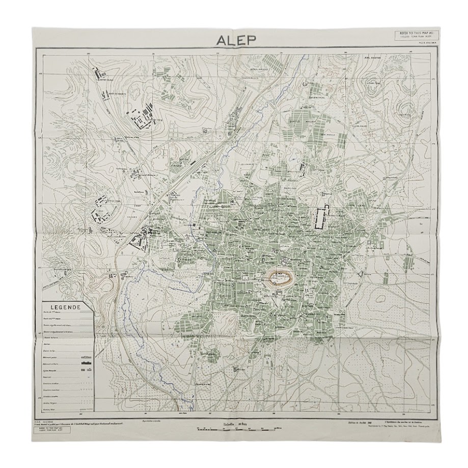
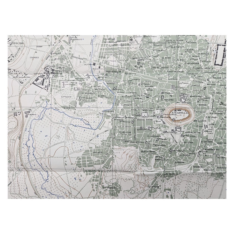
An exceptionally detailed Second World War military town plan of Aleppo, printed in November 1943 by 17 Map Reproduction Section, Royal Engineers, from French pulls of the July 1941 edition prepared by the Annexe de l’Institut Géographique National au Levant. At the unusually large urban scale of 1:10,000, the map provides a remarkably precise wartime record of Aleppo — one of the great historic cities of the Levant — showing its ancient centre, citadel, modern suburbs, communications infrastructure and surrounding terrain during a critical period in the history of Syria and the Middle East.
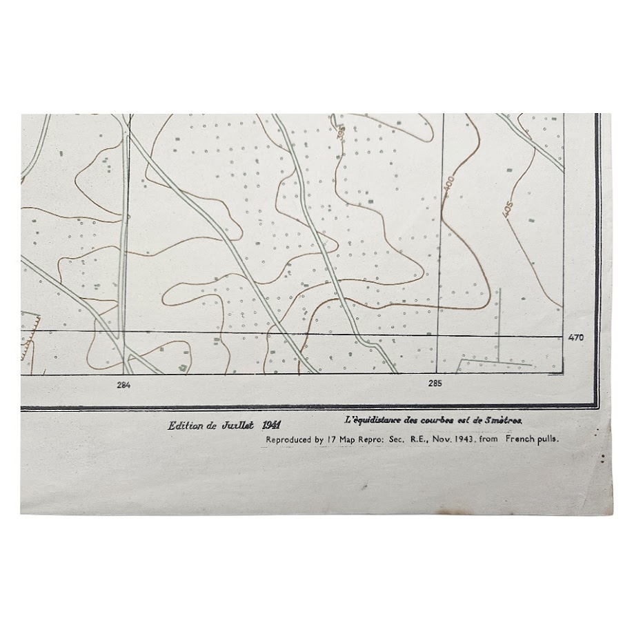
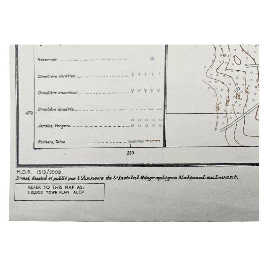
The lower margin identifies the underlying cartography as “Edition de Juillet 1941” and records: “Reproduced by 17 Map Repro: Sec. R.E., Nov. 1943, from French pulls.” The British military reference M.D.R. 1513/3909 appears at lower left, together with the boxed instruction “REFER TO THIS MAP AS: 1:10,000 TOWN PLAN ALEP.” These details identify the sheet as a wartime Royal Engineers reproduction intended for official military use rather than a conventional civilian street plan.
Its 1943 date gives the map considerable historical context. Syria had been under the French Mandate until the Second World War and, following the Syria–Lebanon campaign of June–July 1941, came under Free French authority in association with the Allied presence in the region. Aleppo, situated close to the Turkish frontier and commanding important routes between northern Syria, Anatolia, Mesopotamia and the Mediterranean, was an important communications and administrative centre. Detailed large-scale town plans of this kind were essential military reference tools for movement, logistics, communications, orientation and the identification of strategically useful urban and transport features.
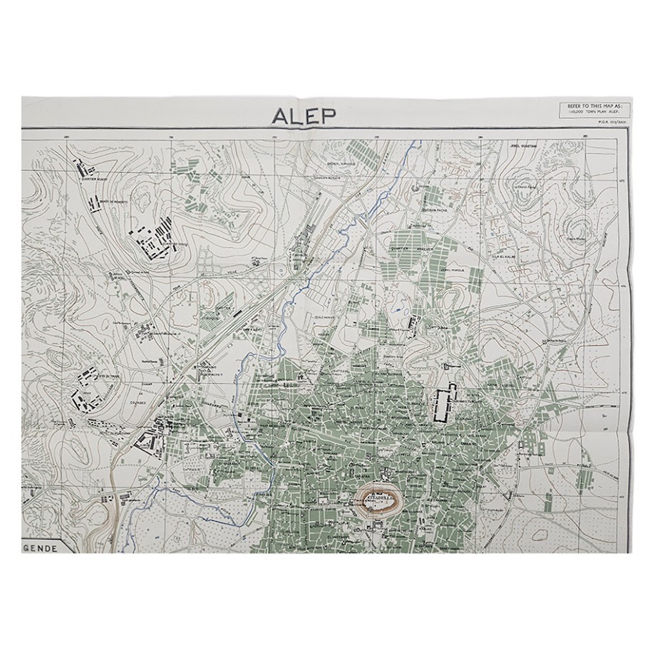
The map is exceptionally rich in topographical and urban information. The dense historic city is represented in green and centred on the unmistakable Citadel of Aleppo, shown prominently on its elevated mound and surrounded by the intricate network of streets, quarters and built-up areas of the old city. Individual districts and neighbourhoods are named throughout, while mosques, churches and other public or religious buildings are identified within the urban fabric.
Beyond the historic centre, the map records the dramatic expansion of Aleppo during the late Ottoman and French Mandate periods. Broad modern roads, planned suburbs, dispersed villas, gardens, institutional complexes and less densely developed peripheral districts contrast sharply with the compact medieval street pattern. This makes the sheet important not only as wartime cartography but also as a detailed document of Aleppo’s twentieth-century urban morphology immediately before the major post-war expansion of the city.
Transport infrastructure is especially clearly represented. The extensive railway installations and sidings to the west and north-west of the city are mapped in considerable detail, together with stations, roads, bridges and connecting routes. Large institutional and military-looking complexes occupy parts of the western outskirts, while the surrounding countryside is carefully rendered with tracks, cultivated areas and relief. The accuracy of this infrastructure would have made the plan particularly useful to Allied forces operating in the Levant.
Topography is expressed by five-metre contour intervals, giving an unusually clear representation of the hills and undulating ground surrounding Aleppo. Watercourses are picked out in blue, roads and other communications are differentiated by type, while green printing distinguishes gardens, orchards and extensive cultivated areas. The French-language legend identifies roads of first and second class, maintained and unmaintained tracks, paths, railways, public and military buildings, churches and mosques, reservoirs, Christian, Muslim and Jewish cemeteries, gardens and orchards, rocks and embankments. The result is a sophisticated combination of street plan, topographical survey and military reference map.
Particularly prominent is the Citadel of Aleppo, one of the defining monuments of the city and one of the most important fortified sites in the Middle East. The map captures the relationship between the citadel, the densely built old city, the souks and the newer quarters with unusual clarity. Given the extensive destruction and alteration suffered by Aleppo in the twenty-first century, detailed historical town plans such as this now have additional value as records of the pre-modern and pre-war urban landscape.
The cartographic ancestry of the sheet is also significant. French surveyors produced increasingly sophisticated maps of Aleppo during the Mandate period, including cadastral and large-scale urban surveys during the 1920s and 1930s. Modern scholarship on the history of Middle Eastern urban morphology specifically notes the importance of the French cadastral mapping of Aleppo and the 1:10,000 plans produced before the Second World War. The present sheet represents the subsequent British military utilisation of that French cartographic intelligence, reproduced by the Royal Engineers for Allied use in November 1943.
Institutional Rarity
The exact November 1943, 1:10,000 Royal Engineers issue, M.D.R. 1513/3909, appears to be institutionally scarce.
Extensive searches of accessible institutional catalogues have located related Aleppo military mapping but have not revealed another clearly catalogued example of this precise issue. The British Library, for example, records a 1941 Alep sheet at 1:50,000, G.S.G.S. 4195, itself derived from French Levant mapping, demonstrating substantial War Office mapping activity in the area, but this is a different scale, series and edition from the present 1:10,000 town plan.
The Royal Scottish Geographical Society / University of Edinburgh catalogue records holdings under “Town plans of Syria and Lebanon”, confirming institutional preservation of British military town-plan mapping for the region, although the accessible catalogue information does not identify this precise 1943 Aleppo state. Digitised map collections likewise contain an earlier 1941 German 1:10,000 Stadtplan von Aleppo, but again this is a separate wartime production.
Commercial evidence for British wartime mapping of Aleppo is also thin.
Accordingly, the safest bibliographical description is scarce, with the exact 1943 Royal Engineers 1:10,000 issue poorly represented in readily accessible institutional and commercial records. We have not found evidence sufficient to claim uniqueness, but the combination of large scale, wartime Royal Engineers reproduction, specific M.D.R. number and survival as a complete sheet makes this a distinctly uncommon example of Allied urban intelligence mapping of Aleppo.
Condition: Very good plus to near fine overall. Folded, with the expected original fold lines and minor handling and age-related marks. A little light marginal wear and occasional minor spotting are present, but the sheet remains complete and the printed surface is exceptionally clear. Colours remain strong, with the green built-up areas and vegetation, blue waterways and brown contours all retaining excellent definition. Please refer to the photographs, which form part of the description.
A significant and unusually detailed piece of Second World War Middle Eastern military cartography, combining the history of Aleppo, French Mandate surveying, Royal Engineers map reproduction, Allied operations in the Levant and the urban development of one of the Middle East’s most historically important cities.
Location: Map Drawer D. Sleeve Military A. 004174.
SHOP WITH CONFIDENCE AT HORNSEYS
At Hornseys, we are dedicated to offering items that uphold the highest standards of quality and authenticity. Our collection of artwork is carefully curated to ensure that each item we offer is authentic, collated, and complete.
Here’s what sets us apart:
- Authenticity and Provenance: Each map is researched and verified for authenticity.
- Expert Curation: We wholly own all our artworks. We trust our taste and have invested heavily in it. We have confidence in all artwork that we offer for sale.
- Customer Satisfaction: We strive to provide an exceptional customer experience, from detailed descriptions and provenance to secure and prompt delivery of your purchase.
- Returns Policy: We offer an unconditional guarantee on every item. If, however, you wish to make a return, artworks may be sent back to us within fourteen days of receipt for whatever reason. We request that we are notified in advance if you wish to do so. They must be returned to us in the same condition as they were sent for a full refund.
OUR COMMITMENT TO QUALITY AND SERVICE
Understanding the value and rarity of these items, we ensure that every aspect of your purchase meets the highest standards of quality and service. This includes:
- Free Expedited, Tracked, and Insured Delivery within the UK: Ensuring that your artwork arrives safely and promptly.
- Fully-Insured Worldwide Delivery: Offering peace of mind for international collectors with reliable and secure shipping options.
EXPLORE OUR COLLECTION
Visit Hornseys today to explore our fine collection of maps and other artworks. Whether you are an avid collector or looking for a special gift, our selection offers something truly unique. Located since 1976 in Ripon in the picturesque Yorkshire Dales, we are recognized as a destination gallery for tastefully curated artwork, rare maps, design, and fine books.