Sinop, Turkey – British War Office World 1:1,000,000 Map, Sheet NK-36, 1959
Description:
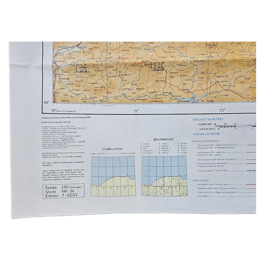
An original British military topographical map of Sinop and the central Black Sea region of northern Turkey, issued as Sheet NK-36 in Series 1301 (G.S.G.S. 4646), World 1:1,000,000, Seventh G.S.G.S. Edition. Compiled by No. 1 Survey Production Centre, Royal Engineers, the sheet was published by D. Survey, War Office and Air Ministry. The cartographic compilation was completed in 1957, the edition was formally issued in 1958, and the printing code identifies this example as a January 1959 impression.
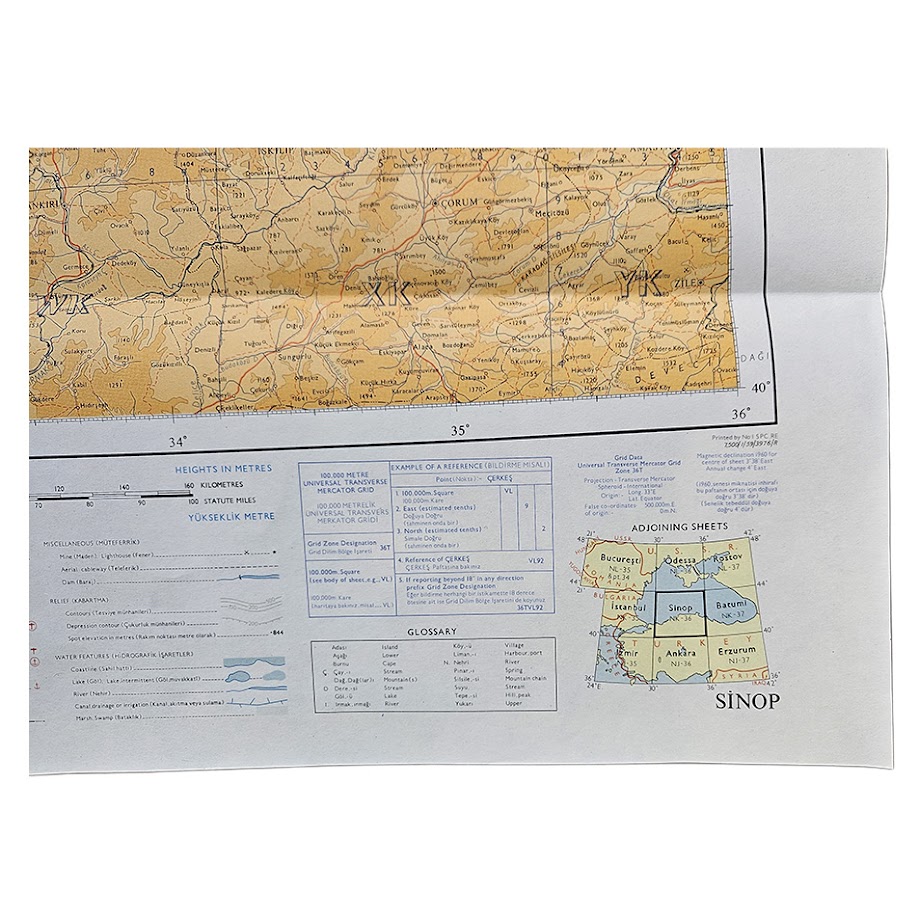
The map covers a broad section of northern Anatolia between approximately 30° and 36° east longitude and 40° and 44° north latitude, extending from the Black Sea coast southwards into the Turkish interior. The prominent Sinop peninsula and harbour occupy the north-central section of the sheet, with Kastamonu, Çankırı, Çorum, Amasya and the surrounding districts represented in considerable detail.
Roads, railways, settlements, rivers, coastlines and administrative boundaries are clearly shown. Relief is expressed through layered altitude tints, contours and spot heights, producing a particularly attractive ochre and brown treatment across the mountainous interior, contrasted with the pale blue of the Black Sea.
The map formed part of the British Series 1301 / G.S.G.S. 4646 World 1:1,000,000 mapping programme, a military continuation of the International Map of the World framework. It uses a Modified Polyconic projection and carries the Universal Transverse Mercator grid, Zone 36T.
The lower margin retains the extensive technical information characteristic of post-war British military cartography, including compilation and reliability diagrams, boundary information, adjoining-sheet index, glossary, kilometre and statute-mile scales, UTM reference instructions and conventional signs.
A substantial and visually attractive Cold War-era British military map of northern Turkey and the Black Sea littoral, notable for its detailed topographical information and complete original marginal apparatus.
Condition
Very good. Original horizontal and vertical folding creases from issue and storage, with minor handling and slight marginal wear consistent with age. The printed surface remains clean and bright, with strong colour and excellent legibility. No significant loss noted.
Publisher: D. Survey, War Office and Air Ministry
Compiler: No. 1 Survey Production Centre, Royal Engineers
Series: Series 1301 (G.S.G.S. 4646), World 1:1,000,000
Sheet: NK-36 – Sinop
Edition: Seventh G.S.G.S. Edition
Compilation Date: 1957
Publication Date: 1958
Printing Date: January 1959
Scale: 1:1,000,000
Projection: Modified Polyconic
Grid: Universal Transverse Mercator, Zone 36T
Size: 60.2 × 59.7 cm
Language: English, with Turkish place-names
Format: Colour-printed military map
Location: Tube A: Asia
SHOP WITH CONFIDENCE AT HORNSEYS
At Hornseys, we are dedicated to offering items that uphold the highest standards of quality and authenticity. Our collection of artwork is carefully curated to ensure that each item we offer is authentic, collated, and complete.
Here’s what sets us apart:
- Authenticity and Provenance: Each map is researched and verified for authenticity.
- Expert Curation: We wholly own all our artworks. We trust our taste and have invested heavily in it. We have confidence in all artwork that we offer for sale.
- Customer Satisfaction: We strive to provide an exceptional customer experience, from detailed descriptions and provenance to secure and prompt delivery of your purchase.
- Returns Policy: We offer an unconditional guarantee on every item. If, however, you wish to make a return, artworks may be sent back to us within fourteen days of receipt for whatever reason. We request that we are notified in advance if you wish to do so. They must be returned to us in the same condition as they were sent for a full refund.
OUR COMMITMENT TO QUALITY AND SERVICE
Understanding the value and rarity of these items, we ensure that every aspect of your purchase meets the highest standards of quality and service. This includes:
- Free Expedited, Tracked, and Insured Delivery within the UK: Ensuring that your artwork arrives safely and promptly.
- Fully-Insured Worldwide Delivery: Offering peace of mind for international collectors with reliable and secure shipping options.
EXPLORE OUR COLLECTION
Visit Hornseys today to explore our fine collection of maps and other artworks. Whether you are an avid collector or looking for a special gift, our selection offers something truly unique. Located since 1976 in Ripon in the picturesque Yorkshire Dales, we are recognized as a destination gallery for tastefully curated artwork, rare maps, design, and fine books.