Sofiya–İstanbul (Sofia–Constantinople) – British War Office Army/Air Map, G.S.G.S. 2758, 1946
Description:
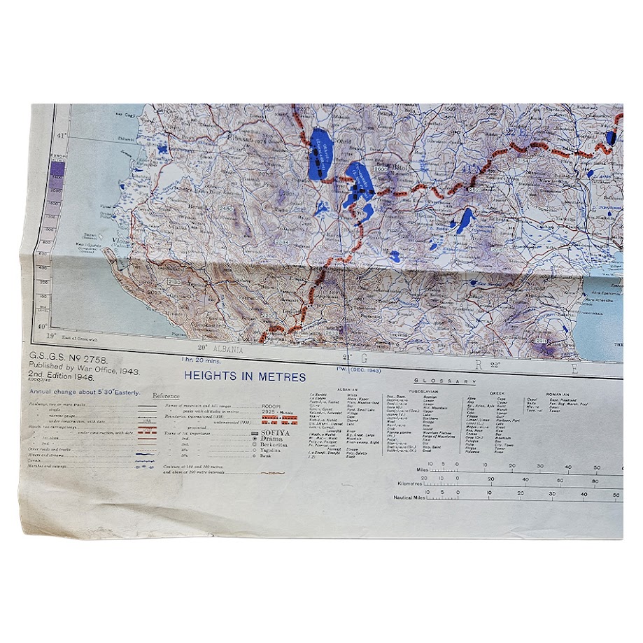
An original British War Office military and air-navigation map of Sofia, Istanbul, the southern Balkans, Thrace and the Sea of Marmara, issued as North K.35 and part of K.34 in the Europe 1:1,000,000 series, G.S.G.S. 2758. This is the Second Edition, Army/Air Style, revised and photolithographed by the Ordnance Survey in 1946.
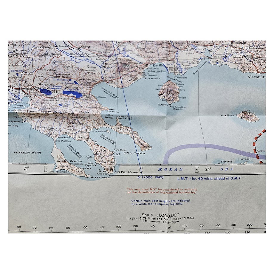
The map covers an extensive and strategically important region extending from Sofia and southern Bulgaria across Macedonia and Thrace to Istanbul, with parts of northern Greece, Albania, Yugoslavia, Romania and north-western Turkey also represented. The Black Sea, Sea of Marmara, Bosporus, Dardanelles and northern Aegean form a particularly prominent part of the sheet, placing the map at the geographical junction between Europe and Asia.
Istanbul is shown under the dual designation İstanbul (Constantinople), while Sofia is similarly given as Sofiya (Sofia). Other important centres and regions include Edirne, Tekirdağ, Gallipoli, Thessaloniki, Plovdiv, Burgas and the surrounding Balkan and Turkish territories. Roads, railways, settlements, rivers, lakes, ports, administrative boundaries and relief are represented in considerable detail.
The Army/Air treatment was specifically designed to increase the map’s usefulness for military aviation and strategic planning. Routes and communications are strongly emphasised, water features are clearly printed in blue and selected relief information is picked out for rapid interpretation. The lower margin retains the original height scales, distance scales, positional-reference instructions, adjoining-sheet diagram and extensive multilingual glossary covering Albanian, Bulgarian, Greek, Romanian, Turkish and Yugoslav geographical terms.
A particularly interesting feature is the prominent depiction across the Sea of Marmara of the “European Layer System” and “Asiatic Layer System”, reflecting the joining of separately derived European and Asian cartographic frameworks at Istanbul. This provides an unusually visible reminder of the way British military mapping systems were assembled across the boundary between two major geographical survey traditions.
The map belongs to the long-established G.S.G.S. 2758 Europe 1:1,000,000 series, one of the principal small-scale British military mapping programmes used during the Second World War and its immediate aftermath. Earlier wartime states of the Sofia–Istanbul sheet were produced during the conflict; the present 1946 Second Edition incorporates subsequent revision by the Ordnance Survey.
Its subject is especially strong. The Bosporus and Dardanelles were among the most strategically important waterways in Europe, controlling maritime access between the Black Sea and Mediterranean. The sheet therefore brings together the Balkans, Turkey, Istanbul and the Turkish Straits within a single large-format military map produced at the beginning of the post-war period.
A substantial and visually impressive British military map of south-eastern Europe and north-western Turkey, particularly relevant to the history of military cartography, aviation, the Balkans, Istanbul and the strategically important Turkish Straits.
Condition
Very good. Original issue folds with general handling and creasing, particularly along the principal horizontal folds, together with minor marginal wear and small edge irregularities consistent with use and storage. The cartographic field remains complete and highly legible, with strong original colour and no significant loss.
Title: Sofiya–İstanbul (Sofia–Constantinople)
Publisher: War Office
Series: Europe 1:1,000,000 – G.S.G.S. 2758
Sheet: North K.35 and part of K.34
Edition: Second Edition, Army/Air Style
Date: 1946
Revision: Revised and photolithographed by Ordnance Survey, 1946
Scale: 1:1,000,000
Size: 62.9 × 98.5 cm
Format: Colour-printed military and air-navigation map
Location: Tube D: Europe
Inventory Number: 004116
SHOP WITH CONFIDENCE AT HORNSEYS
At Hornseys, we are dedicated to offering items that uphold the highest standards of quality and authenticity. Our collection of artwork is carefully curated to ensure that each item we offer is authentic, collated, and complete.
Here’s what sets us apart:
- Authenticity and Provenance: Each map is researched and verified for authenticity.
- Expert Curation: We wholly own all our artworks. We trust our taste and have invested heavily in it. We have confidence in all artwork that we offer for sale.
- Customer Satisfaction: We strive to provide an exceptional customer experience, from detailed descriptions and provenance to secure and prompt delivery of your purchase.
- Returns Policy: We offer an unconditional guarantee on every item. If, however, you wish to make a return, artworks may be sent back to us within fourteen days of receipt for whatever reason. We request that we are notified in advance if you wish to do so. They must be returned to us in the same condition as they were sent for a full refund.
OUR COMMITMENT TO QUALITY AND SERVICE
Understanding the value and rarity of these items, we ensure that every aspect of your purchase meets the highest standards of quality and service. This includes:
- Free Expedited, Tracked, and Insured Delivery within the UK: Ensuring that your artwork arrives safely and promptly.
- Fully-Insured Worldwide Delivery: Offering peace of mind for international collectors with reliable and secure shipping options.
EXPLORE OUR COLLECTION
Visit Hornseys today to explore our fine collection of maps and other artworks. Whether you are an avid collector or looking for a special gift, our selection offers something truly unique. Located since 1976 in Ripon in the picturesque Yorkshire Dales, we are recognized as a destination gallery for tastefully curated artwork, rare maps, design, and fine books.