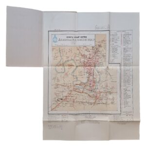
Tobruch [Tobruk] — Manuscript Anti-Aircraft Defence Map with Gunner’s AA Range & Height Calculating Chart — c. November–December 1942
Description:
Date: c. November–December 1942
Map Scale: 1:25,000
Map Size: 70.9 × 78.8 cm
Calculating Chart Size: 37 × 36 cm
Source Map: Enlarged from Cyrenaica 1:50,000 Series, Sheet 19 S.E., Tobruch
Medium: Manuscript map in coloured inks and pencil on prepared translucent tracing cloth; companion printed anti-aircraft calculating chart in white on blue
Subject: Tobruk, Libya — Allied Anti-Aircraft and Searchlight Defence
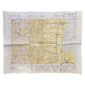
An exceptional Second World War Tobruk anti-aircraft archive comprising two closely associated operational pieces from the same provenance: a large manuscript 1:25,000 anti-aircraft defence map of Tobruk, measuring 70.9 × 78.8 cm, together with a 37 × 36 cm anti-aircraft range and height calculating chart dated XI.42 [November 1942] and inscribed to a Gunner Bowen. Their shared provenance, specialist anti-aircraft purpose and exceptionally close dating place the two pieces firmly within the context of the Allied reoccupation and reorganisation of Tobruk’s air defences following the Eighth Army’s westward advance after El Alamein.
The principal item is a hand-drawn operational map headed “TOBRUCH”, produced on a thin translucent woven support consistent with prepared military tracing cloth. It is explicitly inscribed “ENLARGED FROM CYRENAICA 1:50,000 SERIES 19 S.E.”, identifying its cartographic source. The underlying sheet can be securely associated with Cyrenaica 1:50,000 Series, Sheet 19 S.E., Tobruch, compiled and reproduced by 514 Field Survey Company, Royal Engineers, in June 1942. The present manuscript version doubles the scale to 1:25,000, allowing individual defensive positions around the port and its approaches to be plotted much more precisely.
The map is deliberately selective in its topography and unmistakably concerned with anti-aircraft defence. The coastline and harbour approaches are delineated in blue, important roads in brown, and the sheet is covered by a numbered military grid together with numerous coloured tactical symbols. Its surviving manuscript key identifies “HY. A.A. SITE”, “LT. A.A. SITE”, “SEARCHLIGHT SITE” and a further controlled-searchlight category, documenting the dispositions of heavy anti-aircraft, light anti-aircraft and searchlight defences around Tobruk.
The interpretation and probable dating of the sheet are substantially strengthened by another manuscript map from the same original source, known from photographs although not now present with the group. That map is explicitly dated 3 December 1942, prominently marked “SECRET”, and shows the Tobruk anti-aircraft defence scheme at 1:50,000. Its detailed manuscript key identifies 4 × 3-inch heavy anti-aircraft positions, 4 × 3.7-inch HAA positions with G.L. gun-laying radar, 40 mm light anti-aircraft sites, searchlight and controlled-searchlight positions, inner and outer barrage boundaries, and barrage balloons operating at 2,000 feet by day and night. The same military grid, closely corresponding coastline and roads, related tactical symbols and identical operational subject provide persuasive evidence that the present larger-scale 1:25,000 sheet was a companion, derivative or detailed working enlargement used within the same late-1942 Tobruk air-defence planning environment.
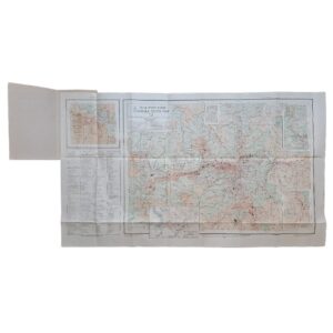
The accompanying 37 × 36 cm blue calculating chart gives the archive an additional technical and personal dimension. Printed in white on blue, it consists of a large circular graduated arrangement combining height, range and angular degrees, with instructions including “SET TO RANGE”. Such a device was intended to assist anti-aircraft personnel in relating the observed angular position of an aircraft to its height and range. Importantly, it is dated in manuscript XI.42, placing it in November 1942, precisely when Allied forces had recaptured Tobruk and were reorganising the port’s defences.
At the lower left the chart bears a faint contemporary ownership inscription which reads “J. H. Bowen, Gnr” or very similar. “Gnr” is the standard abbreviation for Gunner, the Royal Artillery equivalent of private. The identity of Bowen has not yet been conclusively established, and it would therefore be inappropriate to assign him to a particular battery or regiment without further documentary evidence. Nevertheless, the presence of a named gunner on a specialist anti-aircraft calculating device, preserved from the same source as the Tobruk defence map, considerably strengthens the archive’s field-use character.
The historical setting is particularly significant. Following the Allied victory at the Second Battle of El Alamein, Axis forces withdrew westwards and Tobruk was recovered by the Allies in November 1942. Its harbour, airfields and communications made the town once again strategically important, requiring the rapid establishment of substantial anti-aircraft defences. 17 Anti-Aircraft Brigade advanced into Libya as part of this process and was subsequently recorded at Tobruk. Among its heavy anti-aircraft elements was 87 Heavy Anti-Aircraft Regiment, Royal Artillery, comprising 278, 279 and 280 HAA Batteries and operating 24 3.7-inch anti-aircraft guns. The six four-gun 3.7-inch/G.L. positions identifiable on the related SECRET map would account precisely for such a 24-gun deployment. This provides compelling context for the present archive, although neither surviving piece itself carries a unit inscription permitting an absolute attribution to 17 AA Brigade or 87 HAA Regiment.
An especially intriguing feature of the 1:25,000 map is the pencilled word “Queenie”, written beside one of the plotted positions. No definitive documentary identification of a Tobruk site called Queenie has yet been located. Its position and informal character suggest that it may have been a local site-name, nickname, call-sign or other unit-level designation. Together with the named Gunner Bowen chart, it provides tantalising evidence of the human layer behind what would otherwise be purely technical operational cartography.
Rarity and Institutional Context
The precise 1:25,000 manuscript Tobruk anti-aircraft map has not been traced in another institutional or commercial example. Institutional collections preserve printed examples of the underlying Cyrenaica sheet and other manuscript or overprinted Tobruk defence maps, establishing the wider cartographic context, but none so far identified duplicates this particular larger-scale manuscript plotting sheet.
The November 1942 range/height chart is itself an unusual ephemeral survival. Such practical artillery aids were produced to be used rather than preserved and, when encountered separately, often lack any meaningful provenance. Here its exact November 1942 dating, named gunner and preservation with the Tobruk manuscript map significantly increase its historical value.
As a pair, the pieces should therefore be regarded as an apparently very rare associated survival of late-1942 British anti-aircraft operational material, and potentially unique in this particular combination, while stopping short of claiming demonstrable uniqueness.
Condition: Very good overall. Both pieces display convincing evidence of wartime handling and use. The 70.9 × 78.8 cm Tobruk map has been repeatedly folded and shows scattered spotting, surface dirt, creasing, marginal wear and weakness at some fold intersections. There is a small burn hole with minor localised loss, together with other minor areas of fold wear, but the sheet remains substantially complete and the important manuscript tactical information is readily legible. The 37 × 36 cm calculating chart has also been folded and displays handling creases, minor edge wear and general signs of use, but remains substantially complete, legible and visually striking. Please examine the photographs carefully as they form part of the description.
A remarkable associated pair of British Second World War anti-aircraft documents from the Tobruk theatre, combining large-scale manuscript operational cartography, the technical apparatus of anti-aircraft gunnery, personal wartime ownership and compelling evidence for the rapid reconstruction of Tobruk’s air defences in the immediate aftermath of its Allied recapture in November 1942.
Location: Map Drawer D. Sleeve Military A. 004175.
SHOP WITH CONFIDENCE AT HORNSEYS
At Hornseys, we are dedicated to offering items that uphold the highest standards of quality and authenticity. Our collection of artwork is carefully curated to ensure that each item we offer is authentic, collated, and complete.
Here’s what sets us apart:
- Authenticity and Provenance: Each map is researched and verified for authenticity.
- Expert Curation: We wholly own all our artworks. We trust our taste and have invested heavily in it. We have confidence in all artwork that we offer for sale.
- Customer Satisfaction: We strive to provide an exceptional customer experience, from detailed descriptions and provenance to secure and prompt delivery of your purchase.
- Returns Policy: We offer an unconditional guarantee on every item. If, however, you wish to make a return, artworks may be sent back to us within fourteen days of receipt for whatever reason. We request that we are notified in advance if you wish to do so. They must be returned to us in the same condition as they were sent for a full refund.
OUR COMMITMENT TO QUALITY AND SERVICE
Understanding the value and rarity of these items, we ensure that every aspect of your purchase meets the highest standards of quality and service. This includes:
- Free Expedited, Tracked, and Insured Delivery within the UK: Ensuring that your artwork arrives safely and promptly.
- Fully-Insured Worldwide Delivery: Offering peace of mind for international collectors with reliable and secure shipping options.
EXPLORE OUR COLLECTION
Visit Hornseys today to explore our fine collection of maps and other artworks. Whether you are an avid collector or looking for a special gift, our selection offers something truly unique. Located since 1976 in Ripon in the picturesque Yorkshire Dales, we are recognized as a destination gallery for tastefully curated artwork, rare maps, design, and fine books.