-

-

-

-

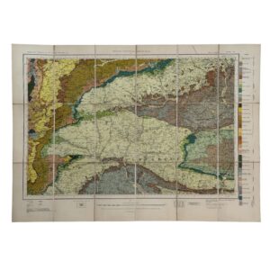
Sheet 61 – Potchefstroom – Union Of South Africa Department Of Mines And Industries – Geological Survey
£125.00Mellor, E. T. Nel, Louis T, Truter, F. C & Willemse, J
-

-

-

Geological Map Of The People’s Republic Of China – Presentation Copy From Geologist Shihe Lei
£125.00Published in Beijing
-

CARTE OÙ SONT TRACÉES LES ROUTES DE M BRUCE DANS LES DEUX TENTATIVES QU’IL FIT POUR PARVENIR AUX SOURCES DU NIL
£125.00Benard & Bruce, James
-

NO 6 – CIRCUMJACENT THE SOUTH POLE
£125.00The Society For The Diffusion Of Useful Knowledge & J & C Walker
-

ROAD MAP OF THE CENTRAL PROVINCES & BERAR CORRECTED UP TO 31ST MARCH 1938
£125.00Offices Of The Chief Engineer P. W. D. C. P.
-

River Mersey From Rock Lighthouse To Eastham & Garston 1969 Corrected To June 1970
£125.00Colbeck, Captain W. R.
-

-

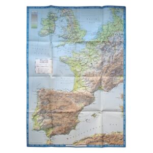
United Kingdom – L’Angleterre Divisee En 5 Grandes Parties Subdivisees En 52 Comtes
£125.00Brion De La Tour, Louis
-

(Italy) Les Environs De Rome Pour L’Intelligence De L’Historie Romaine De Rollin
£125.00D’Anville, Jean-Baptiste
-

-

-

-

-

-

-

-

-

BATAILLE DES DUNES PRÈS DE DUNQUERQUE GAGNÉE PAR L’ARMÉE DU ROI COMMANDÉE PAR LE VICOMTE DE TURENNE SUR L’ARMÉE D’ESPAGNE COMMANDÉE PAR DON JUAN D’AUTRICHE LE 14 JUIN 1658
£100.00De Chattillon, Louis & Cochin, Nicolas
-

ASIA – PLATE 4 – INCLUDING THE TURKISH DOMINIONS WITH MOST OF PERSIA REVISED AND EXAMINED BY MR BOLTON – ASIA – PLATE 5 – PART OF INDIA PERSIA TIBET AND TARTARY EXAMINED AND RECTIFIED BY MR BOLTON
£100.00D’Anville, Jean Baptiste Bourguignon, Searle, Richard William & Bolton, Solomon
-

-
-
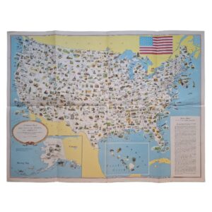
A PICTORIAL MAP OF THE UNITED STATES OF AMERICA – Showing Principal Regional Resources, Products, and Natural Features – c. 1958-1959
£95.00General Drafting Co., Inc.
-
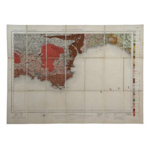
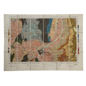
Geological Survey of England and Wales / Ordnance Survey – Sheet 22 – Dartmoor – 1908 – Folding Map
£95.00Geological Survey of England and Wales / Ordnance Survey
-
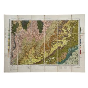
Geological Survey of England and Wales / Ordnance Survey – Sheet 15 – Warwick & Oxford – 1931 – Folding Map
£95.00Geological Survey of England and Wales / Ordnance Survey
-
Geological Survey of England and Wales / Ordnance Survey – Sheet 19 – Berkshire, Wiltshire & Hampshire – 1939 – Folding Map
£95.00Geological Survey of England and Wales / Ordnance Survey
-
Geological Survey of England and Wales / Ordnance Survey – Sheet 11 – Derby & Charnwood – 1937 – Folding Map
£95.00Geological Survey of England and Wales / Ordnance Survey
-
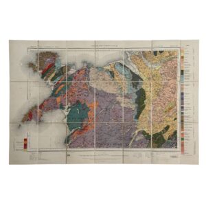
Geological Survey of England and Wales / Ordnance Survey – Sheets 9 & 10 – North Wales – 1930 – Folding Map
£95.00Geological Survey of England and Wales / Ordnance Survey