-

Africa Maps121 Products
-

Antarctic Maps6 Products
-
Asia Maps102 Products
-

Celestial Maps2 Products
-

Europe Maps121 Products
-

Folding Maps102 Products
-

Geological Maps69 Products
-
India Maps50 Products
-
London Maps17 Products
-
Middle East Maps36 Products
-

Military Maps6 Products
-

North America Maps21 Products
-

Oceania Maps25 Products
-

South America Maps23 Products
-

United Kingdom County Maps86 Products
-

World Maps10 Products
-
Yorkshire Maps11 Products
-

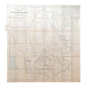
R.T.M. – Rio Tinto Mining Company Limited – General Plan Of Works – c.1874-1876
£15,000.00Rio Tinto Mining Company Limited
-
-

-
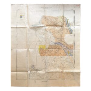
Iran – Persia – Qasr-i-Shirin Area. To Accompany Report M.H.L. 7 – Geological Map – 1929
£2,000.00Anglo-Persian Oil Company
-
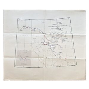
Iran – Map Showing Proposed Journey By Geological Advisory Committee Of Anglo-Iranian Oil Co. Ltd., Autumn 1936
£1,800.00Geological Advisory Committee (Iran)
-

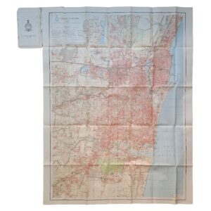
Karachi Guide Map – Season 1926-7 – Published Under The Direction Of Brigadier R H Thomas – Surveyor General Of India 1929
£1,750.00Thomas, Brigadier R. H.
-

-

Astronomie Populaire Ou Description Des Corps Célestes Avec Atlas En Tableaux Transparents
£1,250.00Librarie Kiessling & Cie & P. Imbreghts
-

This Trigonometrical Plan Of The Town And Port Of Liverpool Including The Environs Of Kirkdale Everton Low Hill & Toxteth Park From Actual Survey Is By Permission Most Respectfully Dedicated To The Worshipful Mayor And Common Council By Their Most Obedient And Obliged Humble Servant Michael Alexander Gage
£1,200.00Gage, Michael Alexander
-
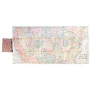
Rand McNally And Co’s New Railway Guide Map Of The United States And Canada – 1875
£995.00Rand McNally And Co
-
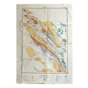
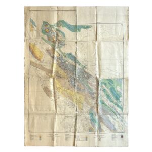
Persia. No. 9 H.E. 10.E – Geological Map Of South-West Iran Including The Masjid-I-Sulaiman And Haft Kel Oil Regions – 1929
£950.00Cornes, H & Anglo-Persian Oil Company (A.P.O.C.)
-
Persia. No. 9 H.E. 10.E – Geological Map Of South-West Iran Including The Masjid-I-Sulaiman And Haft Kel Oil Regions – 1929/35
£950.00Cornes, H & Anglo-Persian Oil Company (A.P.O.C.)
-

-

Peshawar Guide Map – Pakistan – Published Under The Direction Of Brigadier H J Couchman – Surveyor General Of India 1935
£950.00Couchman, Brigadier H. J.
-

-
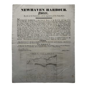
NEWHAVEN HARBOUR – NOTICE – By order of the Commissioners, with the Approbation of The Trinity House – 1814
£750.00Newhaven Harbour & The Commissioners, Trinity House
-

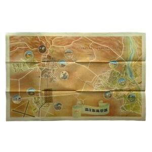
Iran – Persia – Masjid-i-Sulaiman Road Map – South-West Iran – Khuzestan Province – Masjid-i-Sulaiman Oilfield District – c.1949-54
£750.00Anglo-Iranian Oil Company (A.I.O.C.)
-

-
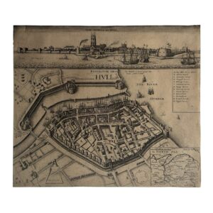
KYNGESTON UPON HULL – KINGSTON UPON HULL – THE SIEGE OF HULL – THE TOWNE OF HULL – c.1680-1890
£650.00Hollar, Wenceslaus
-

-

Tectonic Map Of Australia – First Edition – Map On Four Sheets
£650.00Bureau of Mineral Resources, Geology and Geophysics
-

SCOTIA REGNUM CUM INSULIS ADJACENTIBUS ROBERTUS GORDONIUS A STRALOCH DESCRIPSIT – ORIGINAL COPPER ENGRAVED MAP PUBLISHED BY JOAN BLAEU
£650.00Blaeu, Joan & Gordon, Robert
-

-

CARTE DES NOUVELLES DECOUVERTES AU NORD DE LA MER DU SUD TANT À L’EST DE LA SIBÉRIE ET DU KAMTCHATKA QU’À L’OUEST DE LA NOUVELLE FRANCE
£600.00Santini, François After De L’Isle, Joseph Nicholas and Buache, Philippe
-

-
-
-
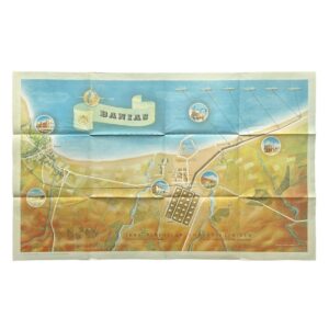
Banias – Iraq Petroleum Company Limited – Sea Terminal of the Kirkuk–Banias Pipeline – 1952
£500.00Iraq Petroleum Company Limited
-
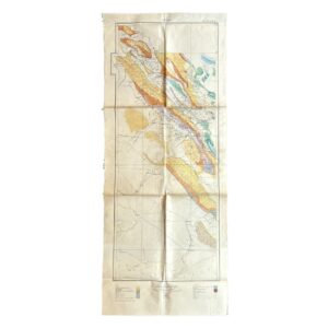
Persia – A.P.O.C. Geological Map Of South-West Iran – Zagros Oilfields – Sheet No. 10 I & 10 J – 1929
£500.00Cornes, H & Anglo-Persian Oil Company (A.P.O.C.)
-

Jaipur Guide Map – 1971 – Published Under The Direction Of Brigadier J. S. Paintal – Surveyor General Of India
£500.00Paintal, Brigadier J. S.
-

-

INDIA AND ADJACENT COUNTRIES – OOTACAMUND – PUBLISHED UNDER THE DIRECTION OF COLONEL C H D RYDER SURVEYOR GENERAL OF INDIA 1922
£500.00Ryder, Colonel C. H. D.