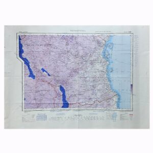
București (Bucharest) – British War Office Army/Air Map, G.S.G.S. 2758, Second Edition, 1945
Description:
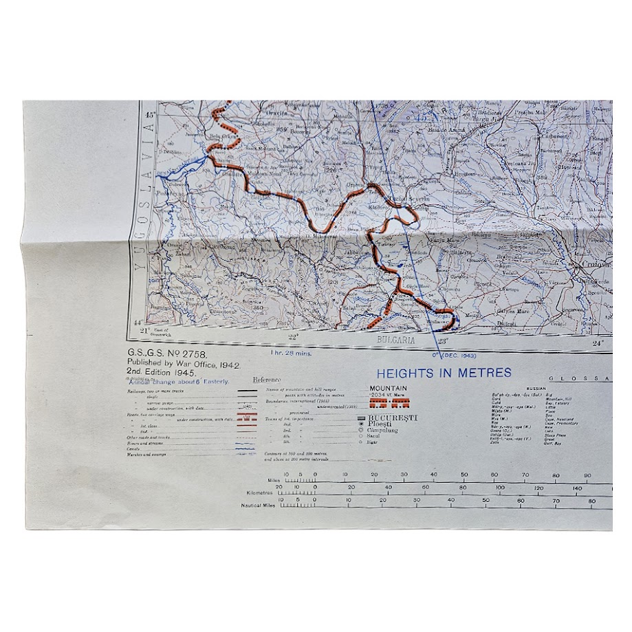
An original British War Office military and air-navigation map of Romania and the lower Danube region, issued as North L.35 and part of L.34 in the Europe 1:1,000,000 series, G.S.G.S. 2758. This is the Second Edition, Army/Air Style, revised and photolithographed by the Ordnance Survey in 1945.
Centred upon București (Bucharest), the sheet covers almost the whole of Romania together with adjoining areas of Bulgaria, Yugoslavia, Hungary, Czechoslovakia and the Soviet Union, extending eastwards to the Black Sea and the extensive wetlands and channels of the Danube Delta. The Carpathian Mountains form the dominant physical feature through the centre and north of the map, while the lower Danube crosses the southern portion before reaching its delta and the Black Sea.
The map provides a detailed representation of the region’s wartime transport and communications infrastructure. Major and secondary roads, railway lines, rivers, canals, towns, administrative boundaries and relief are clearly delineated, with waterways strongly emphasised in blue and international boundaries in red and black. Important centres include Bucharest, Constanța, Brașov, Cluj and Iași, alongside numerous smaller towns and transport junctions.
The Army/Air Style was designed for combined ground and aviation use, providing rapid recognition of communications, terrain and prominent geographical features at a strategic scale. Relief is shown by contours, spot heights and altitude information, while the lower margin retains the original distance scales, positional-reference instructions, adjoining-sheet diagram and multilingual glossary of Romanian, Russian, Bulgarian and Yugoslav geographical terms.
G.S.G.S. 2758 was one of the principal British strategic mapping series used across Europe during the Second World War. This 1945 edition is particularly significant because Romania had undergone a dramatic strategic transformation during the previous year. Following the overthrow of Ion Antonescu in August 1944, Romania changed sides and joined the Allied war effort against Germany. By the time this revised sheet appeared, Soviet forces occupied much of eastern Europe and the political settlement of post-war Romania was already taking shape.
The sheet consequently records the geography of Romania at an important transitional moment between the Second World War and the emerging post-war Soviet sphere. It also predates later changes to communications, settlement and infrastructure across the country.
A substantial and detailed British military map of Romania, Bucharest, the Carpathians, lower Danube and Black Sea coast, combining strong geographical interest with a direct connection to Allied wartime and immediate post-war strategic mapping.
Condition
Very good. Original issue folds with light handling and creasing, principally along the horizontal folds. Minor marginal wear and a couple of small marks to the lower right margin. The cartographic field remains complete, clean and highly legible, with strong original blue, red, violet and black printing.
Title: București (Bucharest)
Publisher: War Office
Series: Europe 1:1,000,000 – G.S.G.S. 2758
Sheet: North L.35 and part of L.34
Edition: Second Edition, Army/Air Style
Date: 1945
Revision: Revised and photolithographed by Ordnance Survey, 1945
Scale: 1:1,000,000
Size: 64.1 × 88.5 cm
Format: Colour-printed military and air-navigation map
Location: Tube D: Europe
Inventory Number: 004117
SHOP WITH CONFIDENCE AT HORNSEYS
At Hornseys, we are dedicated to offering items that uphold the highest standards of quality and authenticity. Our collection of artwork is carefully curated to ensure that each item we offer is authentic, collated, and complete.
Here’s what sets us apart:
- Authenticity and Provenance: Each map is researched and verified for authenticity.
- Expert Curation: We wholly own all our artworks. We trust our taste and have invested heavily in it. We have confidence in all artwork that we offer for sale.
- Customer Satisfaction: We strive to provide an exceptional customer experience, from detailed descriptions and provenance to secure and prompt delivery of your purchase.
- Returns Policy: We offer an unconditional guarantee on every item. If, however, you wish to make a return, artworks may be sent back to us within fourteen days of receipt for whatever reason. We request that we are notified in advance if you wish to do so. They must be returned to us in the same condition as they were sent for a full refund.
OUR COMMITMENT TO QUALITY AND SERVICE
Understanding the value and rarity of these items, we ensure that every aspect of your purchase meets the highest standards of quality and service. This includes:
- Free Expedited, Tracked, and Insured Delivery within the UK: Ensuring that your artwork arrives safely and promptly.
- Fully-Insured Worldwide Delivery: Offering peace of mind for international collectors with reliable and secure shipping options.
EXPLORE OUR COLLECTION
Visit Hornseys today to explore our fine collection of maps and other artworks. Whether you are an avid collector or looking for a special gift, our selection offers something truly unique. Located since 1976 in Ripon in the picturesque Yorkshire Dales, we are recognized as a destination gallery for tastefully curated artwork, rare maps, design, and fine books.