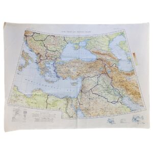
Moyale – East Africa 1:500,000. E.A.F. No. 1707. Third Edition. Nairobi, 1949
Description:
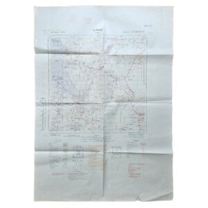
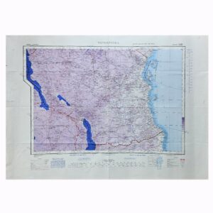
An original large-format East African military and topographical map of Moyale and the Kenya–Ethiopia frontier, issued as E.A.F. No. 1707, Sheet NA 37/2, at a scale of 1:500,000. This is the Third Edition, incorporating wartime and immediate post-war survey work and reprinted by the Government Printer, Nairobi, in 1949.
The sheet covers a substantial and remote area of northern Kenya and southern Ethiopia centred on Moyale, extending across the arid frontier country between approximately 38° and 40° east longitude. Roads, motor tracks, footpaths, settlements, administrative posts, missions, water sources, rivers, relief, lava fields, craters, escarpments, telegraph and telephone lines and other communications are differentiated in considerable detail. The map also includes information relevant to aviation, including aerodromes and landing grounds.
The cartographic history printed in the lower margin is particularly informative. The map was compiled, drawn and partly revised by the East African Survey Group in February 1942, reproduced with a metre grid under the direction of the Survey Directorate, G.H.Q. Middle East, and printed by the South African Survey Company in April 1942. It was subsequently revised and printed by 157 (East African & South African) Base Survey Company in February 1946, before the present 1949 Nairobi reprint.
The map belongs to the important East African military surveying programme developed during the Second World War, when existing cartography of the Kenya–Ethiopia frontier was found inadequate for modern military operations. Much of the region remained sparsely surveyed, and the sheet’s reliability diagram distinguishes areas based on different qualities and sources of survey information.
Moyale itself was strategically significant as a frontier settlement on the principal north–south route between Kenya and Ethiopia. The surrounding landscape is recorded in considerable geographical detail, including extensive lava fields, plains, seasonal drainage systems and the network of routes and water points essential for movement through this difficult terrain.
The map additionally preserves contemporary colonial administrative geography, showing the boundary between Kenya Colony and Abyssinia/Ethiopia, together with tribal and district information characteristic of British East African cartography of the period.
A substantial and uncommon post-war issue of an important wartime East African survey sheet, particularly relevant to the history of British military mapping, the East African Campaign, Kenya, Ethiopia and the development of reliable cartography of the northern frontier.
Condition
Good to very good. Original horizontal and vertical folds with general handling and creasing consistent with practical map use. Minor marginal wear, short edge tears and localised creasing, including a small tear to the right margin. Contemporary or official manuscript and stamped markings appear in the margins. The mapped area remains complete and clearly legible, with the original red, blue, brown and black printed information retaining good definition.
Title: Moyale
Series: East Africa 1:500,000
Sheet: NA 37/2
Reference: E.A.F. No. 1707
Edition: Third Edition
Maker: East African Survey Group / East African Forces
Original Compilation: 1942
Revision: 1946
Reprint: Government Printer, Nairobi, 1949
Scale: 1:500,000
Size: 91.2 × 64.6 cm
Area: Northern Kenya and southern Ethiopia
Location: Tube B: Africa
Inventory Number: 004118
SHOP WITH CONFIDENCE AT HORNSEYS
At Hornseys, we are dedicated to offering items that uphold the highest standards of quality and authenticity. Our collection of artwork is carefully curated to ensure that each item we offer is authentic, collated, and complete.
Here’s what sets us apart:
- Authenticity and Provenance: Each map is researched and verified for authenticity.
- Expert Curation: We wholly own all our artworks. We trust our taste and have invested heavily in it. We have confidence in all artwork that we offer for sale.
- Customer Satisfaction: We strive to provide an exceptional customer experience, from detailed descriptions and provenance to secure and prompt delivery of your purchase.
- Returns Policy: We offer an unconditional guarantee on every item. If, however, you wish to make a return, artworks may be sent back to us within fourteen days of receipt for whatever reason. We request that we are notified in advance if you wish to do so. They must be returned to us in the same condition as they were sent for a full refund.
OUR COMMITMENT TO QUALITY AND SERVICE
Understanding the value and rarity of these items, we ensure that every aspect of your purchase meets the highest standards of quality and service. This includes:
- Free Expedited, Tracked, and Insured Delivery within the UK: Ensuring that your artwork arrives safely and promptly.
- Fully-Insured Worldwide Delivery: Offering peace of mind for international collectors with reliable and secure shipping options.
EXPLORE OUR COLLECTION
Visit Hornseys today to explore our fine collection of maps and other artworks. Whether you are an avid collector or looking for a special gift, our selection offers something truly unique. Located since 1976 in Ripon in the picturesque Yorkshire Dales, we are recognized as a destination gallery for tastefully curated artwork, rare maps, design, and fine books.